

The morning started out with a bang across parts of East Texas and Southeast Texas. Showers and a few stronger thunderstorms moved across the Houston metro earlier this morning dropping small hail and plenty of lightning. Those storms have moved east of Houston at the time of this writing and should exit Texas as a whole by late-morning. All the ruckus was thanks to a cold front which has brought much colder air to the northwestern half of Texas. Temperatures have dropped into the upper teens across the Panhandle this morning. In fact much of the western United States is quite cold thanks to a low pressure system moving into Iowa. More of the cold air will move into Texas by tonight.
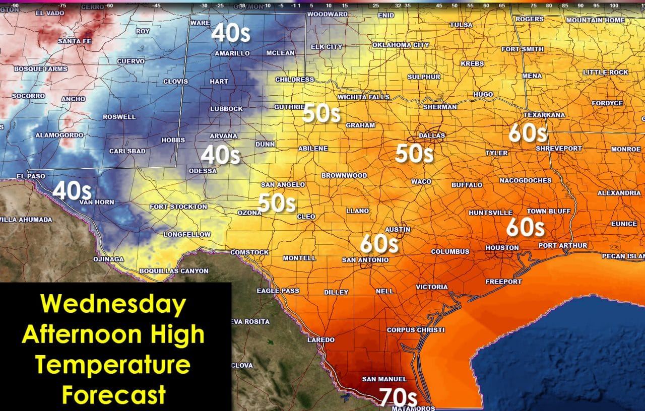
Once the morning showers and storms move east of the state it will actually be a pretty nice December day across Texas. High temperatures will vary thanks to the cold front pushing south. The further south you are the warmer you’ll be today. The Rio Grande Valley and most of the coastline will make it into the lower 70s this afternoon. South-Central Texas, Southeast Texas, and East Texas will peak in the 60s The Texas Panhandle, especially the northwest Panhandle, will struggle to hit 40 degrees this afternoon. The high temperature map above will give you more specific information for your location.

By tonight it won’t matter where you are in Texas – its going to be cold. Low temperatures will drop into the mid teens in the Alpine Mountains and higher elevations of Far West Texas. Upper teens (NW Panhandle) to twenties are expected across the Texas Panhandle, West Texas, Concho Valley, Big Country, Northwest Texas, and locations west/northwest of the D/FW Metroplex in North Texas. 30s will be common Thursday morning across East Texas, Southeast Texas, Central Texas, the remainder of North Texas, South-Central Texas, and even Southwest Texas. The Rio Grande Valley and immediate coastline will drop into the low 40s – plenty cold for those regions.
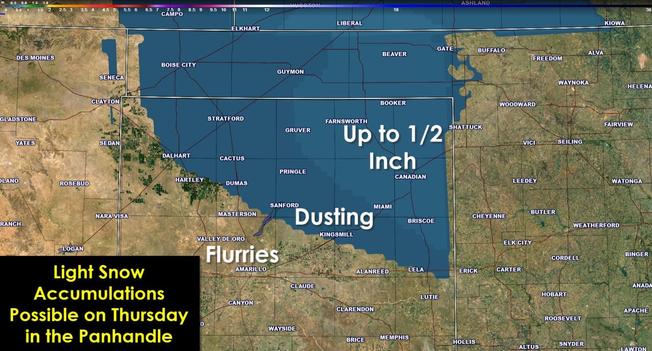
An upper level disturbance will quickly move across the Oklahoma and Texas Panhandles on Thursday. With cold air in place there is the possibility of light snow showers. Low moisture levels will limit overall snow coverage and intensity. Current indications are that a half inch of snow may accumulate across the northeast Texas Panhandle. A dusting may occur along/north of a Dalhart, Dumas, Kingsmill, Shamrock line. Little to no travel issues are expected due to the light nature of the snow. If the system looks any weaker its possible the accumulation totals will be dropped entirely with just flurries.
The next chance for rain further east looks to be on Monday and Tuesday as another upper level disturbance moves through the region. Looking at the extended range things look unsettled next week. At this point above-average temperatures seem likely into Christmas with a storm system possibly approaching from the west. That system could lead to more active weather just after Christmas. Time will tell as we get closer to the end of the year. Still no signs of a true arctic intrusion but winter hasn’t even officially started yet!

0 Comments