
This update will concern the potential for strong thunderstorms later today and tonight. Jenny will have a more complete blog later this morning with a detailed forecast including the potential for accumulating snow in the Texas Panhandle. This morning has started out warm, windy, and mostly cloudy. It may be December but if you step outside you would think it was an April morning. That’s because dewpoints have risen into hte 60s across the eastern two-thirds of Texas overnight thanks to strong southerly winds. As an upper level storm system moves in this afternoon we’ll start seeing the weather become more active.
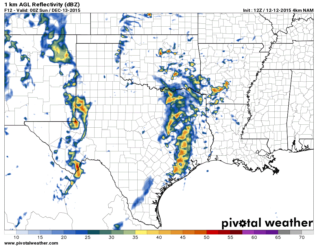
ANIMATION: Simulated Radar For Tonight – Click on the image for the full loop.
We anticipate two rounds of convection today and tonight. The first round of rain/storms will impact Northeast Texas and East Texas this afternoon. Some locally heavy rain and strong storms will be possible. The severe weather risk with this first round of convection is marginal but we’ll be on the look out for a few stronger storms. The heavy rain threat will be watched as well for any isolated flash flooding issues.
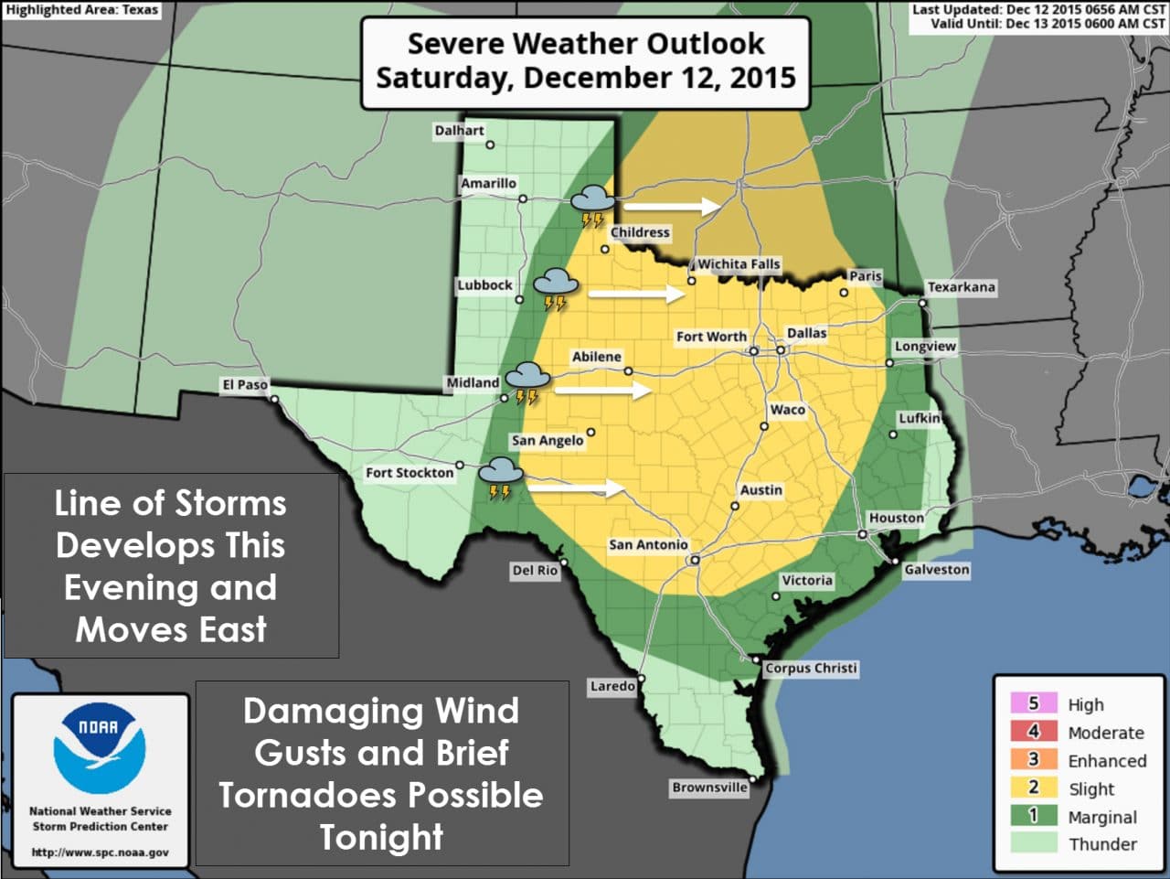
The second round of thunderstorms will develop this evening across Northwest Texas, the Big Country, and Concho Valley in the form of a squall line. This squall line will quickly move east this evening and approach the Interstate 35 corridor from Central Oklahoma through North and Central Texas near or a few hours after midnight. From there it’ll continue to move east impacting Northeast Texas, East Texas, and Southeast Texas during the morning hours on Sunday. Wind shear values will be quite high along and in advance of the squall line. A mitigating factor for a significant/widespread severe weather outbreak is that the atmosphere will only be marginally unstable. Widespread clouds and a general lack of destabilization will help put a lid on the severe weather threat – but definitely not eliminate it. Even with the clouds and overnight timeframe the atmosphere will still be able to become marginally unstable thanks to warm-air advection and cooling temperatures aloft. The entire squall line will not be severe. Individual storms or bowing segments in the line will have the potential to produce damaging wind gusts over 60 MPH. In addition the strong wind shear in the low-levels will result in a low-end tornado threat. The linear mode of storms tonight along with the possibility of outflow pushing ahead of the storms will keep the tornado threat low. We’ll be watching for book-end vortex and comma-head signatures in the squall line that would indicate the potential for a brief tornado. The line will also drop a quick inch or two of rain with lighter rain continuing for a few hours behind the squall line.
There is a slight possibility that isolated storms may develop in advance of the squall line this evening. Should any discrete storms develop they would be in an environment supportive of low-level rotation and possible tornadoes. We’ll keep an eye on trends just in case we have one or two pesky storms try to spin up tonight.
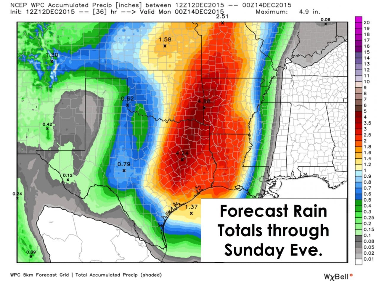
Some minor flooding is possible with a more concentrated flooding threat possible in Northeast and East Texas. This is not expected to be a major/high-end severe weather or flooding event. Mother Nature doesn’t care if its December or May – don’t let your guard down just because we’re two weeks away from Christmas. This is our secondary severe weather season and we’ll likely be reminded of that tonight. We’ll keep you updated and we know you’ll keep an eye to the sky.


0 Comments