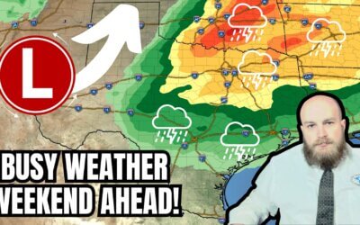
Rather dreary weather with showers and storms will be the name of the game across the eastern half of Texas today. We’ve already had showers and a few storms this morning, and we’ll see an uptick in coverage by lunchtime across the Brazos Valley, Southeast Texas, and East Texas. Most activities will behave in themselves, but we will sometimes see frequent lightning and heavy rain. Isolated severe storms with hail, gusty winds, and a brief tornado can’t be ruled out closer to the Upper Texas Gulf Coast (Southeast Texas). Activity will move east/northeast through the evening hours.
A second round of thunderstorms may develop late this afternoon and move east this evening across Texoma, the Ark-La-Tex, North Texas, Central Texas, and the Brazos Valley. Some of these storms may be capable of producing pocket-change size hail, frequent lightning, and heavy rainfall. Storms will probably weaken as they approach Interstate 35 this evening. Rain chances will continue into Friday morning across the Ark-La-Tex, East Texas, and Southeast Texas – with decreasing intensity overnight. One-half to two inches of rain may fall over sections of Texoma, North Texas, Central Texas, the Brazos Valley, Southeast Texas, East Texas, and the Ark-La-Tex by tomorrow morning. Street flooding and isolated instances of flash flooding may occur. The highest (relative) chance for flash flooding will be across Southeast Texas and the Coastal Plains.
By Friday afternoon, most of Texas should see partly cloudy to mostly clear skies, ushering in a few days of dry weather.
Our next weather-maker will arrive on Sunday and Monday. Gusty south winds are expected Sunday across most of Texas a an impressive storm system intensifies across the Plains of the United States. If today’s storm system wasn’t bringing drier air behind it, we’d be looking at a significant severe weather and tornado outbreak across Texas, Oklahoma, and Kansas on Sunday. As it stands, moisture return (quality) will be a limiting factor for severe weather potential. A thin line of thunderstorms may develop along an eastward-moving cold front Sunday night into Monday morning, with those storms moving east across the northern half of Texas, east of Highway 83, and north of Interstate 10. Some storms may have gusty winds, brief heavy rain, and perhaps some hail. We’ll keep tabs on the following system as we get into the weekend and past today.
A cool front will arrive behind the system on Monday, with much cooler conditions likely for at least the Texas Panhandle and West Texas. There may even be a bit of snow in the northern Texas Panhandle. If you want a full-on blizzard, you must head up into New Mexico and Colorado.
My FREE & AWESOME weather app for radar/alerts/more: https://texasweather.app/
My website, also with radar: https://texasstormchasers.com
The 24/7 Texas weather tracker & music: https://www.youtube.com/watch?v=lNZuPEWS5AI&t=0s
Storm chaser videos: https://www.youtube.com/texasstormchasers
Facebook: https://www.facebook.com/TxStormChasers
TikTok: https://www.tiktok.com/@texasstormchasers
X (Twitter): https://twitter.com/TxStormChasers


Be sure to hit the thumbs up icon folks!!
Thanks David!
Thank you for weather and fire reports.🙋