
I don’t know what our technology ate on Thanksgiving, but we’re giving Thanks for getting this video out – even if it’s several hours past our typical publishing time. Our apologies, but better late than never.
With the shopping weekend frenzy underway, I invite you all to check out the Texas Storm Chasers store. Our annual weather calendar, stickers, shirts, and more are available. You can find our store at https://texasstormchasers.store. From the Texas Storm Chasers team and I, we all thank you for your support.
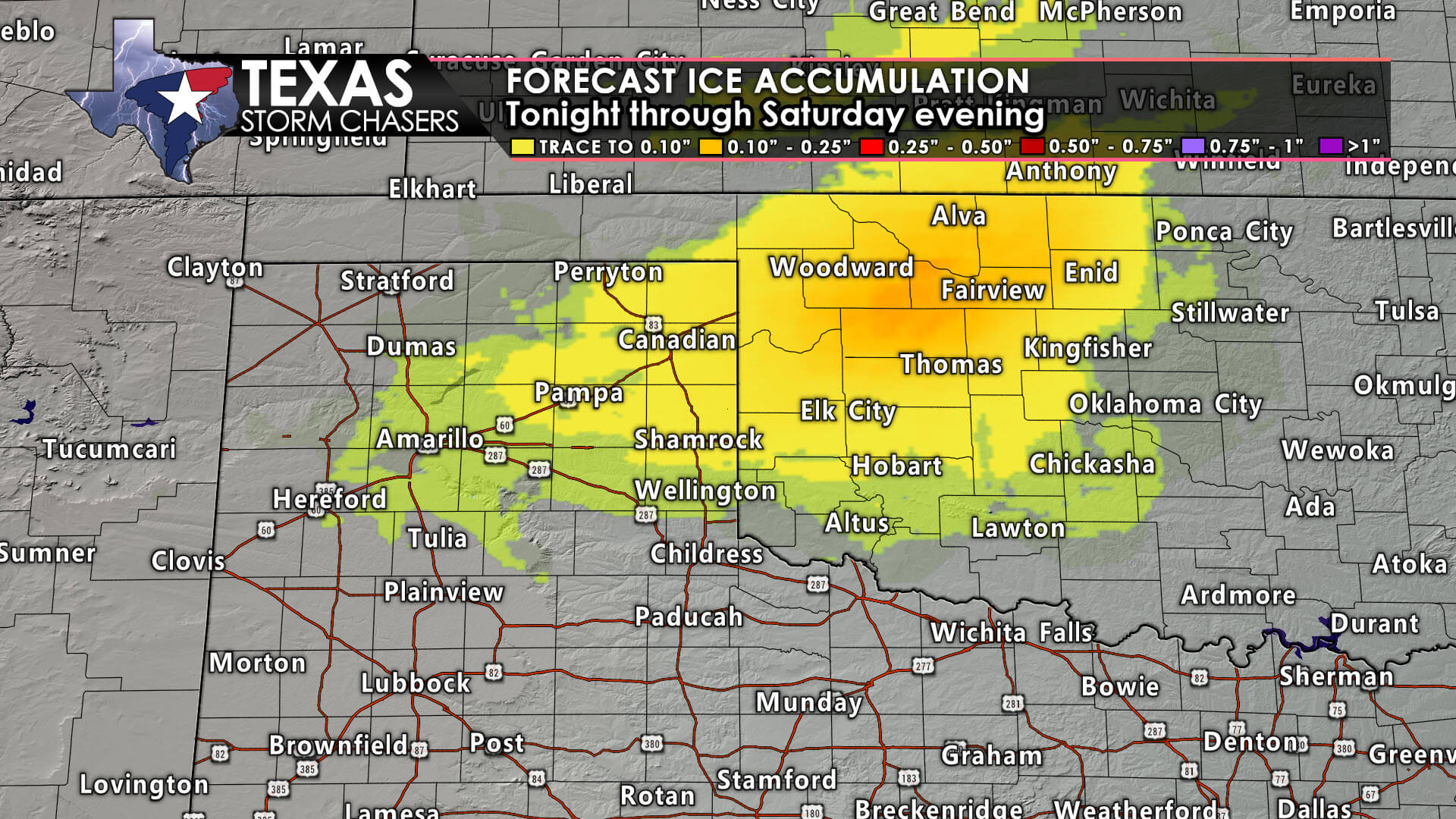
Accumulating snow will begin falling late this evening across the Texas Panhandle. Hazardous travel conditions are possible, if not likely, at times beginning late tonight through Sunday morning along and north of Interstate 40. Some freezing rain and sleet may sometimes mix in, adding a thin layer of ice to exposed objects.
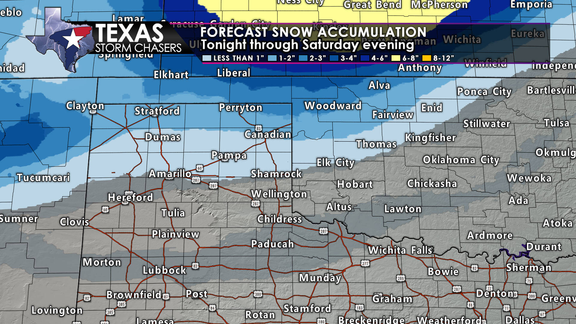
Two to four inches of snow may fall across the northern Panhandle, especially closer to places like Dalhart, Stratford, and Perryton. Snowfall amounts of four to eight inches will be possible just to the northeast in Kansas and Northwest Oklahoma, so we’ll have to keep an eye on things to ensure those higher amounts don’t try sneaking farther southwest into the Panhandle.
Light rain, perhaps mixed with the occasional snowflake or sleet pellet, will be possible on Saturday and Saturday evening in Northwest Texas. Surface temperatures *should* remain above freezing until precipitation ends.
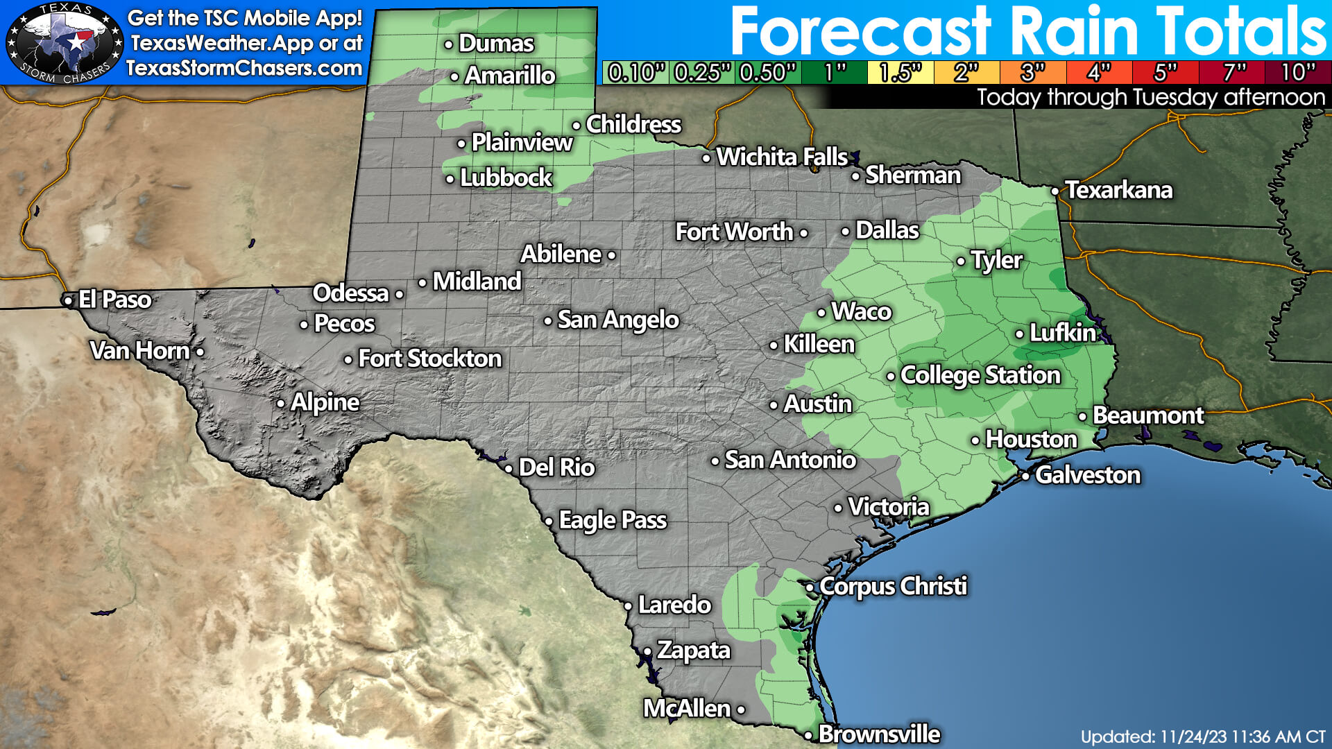
Across the eastern third of Texas, we’re expecting scattered to numerous showers Saturday evening through Sunday morning. No severe storms or flash flooding is expected. It’ll be a quick-hitting rain event that’ll exit Texas to the east by lunchtime Sunday. One-tenth to perhaps one-half inch of rain will be possible. Dry weather arrives in Texas from Sunday afternoon through mid-week.
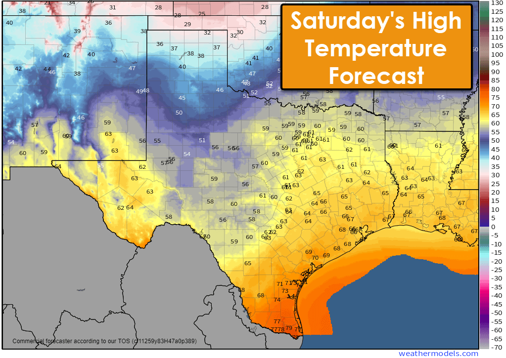
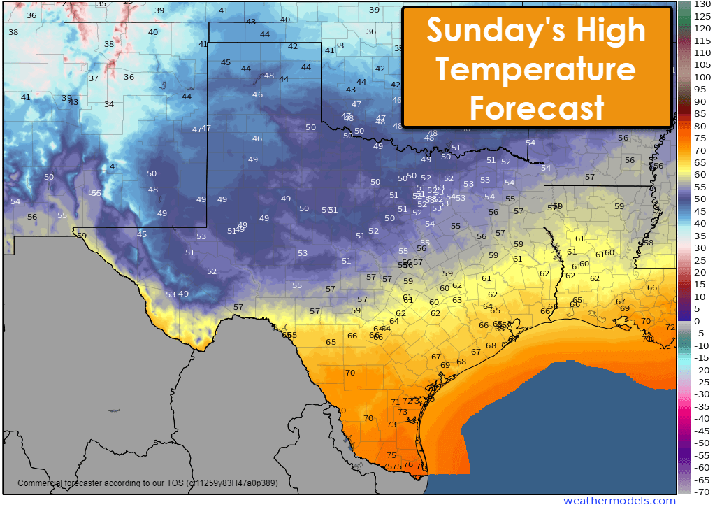
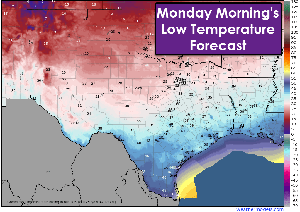
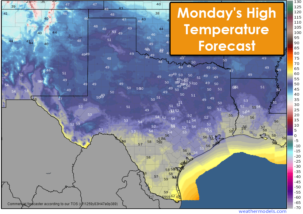
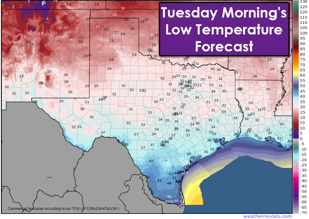
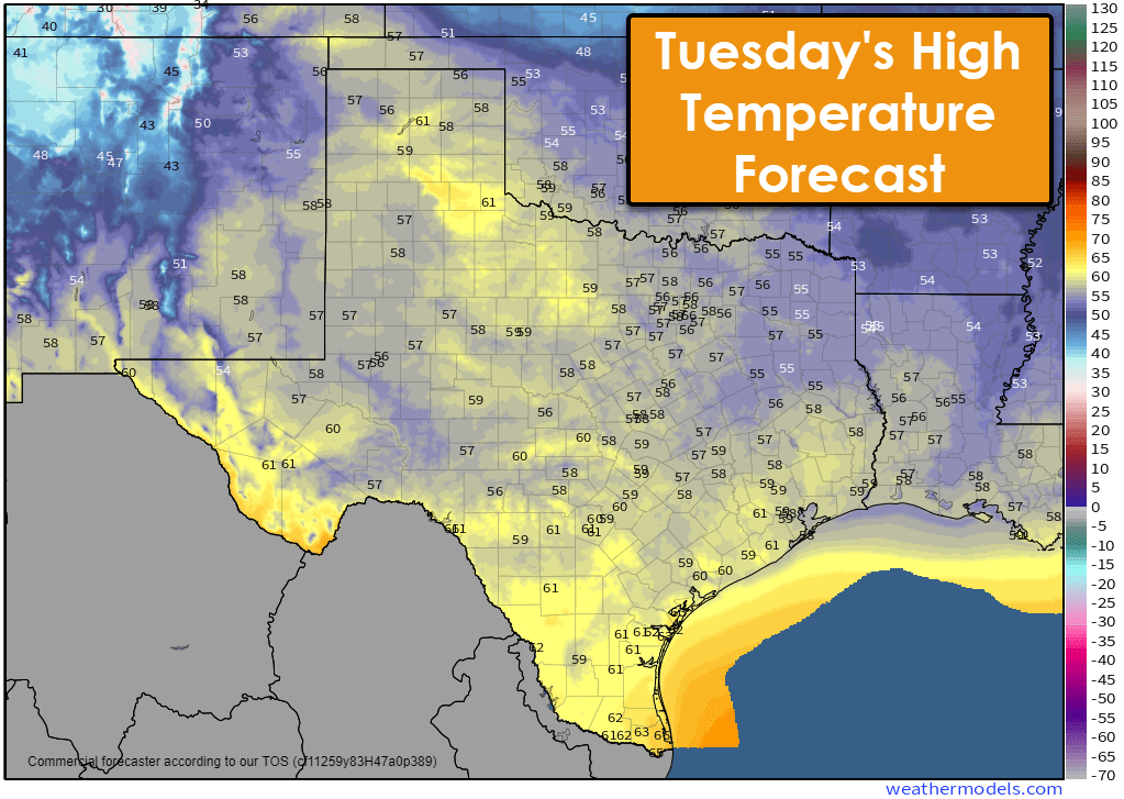
The colder weather affecting the Panhandle tonight will arrive in the remainder of Texas by Sunday as a cold front makes steady but somewhat slow progress to the south. High temperatures in the 60s and 70s will fall into the 30s, 40s, and 50s by Sunday. We’ll see the chance of a frost or freeze across the northern two-thirds of Texas by Tuesday morning. A slow climb up the temperature roller-coaster begins Tuesday, but temperatures will remain seasonable (cool but pleasant).
Have a great Friday, and don’t forget to check out the Texas Storm Chasers store for your Christmas gift items! You can find our store at https://texasstormchasers.store/
Get the FREE Texas Storm Chasers Mobile App for your local weather forecast, interactive weather radars, live Texas weather coverage, and more! Available in your device’s app store.

0 Comments