
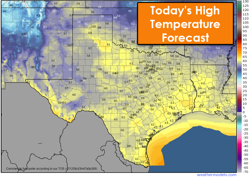
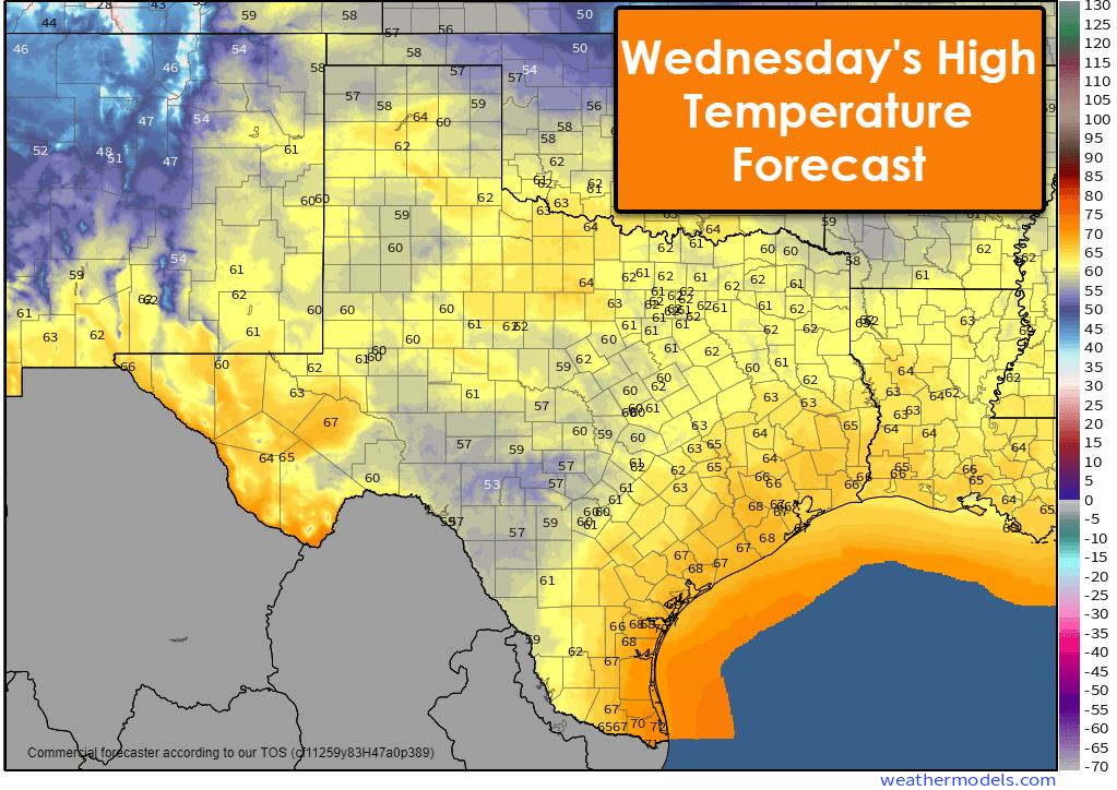
Partly cloudy to overcast sky conditions will continue across Texas through the day and for much of Wednesday. Today’s high temperatures will be a tad warmer than Monday’s, with afternoon highs in the 50s and 60s. Wednesday will be around the same, perhaps a few degrees warmer in the west and closer to the Texas Gulf Coast. Not too shabby for late November. No appreciable rain is expected until our next upper-level storm system begins arriving from the west Wednesday evening.
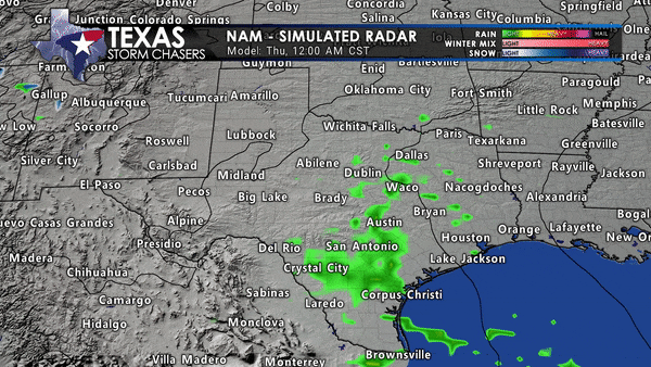
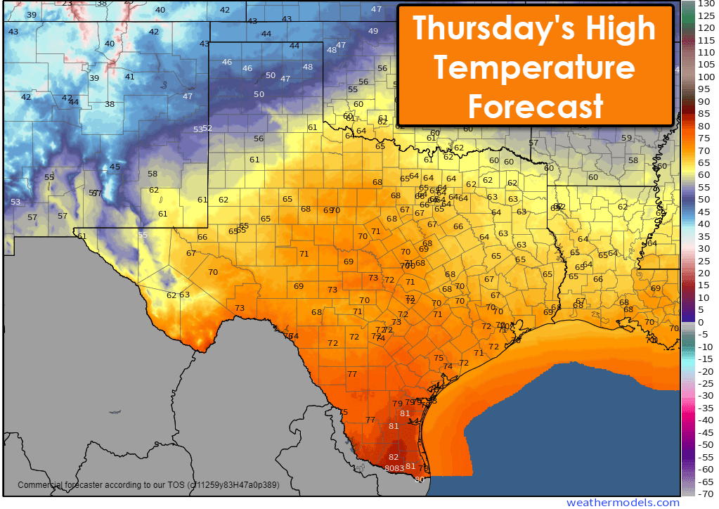
Scattered showers and thunderstorms will begin developing around or just after dinner Wednesday across the Hill Country and Central Texas. By Thursday morning, we could have scattered showers and thunderstorms underway up into North Texas and Texoma. As we continue through Thursday morning into Thursday afternoon, scattered to numerous showers and thunderstorms are expected to move from west to east across the eastern third of Texas.
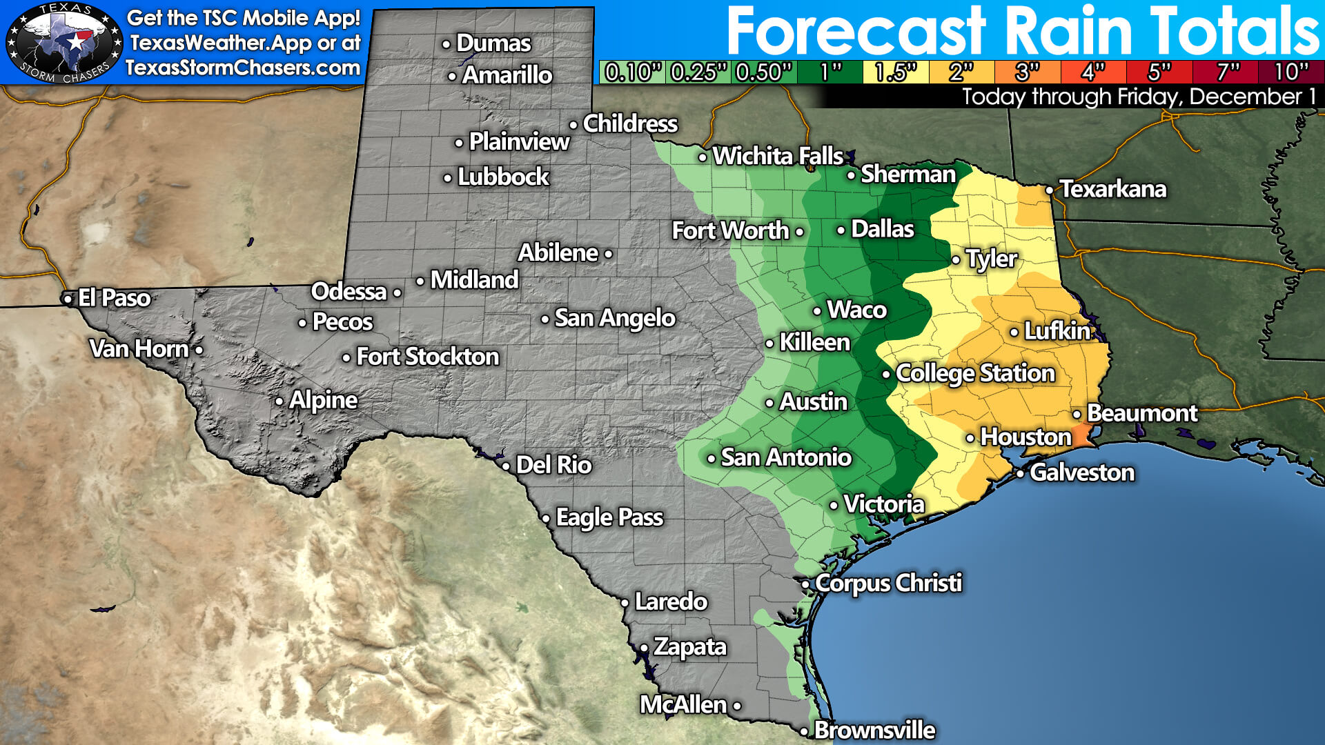
Beneficial rains are likely, with one to three inches of rain possible in the Ark-La-Tex, East Texas, into the Golden Triangle and Southeast Texas. One-tenth to one-half inch of rain may fall as far west as North Texas, Central Texas, the Brazos Valley, south into the Hill Country and South-Central Texas. Back on the ‘cold side’ of the system, we may see a few snow flurries or even a snow shower across the Texas Panhandle on Thursday.
The timing of Thursday’s upper-level storm system and the inland progression of low-level instability will determine the eventual specifics of any severe thunderstorm threat. As it stands, there does appear to be at least a low-end chance for localized damaging wind gusts and perhaps a tornado Thursday morning into Thursday afternoon across the Coastal Plains, Southeast Texas, the Golden Triangle – perhaps extending north into the Brazos Valley and East Texas.
Storms further north into the Ark-La-Tex may have some small hail, but the low-level atmosphere should remain fairly stable, keeping the overall severe thunderstorm threat very low. It’ll still be raining, though! As we get into the range of higher-resolution weather model guidance later today, we should be able to start fine-tuning any smaller regions of higher severe thunderstorm potential – if any.
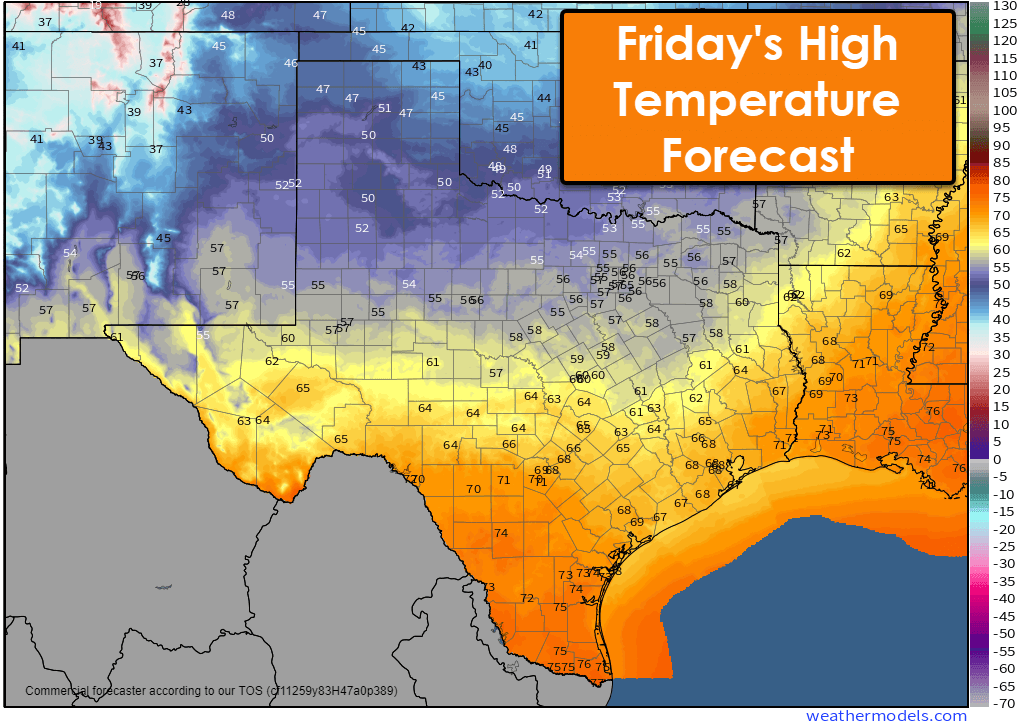
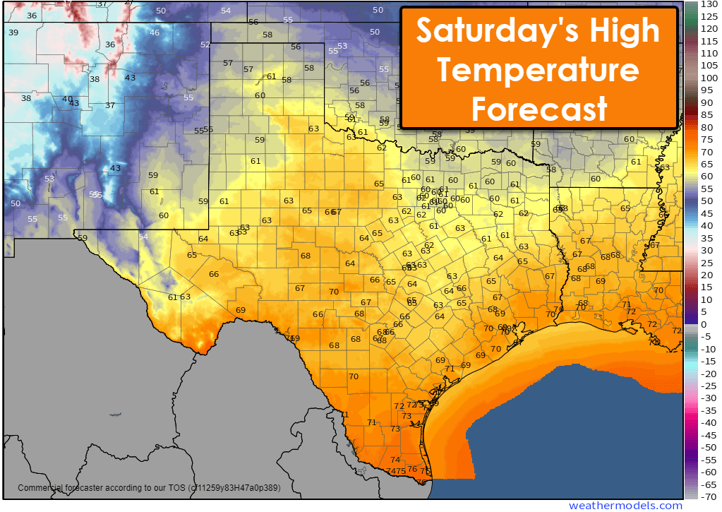
Rain chances will end in Texas Friday morning, with cooler air filtering into the northern half of Texas behind a cold front. The cold front will stall about halfway south into Texas before moving back north as a warm front on Saturday. High temperatures will rebound into the upper 50s, 60s, and 70s this weekend.
Get the FREE Texas Storm Chasers Mobile App for your local weather forecast, interactive weather radars, live Texas weather coverage, and more! Available in your device’s app store.
Why does it rarely rain in central Texas anymore? Been a draught the past decade
Just nothing west from there.
I don’t want more rain…I would prefer lows in the 50s and highs in the 70s also…
Cheenah Mitsdarffer
Alexandra Hernandez
Esmy Murphy
Ryan Michaels
Trevor Chiglo
Send SATX 78213 some more rain. An inch would be good.
Bring on the rain . We can always use the water!