
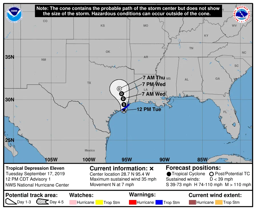
Surface observations indicate that Tropical Depression #11 has strengthened into a tropical storm as it nears Freeport. Maximum sustained winds are now 40 MPH with slightly higher gusts. As stated with my morning blog post we continue to anticipate excessive rainfall to be the primary threat. Imelda will move onshore later today. We’ll have a more detailed update later this afternoon with the latest rainfall forecast. Please see my morning detailed blog post for a detailed timing/rain forecast.
- A Tropical Storm Warning is in place from Sargent to Port Bolivar. Winds of 40 to 60 MPH may occur at times today, especially in heavier convection.
Tropical Storm Imelda Tropical Cyclone Update
NWS National Hurricane Center Miami FL AL112019
1245 PM CDT Tue Sep 17 2019
…DEPRESSION BECOMES TROPICAL STORM IMELDA…
Surface observations indicate that the depression has strengthened
as it nears the coast and has become Tropical Storm Imelda, with
maximum sustained winds near 40 mph (65 km/h). A National Ocean
Service observing site at Freeport, Texas, recently reported a
sustained wind of 40 mph (65 km/h) and a wind gust of 47 mph (76
km/h).
SUMMARY OF 1245 PM CDT…1745 UTC…INFORMATION
—————————————————
LOCATION…28.9N 95.3W
ABOUT 0 MI…0 KM S OF FREEPORT TEXAS
ABOUT 40 MI…65 KM SW OF GALVESTON TEXAS
MAXIMUM SUSTAINED WINDS…40 MPH…65 KM/H
PRESENT MOVEMENT…N OR 5 DEGREES AT 7 MPH…11 KM/H
MINIMUM CENTRAL PRESSURE…1009 MB…29.80 INCHES


0 Comments