
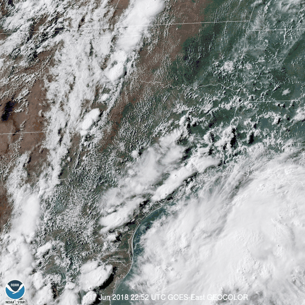
A large area of showers and thunderstorms are occurring across the western and northwestern Gulf of Mexico this evening. This system is not expected to become a tropical cyclone. It is producing gale-force winds across the northwestern Gulf of Mexico along with high seas. An abundance of tropical moisture accompanies this storm system (surface trough). That abundant moisture will bring increasing rain chances to the Texas coast and adjacent inland regions over the coming days.
Numerous showers and thunderstorms are expected on Monday and Tuesday across Southeast Texas, the Brazos Valley, South-Central Texas, south through the Coastal Plains and Middle Coast. Rain coverage will decrease as you go north from those regions. The highest rain coverage during the night-time hours both Monday and Tuesday nights will be closer to the coast.
Wednesday will be another wet day with the highest rain chances (as of now) being in the Rio Grande Valley, Deep South Texas, South Texas, the Middle Coast, northeast into the Coastal Plains. Rain chances will also continue in South-Central Texas, the Brazos Valley, East Texas, and Southeast Texas. We’ll also have storm chances increasing across the Texas Panhandle by Wednesday and into Thursday.
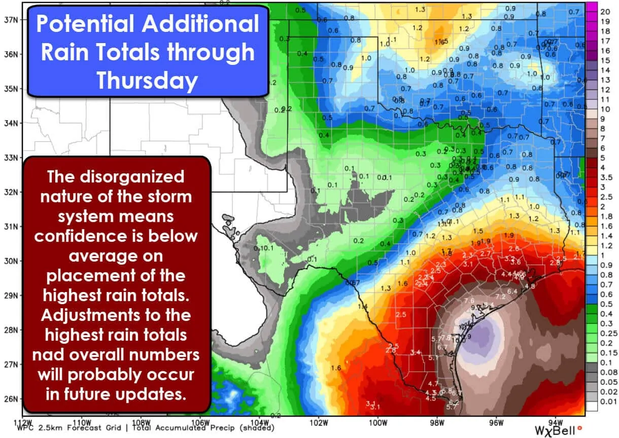
The rainfall forecast through Thursday shows two distinct regions of higher totals. One is in the Texas Panhandle, Northwest Texas, and Oklahoma where a storm system will bring rain/storm chances by mid-week. However, our focus will be on the enhanced rainfall totals along the Gulf Coast and adjacent inland regions.
Several inches of rain will be possible over the next four days in the Rio Grande Valley, South Texas, the Coastal Plains, and Southeast Texas. Compared to yesterday we have seen an uptick in rain totals in those regions. The bullseye in the evening outlook from the Weather Prediction Center is nearly 12″ of rain near Corpus Christi.
Weak steering winds aloft and the disorganized nature of the storm system is making the forecast a difficult one. Our rainmaker is going to meander on the coast for several days. One day it could be close to Corpus Christi and the next closer to Houston. Weather models are not going to handle that well. This will be more of a ‘nowcast’ versus forecast event. At some point, you have to stop looking at models and just look out the window. All of that is to say that forecast confidence is below average and changes are probably going to occur.
Confidence is high we’re going to see several inches of rain, but where it falls is still up in the air. This system has a lot going for it in the heavy-rain department so we’re going to have to watch it closely.
We need the rain and drought-conditions are expanding across all of Texas. The dry weather will help keep the threat of widespread flooding lower. Most locations would need four to five inches of rain in six hours to cause flash flooding. Take note that if someone receives three inches of rain in one hour that will cause flash flooding, no matter how dry it’s been. Most rivers, lakes, and tributaries are in good shape. That’ll help drain the water more quickly, but we’ll probably have to keep an eye on river levels after we’re several days in.


0 Comments