
The Storm Prediction Center has placed a standard category two risk zone for severe weather across Northwest Texas, the Big Country, and western North Texas. A level one marginal risk includes the Texas Panhandle, the Concho Valley, and Central Texas. The primary threat will develop by early this evening as thunderstorms fire up in the Texas Panhandle. Like last night some of the initial storms could be supercellular with a threat of large hail and localized damaging wind gusts. With time the storms should grow upscale into a squall line or a cluster. That area of thunderstorms will move southeast at 20 to 30 MPH tonight with an attendant threat of localized damaging wind gusts, small hail, and a brief tornado all possible. There may be localized flooding since soils are quite saturated – but this is not expected to be a widespread or significant flooding issue tonight. Depending on how the eventual track of the storm cluster plays out tonight the severe weather risk zones may have to be adjusted. Conditions won’t be as favorable for a intense storm cluster tonight as they were last night. Nevertheless it appears likely we’ll have another round of storms move southeast tonight – albit less intense.
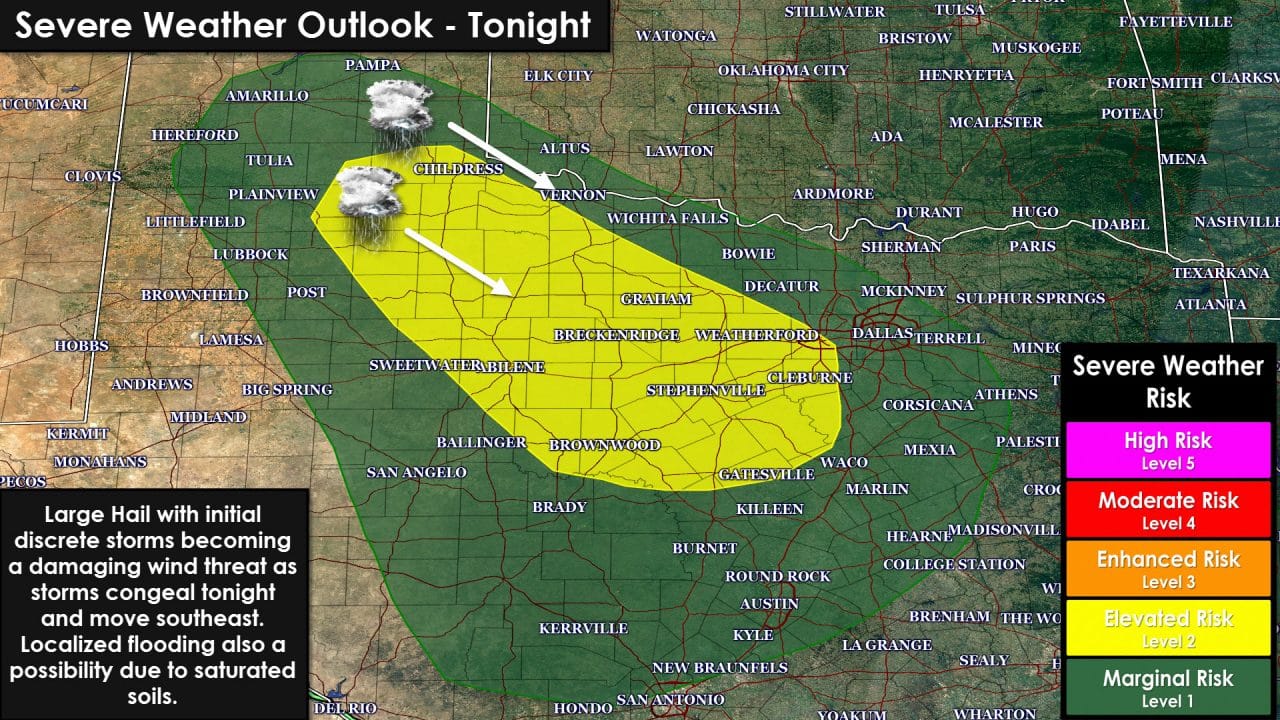
Timing aspects will depend on when storms form and what eventual path they take to the southeast. Most high-resolution weather models are in agreement that isolated thunderstorms will fire up in the 4 to 6 PM time frame in the Texas Panhandle. Given time those initial storms will likely grow upscale as a cold pool (outflow boundary) becomes established and moves southeast. I do believe tonight’s storms will be less intense than what we saw last night based on expected conditions. The complex of storms will likely move into Northwest Texas after 9-10 PM and make it into the Big Country and western North Texas after 12-1 AM. Those times will likely need to be refined later this afternoon once we get a better idea of what will play out. Storms could very well move into the D/FW Metroplex after 2-4 AM Thursday. Storms should be on a weakening trend as they move into North Texas late tonight. We will have to be on the watch for localized flooding since any additional rain will quickly run-off.
Texas Tech Weather Model simulated radar early this evening
Texas Tech Weather Model simulated radar well after midnight Thursday


0 Comments