
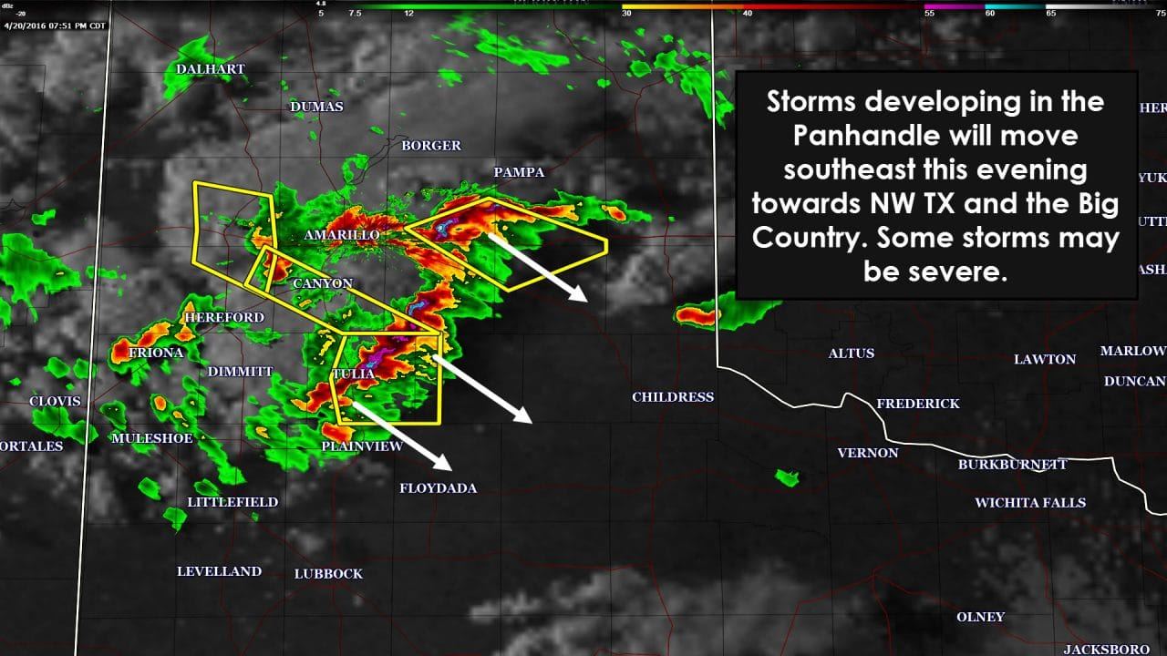
Thunderstorms have been increasing across the southern Texas Panhandle over the past hour. We did have an isolated severe storm east of Lubbock around 6 PM but that storm has since dissipated. Unlike last night there is a bit more of a cap in place. The atmosphere is also less unstable than what we saw on Tuesday. The largest hail we’ve seen so far this evening in the Panhandle is up to the size of a quarter. I can’t rule out a few hailstones up to the size of ping-pong balls. Decent temperature and dewpoint spreads are creating high cloud bases which could also result in localized downburst winds over 60 MPH. As storms organize into a squall line or cluster over the next two hours we may see the threat for quarter size hail and 50-60 MPH wind gusts increase a little bit. I really don’t think we see the number of severe weather issues that we saw last night.
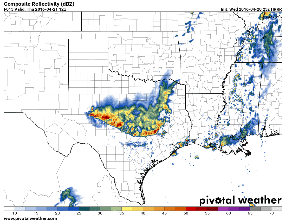
The 23Z run of the High resolution Rapid Refresh (HRRR) seems to have a good handle on timing aspects of the thunderstorm complex tonight. There still remains some uncertainty on which path to the southeast the complex will take. My current thoughts are that the complex moves southeast into southern sections of Northwest Texas and the Big Country this evening. The complex may end up approaching western sections of the D/FW Metroplex late tonight but I do believe the most intense portion of the line will remain in western North Texas. Like last night the squall line will probably make it near the metroplex by 2-4 AM. Storms should be weakening by that point but could continue to move south into Central Texas towards sunrise in a sub-severe state. Some of the storms in the squall line tonight could be severe with quarter size hail and localized wind gusts over 60 MPH. Some flash flooding could occur where a quick 1 to 2 inches of rain falls on saturated soil. I do not expect a widespread/significant severe weather or flooding threat tonight.
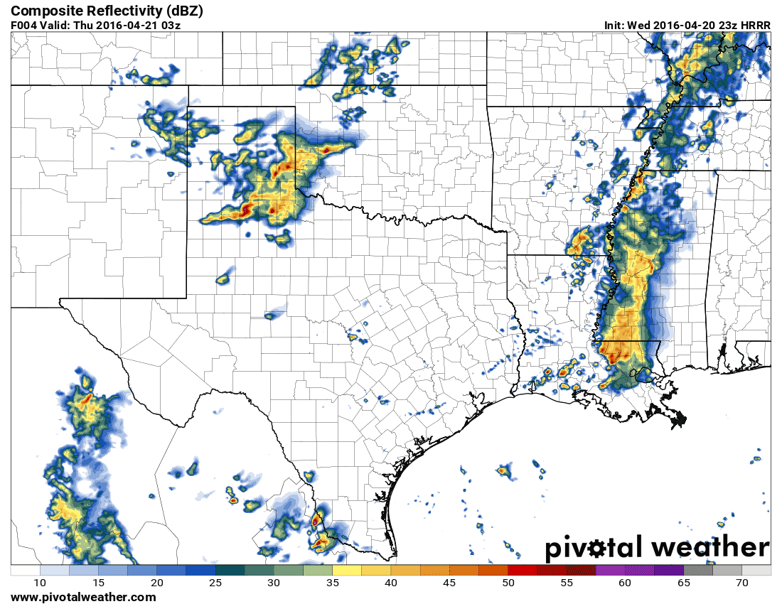
23Z HRRR – Simulated Radar at 10 PM CT Tonight
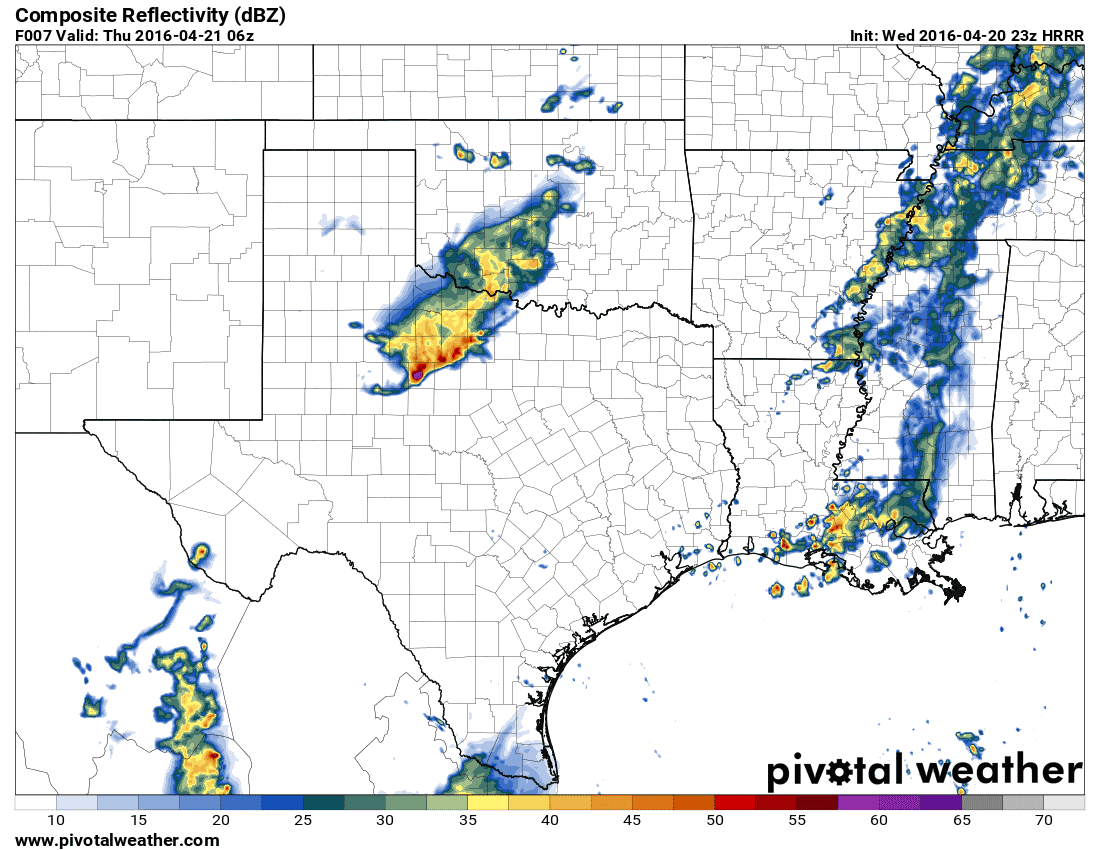
23Z HRRR – Simulated Radar at 1 AM CT Thursday
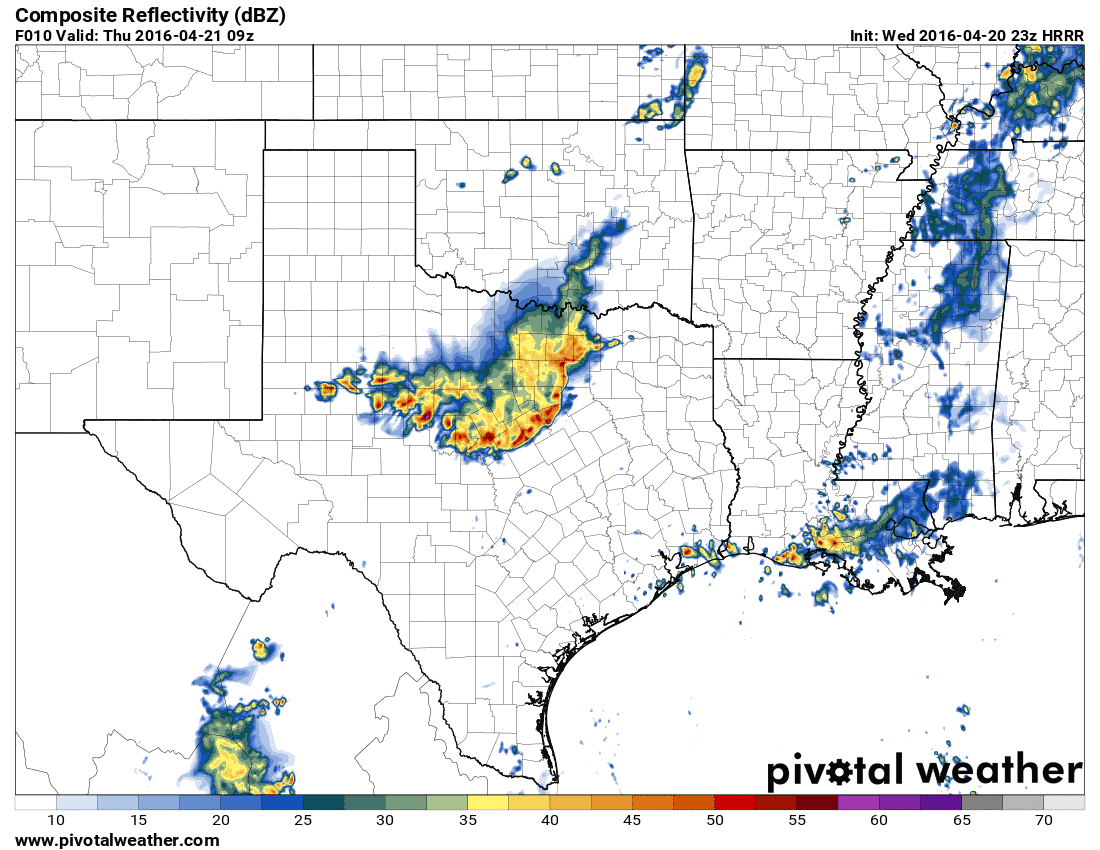
23Z HRRR – Simulated Radar at 4 AM CT Thursday
23Z HRRR – Simulated Radar at 7 AM CT Thursday

0 Comments