
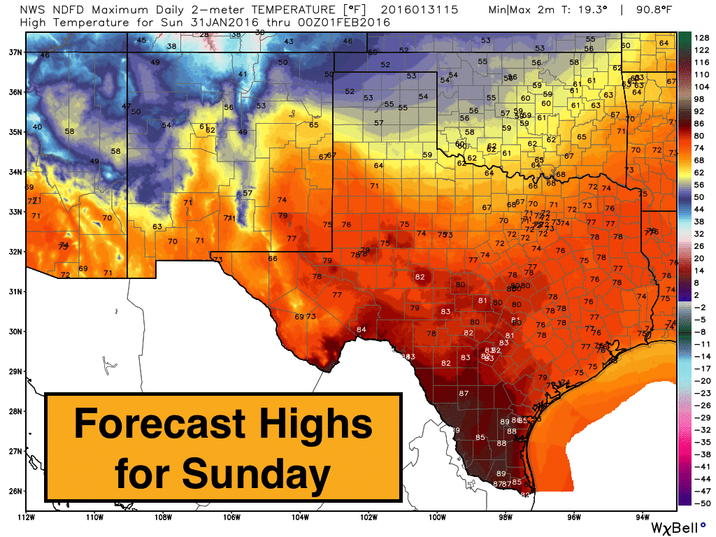
Warm and windy will the the theme for the day across most of the state with significant risk of grass fires across west and west central Texas once again. A weak cold front has moved through the panhandle region and will knock temps down about 20 degrees from yesterday’s highs. Ahead of the front, temperatures will soar well above normal for this time of the year. The highest temps today will be found across south, southwest and west central Texas where temps will reach the low 80s to near 90s degrees the further south you are. The panhandle region will benefit from a cold front that has moved through which has knocked temps down a good 20 degrees from yesterday. From southeast Texas up into north central/northeast Texas will see highs in the mid 70s. All well above normal for this time of the year.
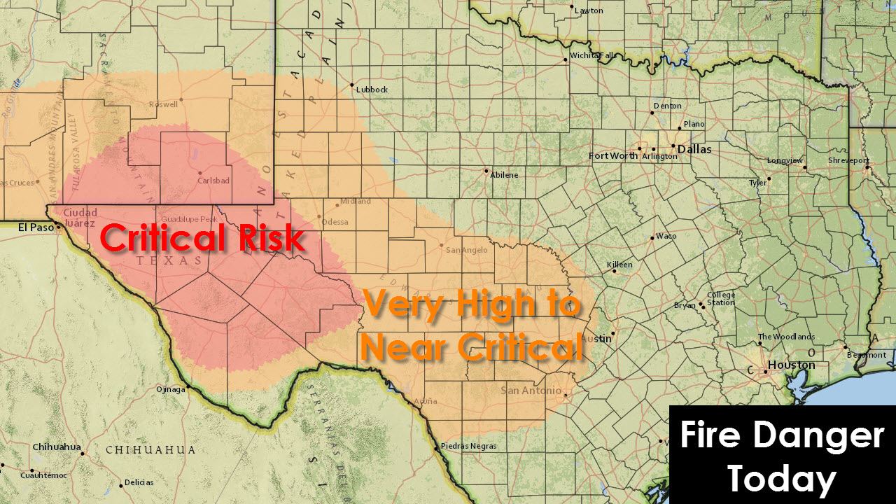
While humidity levels will be on the increase today across the eastern half of the state, that will not be the case across the western half of the state where we will still see significantly dry conditions and considerable wildfire danger today through tomorrow. Very low humidity values combined with gusty winds will pose a significant risk of grass fires again today. We already had one grass fire get out of control yesterday near Eula, TX, southeast of Abilene, which prompted evacuations and destroyed several buildings and homes. Fingers crossed everyone can stay safe and we don’t have a repeat of that today or tomorrow.
Texas A&M Forest Service encourages vigilance and preventative measures against human-caused wildfires.
- Postpone outdoor burning until conditions improve.
- With high fire danger, caution should be used when involved with an outdoor activity that has the ability to cause spark. It only takes one spark to start a wildfire.
- Dispose of smoking materials properly. Extinguish them in an ash tray. Don’t throw them out of a window.
- Avoid parking and idling in tall, dry grass. Catalytic converters can get hot enough to ignite the grass under a vehicle.
- Avoid sitting hot chainsaws or other hot, gas-powered equipment in dry grass.
- Wildfires burning in grass can spread and grow extremely fast. It is important that if you spot a wildfire you report it immediately to local authorities. A quick response can help save lives and property.
Lows tonight will drop down into the 30s across the panhandle, 40s across north, central and west central Texas with 50s down closer to the coast. Light rain mixed with snow is forecast to being across the far northwestern panhandle overnight into Monday with just minimal accumulations expected. Fog will also be an issue once again along the coast by tomorrow morning, so for residents in this region, make sure you add few extra minutes to your commute time to work or school tomorrow morning! 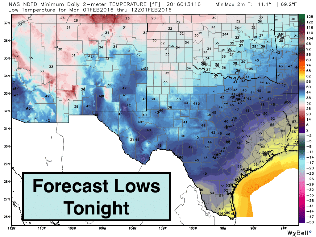
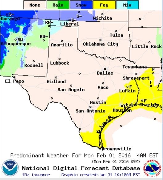
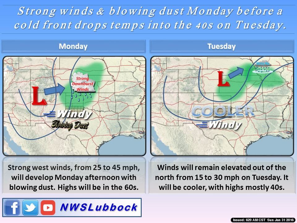
A strong upper level low will arrive across the southern plains on Monday, but will unfortunately not have much of an impact on our weather aside from bringing more gusty winds out ahead of it on Monday, light snow chances across the northern panhandle Monday afternoon through Monday night, and some rain chances across the eastern half of the state Monday afternoon into Tuesday. Precipitation amounts are expected to be very light and generally less than 1/2 inch across the eastern half of the state…with no precipitation expected across the western half of the state to help with the dry conditions. Expect blowing dust to be a concern across west and west central Texas on Monday as the front moves through.


0 Comments