
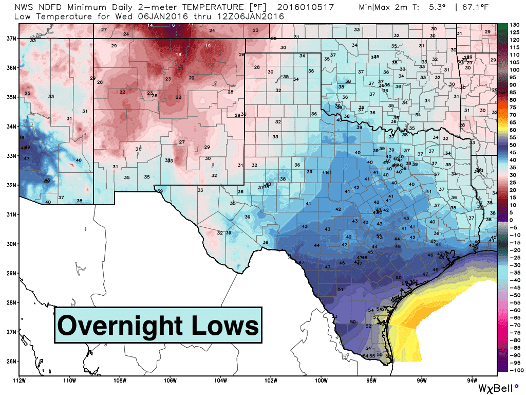
The overall pattern for tomorrow through the coming work week looks fairly quiet even with a few weak upper level disturbances passing overhead. We will stay cold tomorrow through Monday, then we’ll see a little bit of a warming trend getting back into normal range for most by the middle of next week. Little in the way of rainfall is expected, and what does fall will likely be confined to areas closer to the coast where better moisture will be present. For tonight, lows will drop into the teens and 20s across the panhandle and western Texas where skies have cleared out today. For north Texas, we’ll be looking at lows dipping into the mid to upper 20s. Further south, lows will dip down into the mid 30s with some threat of upper 20s in the rural outlying areas. Winds will be light as high pressure moves in and are expected to remain light through tomorrow as well.
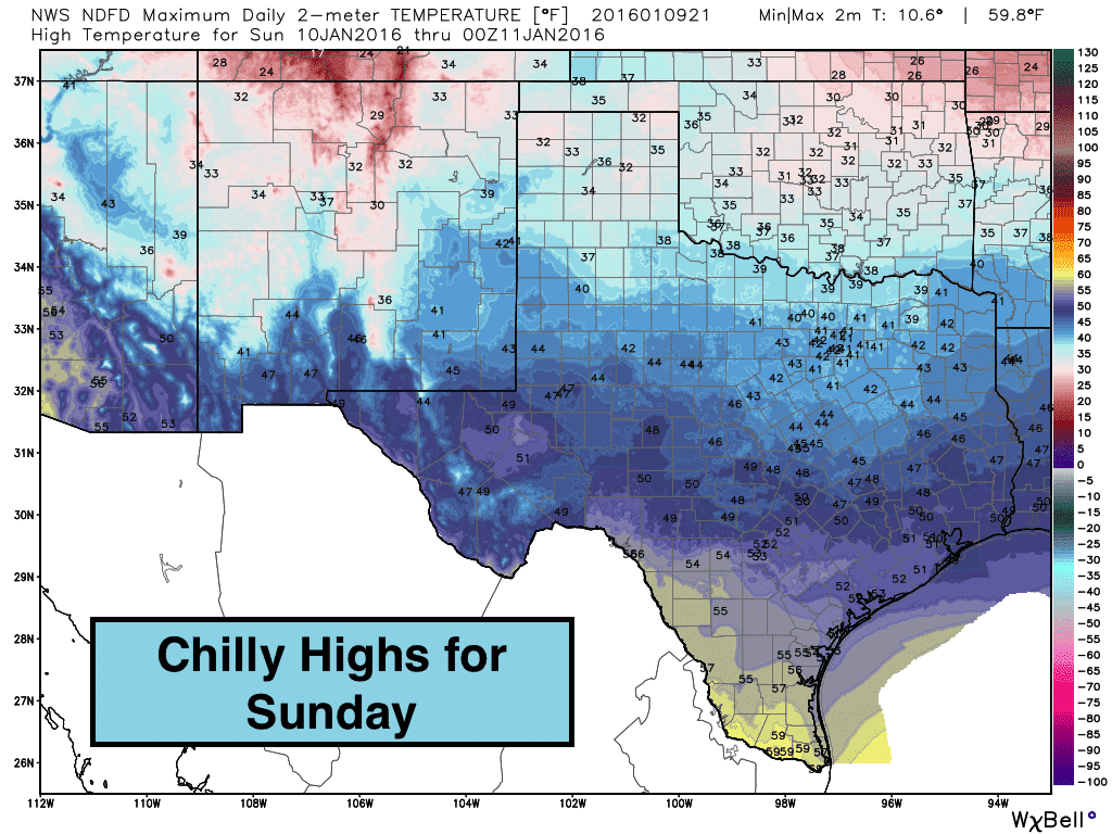
Highs on Sunday will also be on the chilly side. The panhandle will see temps only reaching the low to mid 30s tomorrow. South Texas will be the warmest with temps reaching the mid to upper 50s. In between…we’ll see a range of 40s spanning west, central, north and east Texas by tomorrow afternoon. We will see much more sunshine tomorrow than today, but it will be short-lived as clouds gather once again with the approach of a weak upper level disturbance by Monday.
The Climate Prediction Center Outlook issued back on January 3rd for this coming week looks like it will verify with a trend of cool temps and dry conditions expected. We will warm to near normal by Wednesday through Friday. Beyond that, the long-range forecast is unclear with none of the models showing any consistency at this time. The American (GFS) brings a stronger upper level low towards the region at the same time a strong cold front arrives by next weekend. If that verifies, we could see a chance for snow again for the panhandle and western Texas possibly encroaching on western north Texas. The European model keeps most of the rain further south out ahead of the colder air with just minimal chances of snow across the western panhandle and west Texas. We’ll have to keep an eye on that this week for the chance of mischievous weather next weekend!


0 Comments