
Rain Forecast through this evening
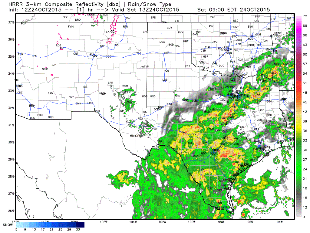
The 7 AM run of the High Resolution Rapid Refresh (HRRR) weather model has done fairly well with this event so far. It shows a lightning of rain across North Texas this afternoon and across Central Texas. We’ll see an increase in precipitation intensity in the Texas Coastal Plains and in Southeast Texas by dinnertime and this evening. A flash flood threat is anticipated and could become locally high-impact/dangerous including in the Houston Metro. Rain will also continue in Northeast and East Texas today.
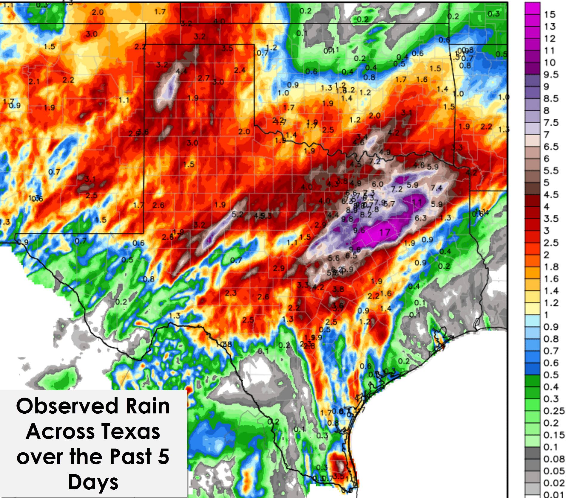
Rainfall Accumulation Forecast Through Sunday
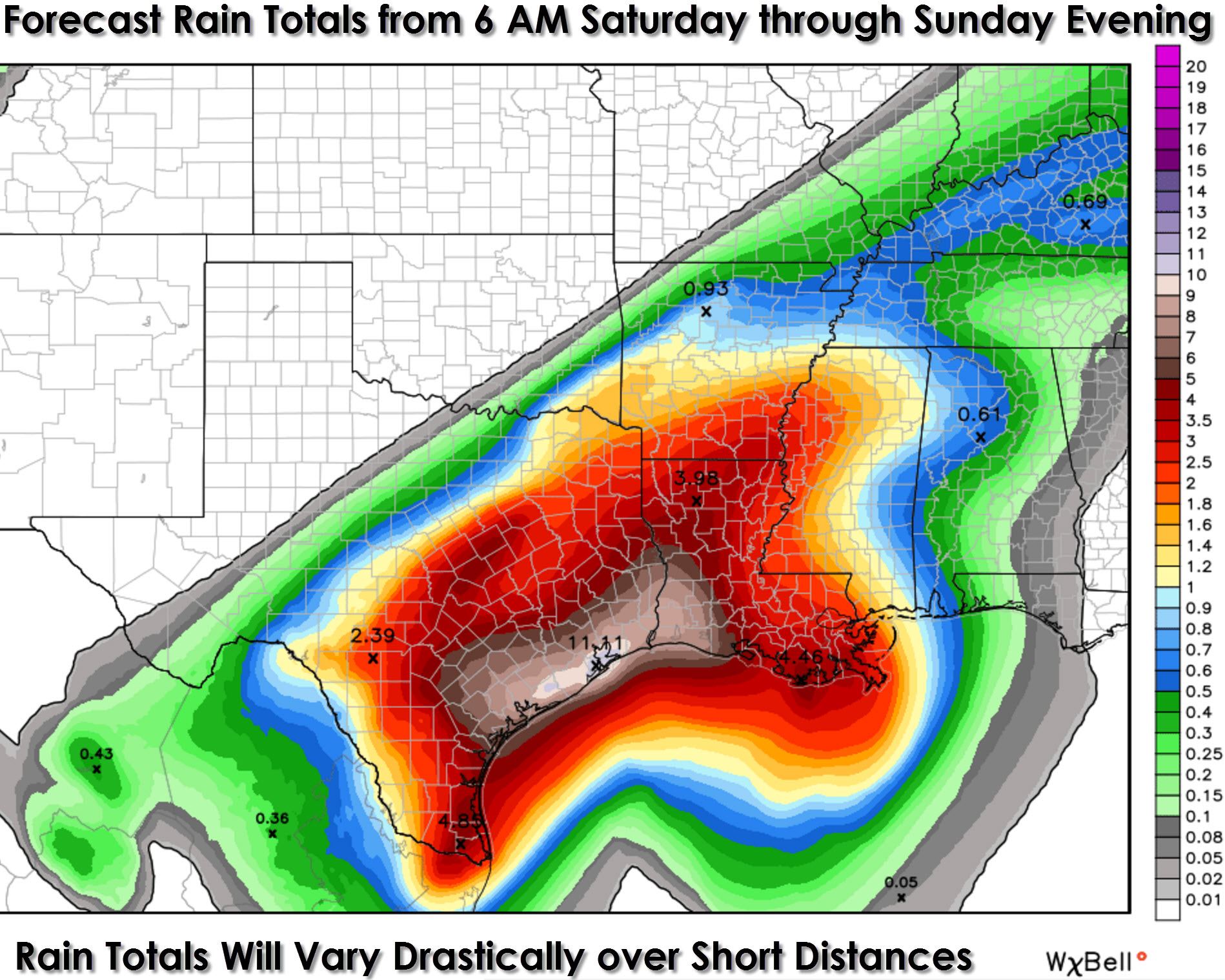
The heaviest rains have now moved southeast of the D/FW Metroplex and that should remain the case today. Additional rains of half an inch up to locally two inches will be possible – but the overall flash flood threat is diminishing. Widespread additional rains for Northeast Texas, East Texas, Central Texas, and the Rio Grande Valley will range from 2 inches to 5 inches. Later today, tonight, and on Sunday an extremely heavy area of rain will develop to the north of a east/northeast moving low pressure area along the coast. That band of potent rain will be capable of producing 2-4 inches of rain per hour with at least a few hours of that type of rain possible. Local rain accumulations of 8 to 14 inches will be possible along the Texas Coastal Plains and in Southeast Texas – including Houston and Galveston. Rain totals will vary over a short distance due to training of heavier bands of rain.
Flash Flood Risk Today and Tonight
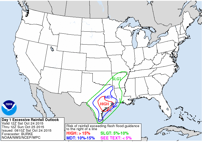
The Weather Prediction Center has placed South-Central Texas, the Coastal Plains, and Southeast Texas in a High Risk for Flash Flooding today and tonight. A large moderate risk area includes Northeast Texas. East Texas, and the Rio Grande Valley in addition to the southeast half of North Texas. Extremely heavy rainfall is forecast later today and tonight along the Texas Coast from the Coastal Plains into Southeast Texas. Hourly rainfall totals may exceed 3 inches at time. Even with months of dry weather that amount of rainfall will quickly lead to flash flooding. Houston and Galveston are in the High Risk zone and we are anticipating an active evening and night of flooding. Be ready to act!
Severe Weather/Tornado Threat Today

The remnants of Hurricane Patricia will move into Deep South Texas later today as a non-tropical low pressure. This low pressure will create a favorable environment for low-topped rotating thunderstorms off-shore. As the low pressure moves closer to the South Texas coast there is the possibility that a low tornado risk may develop in the Rio Grande Valley, Texas Coastal Plains, and immediate Southeast Texas coast. Any tornado threat would be tropical in nature which typically result in very brief, weak spin up tornadoes or funnel clouds.


0 Comments