
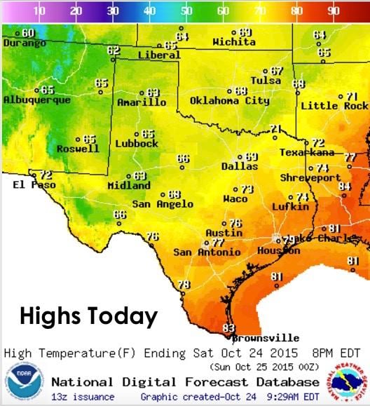
Since we’ve been so focused on the massive rain event impacting the state over the past several days, I thought it would be good to take a look at other weather features expected this weekend, plus take a first look at what’s in store for us into next week! A cold front dropped into the panhandle yesterday and is currently stretched northeast to southwest from around Paris, through Dallas and down towards Del Rio. Behind the front, temps are currently in the mid 40s across the northern panhandle and down into the 50’s across northwest Texas, the rolling plains, far west and west central Texas.

Highs today behind the front will range from the low 60s to low 70s. Further south, rain cooled air and persistent heavy cloud cover will keep temps generally in the 50s and 60s, with 70s and a few low 80s expected out ahead of the front and along the coast. For folks well behind the front and not impacted by our current major rain event down south, today will be a very pleasant fall day and a great time to get outdoors and enjoy the season!
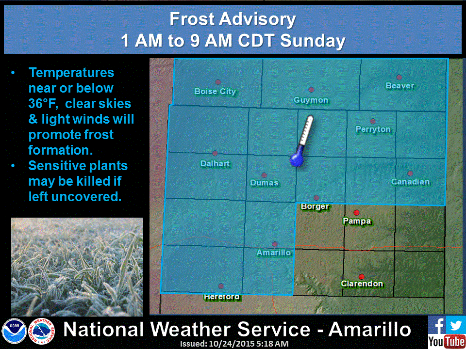
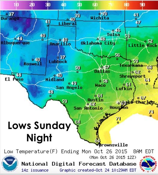
Cloud cover across the panhandle and west Texas region may be a bit stubborn to clear out today, but it will eventually, and leave most of the area with clear skies and drier air overnight into tomorrow. With lows expected to drop down into the 30s and 40s across the panhandle, rolling plains and far west Texas, frost is possible, especially for areas north and west of Amarillo where temps could briefly dip close to or right at the freezing mark by tomorrow morning. With clear skies, light winds and temps that low, the first frost of the season is likely!
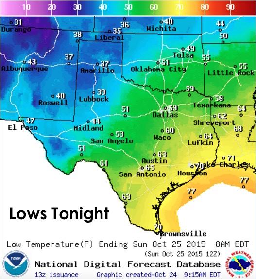
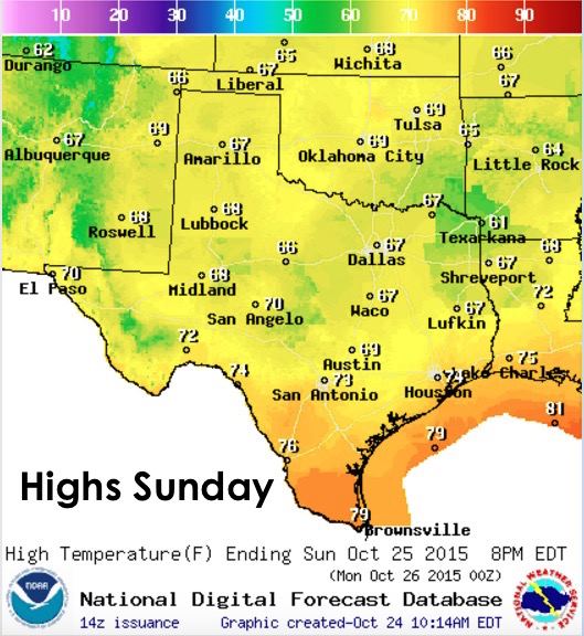
For Sunday through Sunday night, we’ll see a continued trend of cooler and drier air as our rain system down south continues to move east and eventually out of the state by sometime Monday. Temps in general will be a bit cooler than what’s normal for this time of the year, at least for the first part of the work week, then we’ll start to see a gradual warming trend each day.
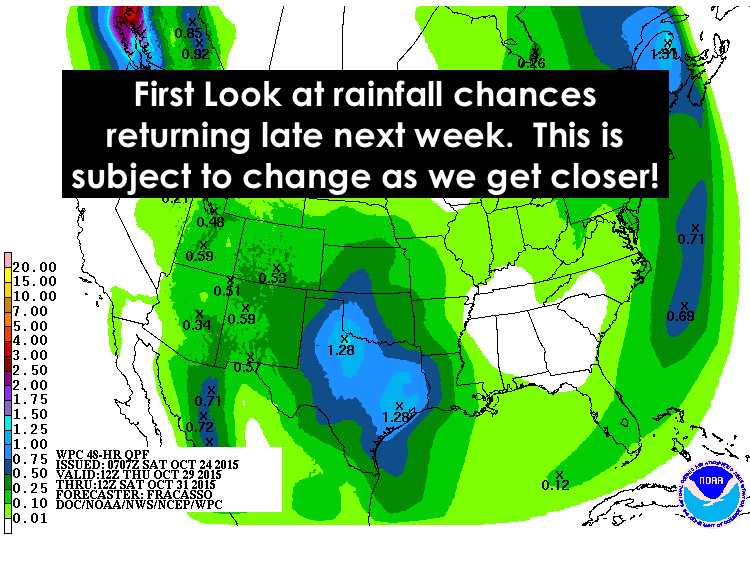
Early next week…Monday through Wednesday, we’ll be drying out with no rain expected until we get into the latter part of next week. At that time, another area of low pressure is expected to drop down across the desert southwest, possibly develop into a cutoff low, and slowly eject east from mid-week into the next weekend. At the same time, another cold front is expected to arrive Wednesday into Thursday, but it’s not expected to hang around for too long. Rain chances look to arrive back in the forecast beginning Thursday with chances possibly continuing through next weekend depending on how this next system sets up. Still too early to provide exact details, but the long range models are keeping us in a somewhat active pattern through next weekend into early next week!


0 Comments