
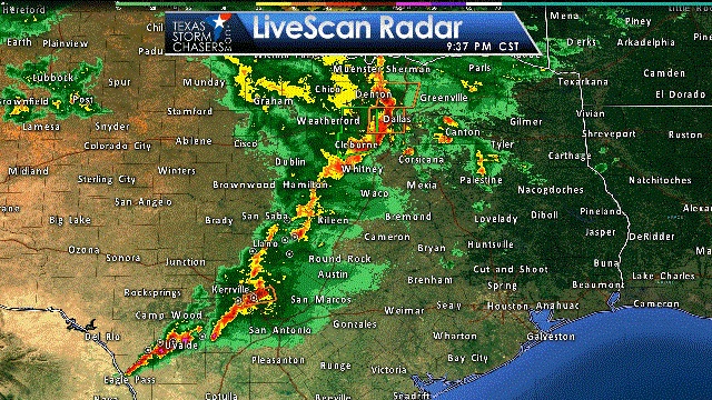
The leading edge of the squall line extends from near Carrolton to Duncanville to Itasca to Clifton to Burnet to Boerne to near Hondo. The line as a whole is moving east around 25-35 MPH, but individual cells in the line are moving northeast. Not all storms in the line are severe, and some parts of the line are actually pretty weak. The threat for severe weather should decrease as storms move east of Interstate 35 due to low instability values. However, wind shear values are very strong and may help to partially compensate for weak instability. That’s why we’ll be watching any discrete storm for signs of rotation.
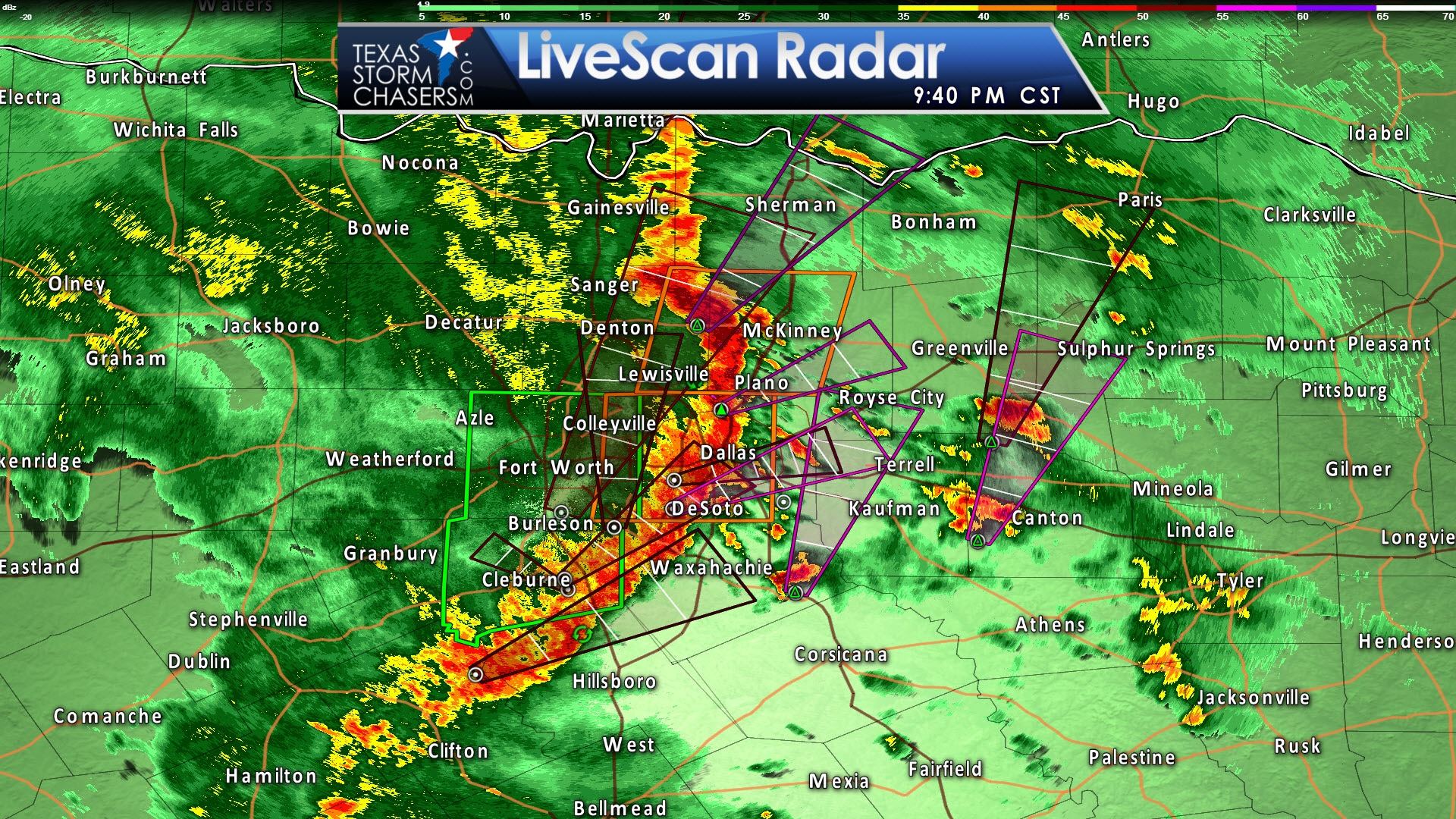
Lets chat about a few sections of the squall line. The line itself is moving through the D/FW Metroplex as I type this. Strong winds up to 65 MPH and brief spin-up tornadoes are possible along the leading edge of the line from McKinney south through Dallas to Waxahachie. The safety precautions are the same regardless and I would advise moving away from windows and into an interior room. This squall line will continue to move east at about 30-40 MPH with rain continuing for an hour or two behind it. The threat for severe storms should decrease as storms move east of the metroplex, but damaging wind gusts may continue even though instability values are low. At the same time we’ll be watching for isolated severe storms ahead of the squall line for signs of rotation.
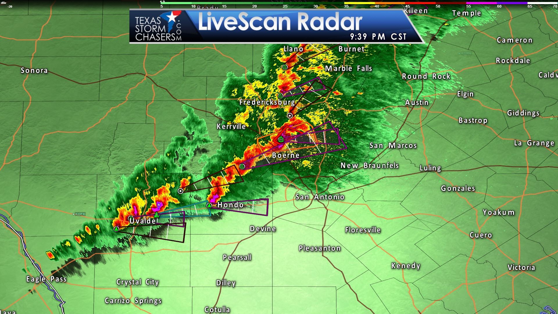
Moving south into the Hill Country – a broken line of strong to severe storms extends from Burnet to Boerne to Hondo to Uvalde. The storms from Boerne to Uvalde are more impressive looking because instability values are higher. These storms may produce large hail, damaging wind gusts, and brief tornadoes. A tornado warning is in effect northwest of Boerne with the storm moving slowly to the northeast. We’ll keep an eye on the storms as they move east toward Interstate 35. Severe storms aren’t out of the question in either Austin or San Antonio, but uncertianity remains on if storms will maintain their organization that far east. Something to watch for sure.


0 Comments