
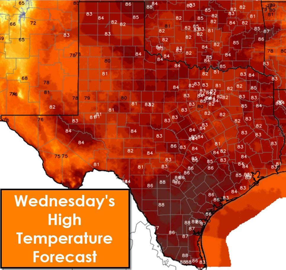
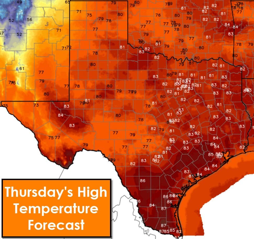
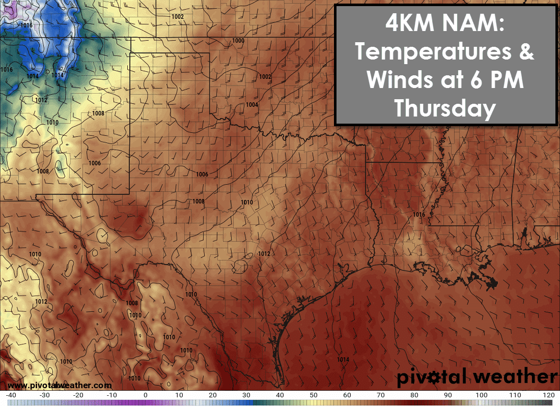
Today and Thursday will be the warmest day we’ve experienced in about two weeks, and should be the warmest we see for the next week (hopefully much longer). High temperatures will range from the upper 70s into the upper 80s. I can’t rule out a 90 degree peak in Deep South Texas this afternoon. High temperatures on Thursday will be similiar in Deep South Texas, but a few degrees cooler elsewhere due to strong winds. Thursday will feature strong southerly winds across all of Texas (except behind a dryline) as a storm system organizes in Colorado.
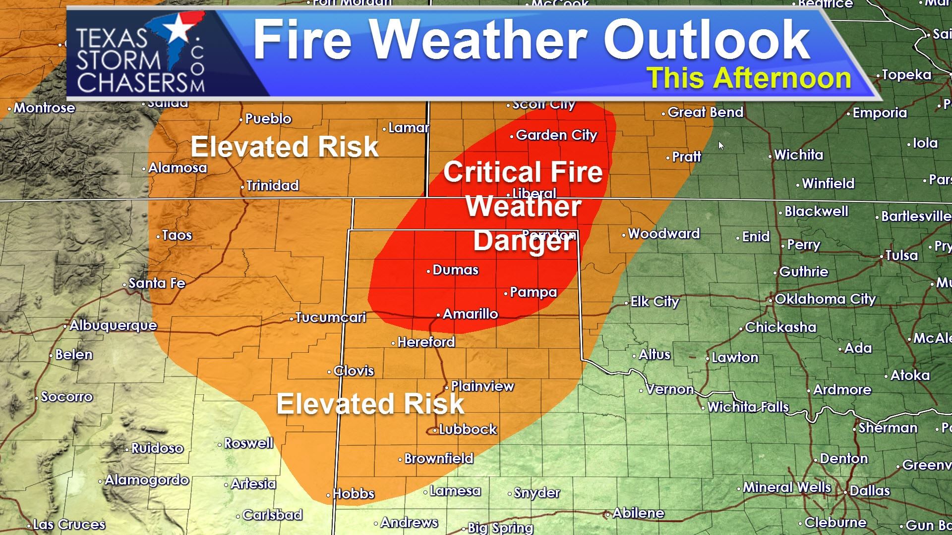
The next two days will feature dangerous fire weather conditions across the Texas Panhandle and West Texas. For today we have a Red Flag Warning in effect for the northern Texas Panhandle. Critical Fire Weather conditions are forecast there with south winds up to 30 MPH, record high temperatures in the 80s, and minimum humidity values below 20 percent. Fire weather conditions will be elevated in West Texas, but not as high as the Texas Panhandle.
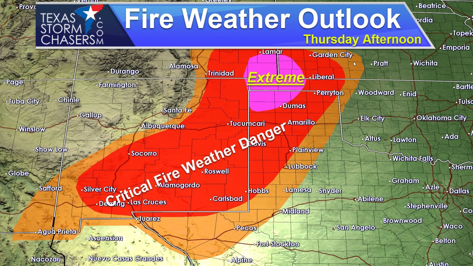
A dryline will surge east on Thursday through the Texas Panhandle and West Texas. Conditions to the west of the dryline will deteriorate quickly. Westerly/southwesterly winds will become strong with gusts upwards of 45 to 50 MPH. Dewpoint values will drop into the teens and single digits. Relative humidity values will do the same. Surface temperatures will soar into the upper 70s. Compared to today the winds will be stronger tomorrow and relative humidity values will be lower. An extremely critical fire weather zone has been designated in the northwestern Texas Panhandle. Critical fire weather conditions are expected across the remainder of the Panhandle and south across all of West Texas. The extremely critical risk is fairly rare and the last one for Texas was issued back in February and March. Those events resulted in numerous wildfires in the Texas Panhandle, including one that came dangerously close to Pampa. Fire danger will slowly decrease during the early evening hours as temperatures start to cool. The fire danger will decrease later Thursday Night as much colder air moves in behind a cold front. Winds will become quite strong out of the northwest – a concern for firefighters working on the east/south flanks of fires.
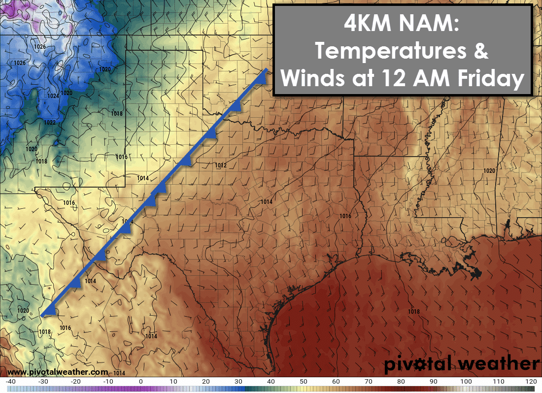
A strong cold front will start pushing into Texas during the evening hours Thursday. The front will push through the Texas Panhandle and West Texas first with strong north winds and a rapid drop in temperatures. While specific timing will undoubtedly be off a few hours we’re now in range to give a more specific front timing forecast. The 4KM NAM has the cold front moving into Northwest Texas, the Big Country, and the Permian Basin at midnight Friday.
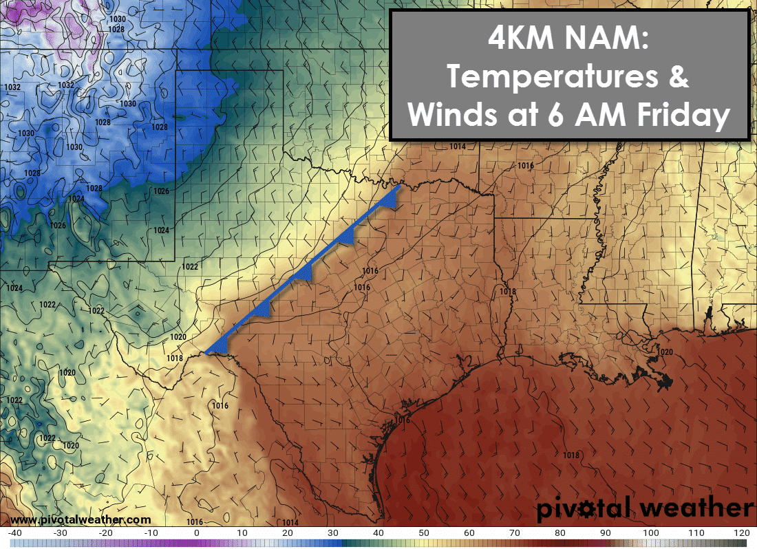
The front should be moving through Texoma, North Texas, into the Concho Valley and western Hill Country by sunrise on Friday. Winds behind the front will be out of the northwest with temperatures falling into the 40s and 50s. The Panhandle will be in the 30s with freezing temperatures across the western half of the Panhandle.
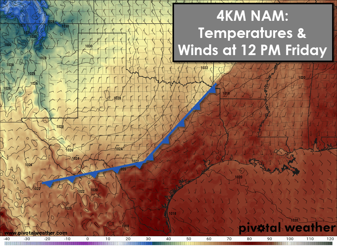
By noon Friday the front should have pushed through the northwest half of Texas. The front should be approaching San Antonio, Austin, northeast through Fairfield to near Texarkana. Gusty north winds will be underway on Friday behind the front with temperatures in the 40s and 50s. It’ll be a chilly wind. The front will continue a fast push south on Friday. By late Friday evening the front should be through nearly all of Texas and pushing into the Gulf of Mexico.
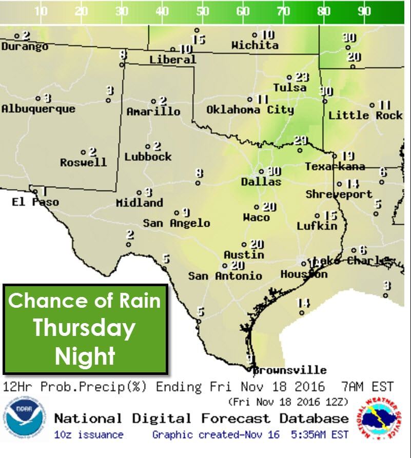
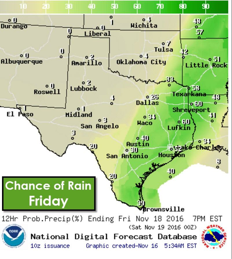
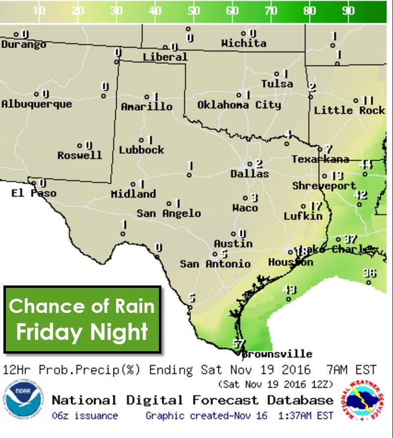
For the northwest half of Texas this frontal passage will be dry. The cold front will interact with increasing atmospheric moisture in North Texas and the Hill Country. That is where, by late Thursday night or early Friday, a borken line of thunderstorms may begin to develop along the front. The severe weather risk is currently anticipated to be very low. Thunderstorms will become more common along the front as it moves into Northeast Texas, East Texas, Southeast Texas, the Brazos Valley, South-Central Texas, into Deep South Texas and the Rio Grande Valley. At this point we’re expecting the line of storms to remain broken – versus a solid squall line. If more instablity is present and/or moisture levels are higher the chance of storms will be higher – as the risk for strong storms. Rainfall amounts with this frontal passage will remain light. A few spots may get enough rain to total one half inch, but most will get less, if any at all.
This upcoming weekend is going to feature the coolest weather so far this fall. A strong surface high pressure will be in place allowing clear skies, light winds, and excellent radiational cooling. High temperatures will be in the 40s, 50s, and lower 60s for most. Low temperatures will be chilly with 20s, 30s, and 40s. Sunday morning looks to be the coldest with temperatures falling into the 30s all the way into Southwest Texas, the Hill Country, and Southeast Texas. Several locations will also experience their first freeze this season marking the end of the growing season. Temperatures will moderate by early next week. Another cold front will probably arrive shortly before Thanksgiving.


0 Comments