
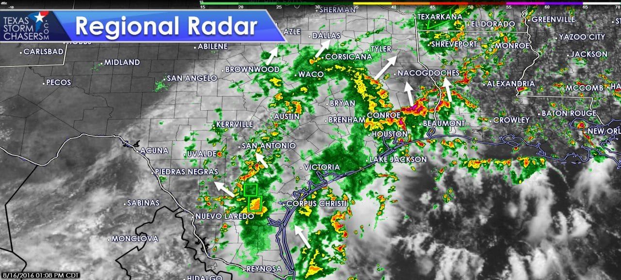
A stationary front is located from near Del Rio northeast to just south of Dallas towards New Boston. This stationary front is essentially the dividing line between rain chances and mostly sunny skies. To the south/east of the front skies are cloudy with scattered to numerous showers and thunderstorms early this afternoon. The most intense rains are currently across Southeast Texas in association with a cluster of storms moving north towards Lufkin and Nacogdoches. Additional showers and thunderstorms are moving northwest into the San Antonio and Austin metros while lighter rain is just about to move north of Houston. These rain chances look to continue through the afternoon. Heavier activity may produce hourly rainfall rates over two inches per hour. Widespread flash flooding is not expected today, but localized issues are certainly possible in locations that have already had several inches of rain over the past few days.
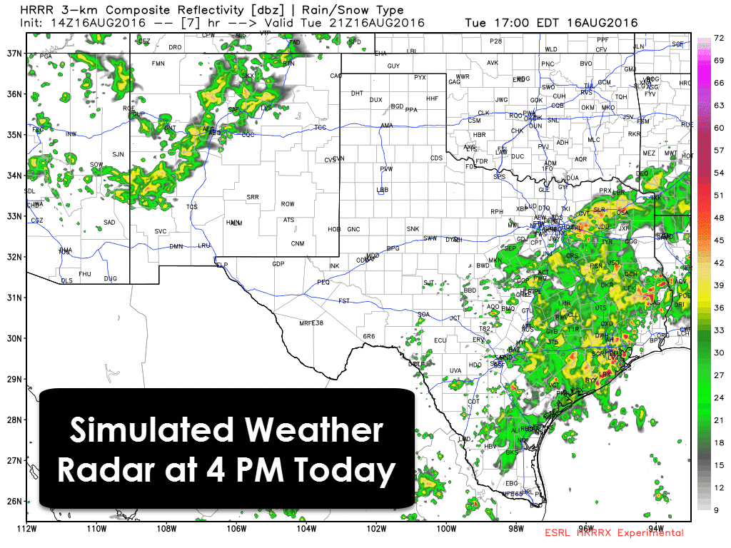
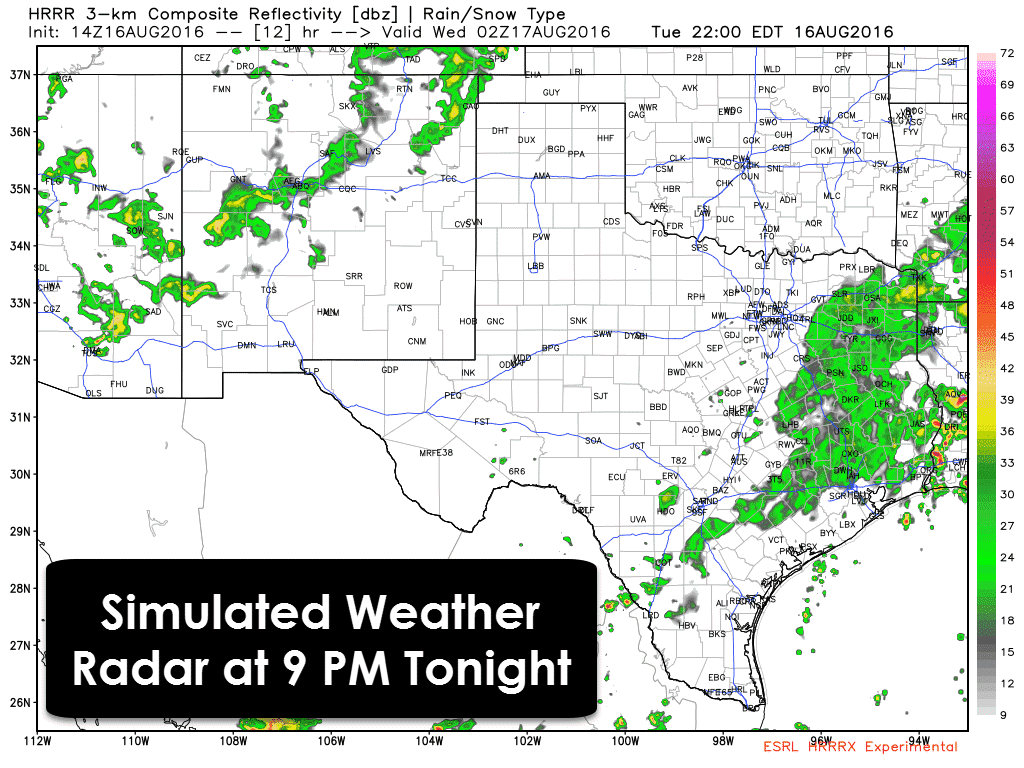
The high resolution rapid refresh (HRRR) shows precipitation chances continuing through the late afternoon south of the stalled front. Localized flooding issues may develop in locations that have already dealt with their fair share of rain over the past few days. The good news is rain coverage and intensity should diminish as we proceed into the evening. Light rain will certainly remain possible tonight south/east of the stalled front but the chance of heavier rains will decrease. Temperatures will remain in the 70s and 80s where rain falls today. North/west of the stalled front skies are mostly clear and temperatures will climb into the upper 80s to lower 90s this afternoon.


0 Comments