
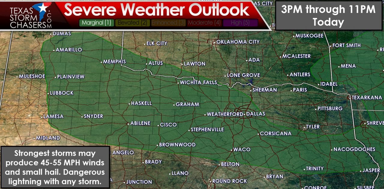
The Storm Prediction Center has issued a category 1 severe weather risk for this afternoon and evening. This risk covers the Texas Panhandle, South Plains, West-Central Texas, Northwest Texas, the Big Country, North Texas, and East Texas. We had a category 2 severe weather risk yesterday so today’s risk is lower. The impacts from the strongest storms today will be similar to yesterday, but fewer storms are expected. The strongest storms may produce localized wind gusts of 45 to 55 MPH and quarter size hail. Any storm that develops this afternoon could be strong since temperatures will be in the 90s/100s. Wind shear values, however, are quite marginal for a organized severe weather threat. A couple storms may become marginally severe but widespread severe weather is unlikely.
Without any major source of lift we’ll be looking at more random thunderstorm development today. The chance of being impacted by a thunderstorm in the marginal risk zone is around 30 percent this afternoon and this evening. That means a third of folks may end up getting wet today. Even if a thunderstorm doesn’t directly impact your location please be mindful of lightning and unexpected strong wind gusts well away from thunderstorms. Outflow boundaries produced by collapsing thunderstorms may cause wind gusts up to 50 MPH well away from thunderstorms. These unexpected wind gusts are particularly hazardous to those on lakes and bodies of water. Any thunderstorm that develops today will produce dangerous lightning and brief heavy rain.
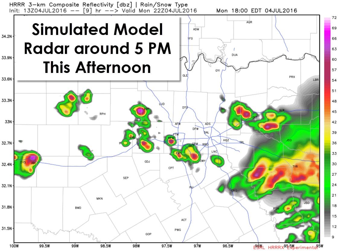
The experimental high resolution rapid refresh has been showing slightly better storm chances in the Big Country and western North Texas late this afternoon and early this evening. This model may be picking up on outflow boundaries left over from storms this morning. It is certainly possible that isolated to scattered storms could popup on these residual outflow boundaries during peak heating this afternoon. Any storm that develops would move east around 15-20 MPH. If thunderstorms do organize into a small cluster they may move east around 25-30 MPH and with a slightly higher threat of damaging wind gusts. With this evening’s outdoor festivities any thunderstorm could be dangerous to those outdoors. I do believe most folks will be dry and for most tonight’s festivities will go off without a hitch (weatherwise). There will be some issues and its not ouf of the question that storms may be into western D/FW around 7-8PM. We’re going to have to keep an eye on trends as I can’t definitively say what will play out today.


0 Comments