
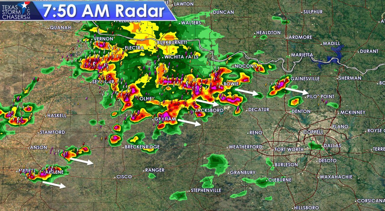
Scattered thunderstorms are impacting portions of Northwest Texas and western North Texas this morning. Shortly before 8 AM this cluster of thunderstorms extends from Seymour east to Bowie and south to Graham. Isolated storms continue south to Abilene and west to Haskell. All this activity is being generated by an outflow boundary that is moving east/southeast. These storms are not severe but are producing frequent cloud to ground lightning, 40 MPH winds gusts, and heavy rain. It is unknown how far east this activity will go before it weakens. At this point it seems likely these storms will make it into the D/FW Metroplex by 9 AM. With all the rain yesterday and overnight some minor flooding issues could occur in cities that get under one of the heavier storms. As storms move east of Interstate 35 we should see them weaken later this morning.
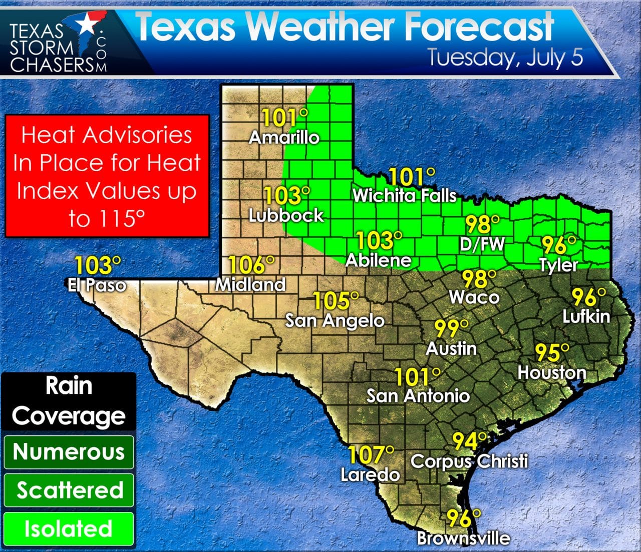
Another day of hot to record breaking temperatures are forecast with high temperatures in the upper 90s to upper 100s. Where humidity values are higher (along and east of Interstate 35) the heat index values could approach or exceed 110 degrees. Regardless of one location making it into the triple digits officially today it’ll feel like it regardless. Isolated or scattered thunderstorms will likely develop this afternoon from the Texas Panhandle and West Texas east through Northwest Texas, the Big Country, North Texas, and East Texas. These storms will be hit or miss and like the previous days could be strong. Remnant outflow boundaries could be focal points for new storm development later today. If we have another cluster or line of storms organize the threat of damaging wind gusts would increase.
0 Comments