
If you live in the Rio Grande Valley then today was a pretty yucky day with cool temperatures and cloudy skies. Everywhere else the sun ruled the sky once again. Saturday will be the warmest day we’ve seen in a while with 60s to lower 70s across Texas. We’ll begin to see changes tomorrow night as another storm system begins to approach from the Southwest United States. We remain in a very active weather pattern. Apparently El Nino has finally decided to show up or at least we’re seeing conditions similar to a weak El Nino. That’s good news as we continue into March as we should see the subtropical jet stream remain active. That means we’ll have upper level storm systems move through the region every few days with each one potentially bringing us chances for precipitation. Many atmospheric indications are pointing to a very active last half of March setting up.
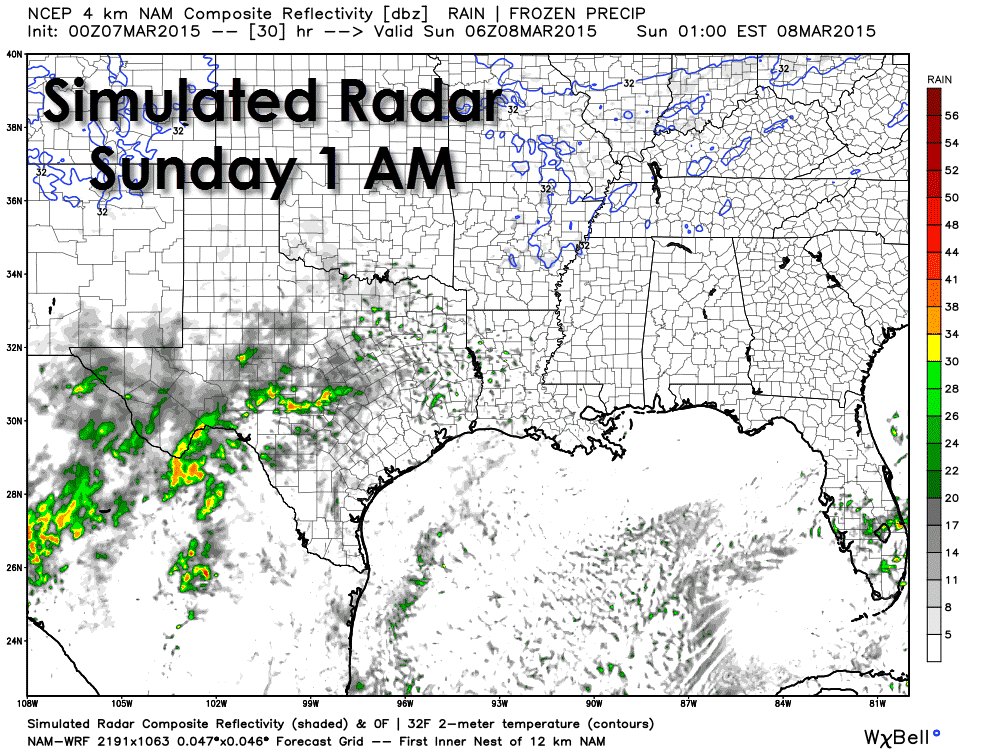
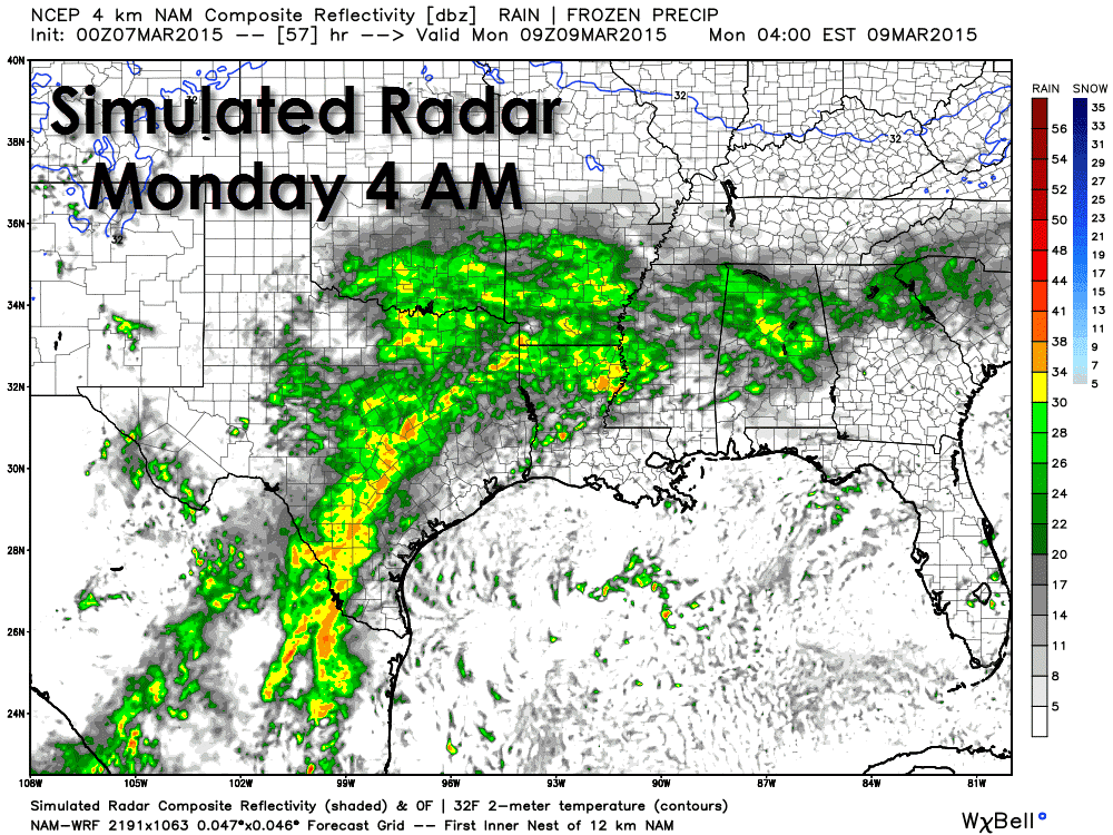
At this time we do not see indications of another arctic air outbreak within the next week. While I doubt we’ve seen the last of the cold weather it becomes more difficult to get arctic intrusions this far south as we continue into March. We may not be done with winter yet – but for the next week we’ll be enjoying spring-like weather. We have a split flow aloft this evening with a ridge across the western United States and a trough across the northeastern United States. The subtropical jet remains active from Baja California across Texas. By Saturday evening an upper level storm system will be taking shape across Baja California. Moisture will be streaming in from the Pacific and we’ll start seeing showers develop across the Permian Basin into the Concho Valley and Hill Country. As the storm system slowly moves east on Sunday we’ll see rain expand spatially and intensity across South-Central Texas into North, Northeast, and East Texas. The eventual track of the upper level storm system will determine where we end up seeing the most widespread and beneficial rain. Temperature profiles will be far too warm for any winter precipitation and this is not going to involve any sort of cold front. Widespread cloud cover and the nature of the setup will also preclude widespread thunderstorms and keep the threat of severe weather non-existent. Rain will continue from Deep South Texas north through South Central, Central, North, Northeast, East, and Southeast Texas during the overnight hours Sunday into Monday morning.

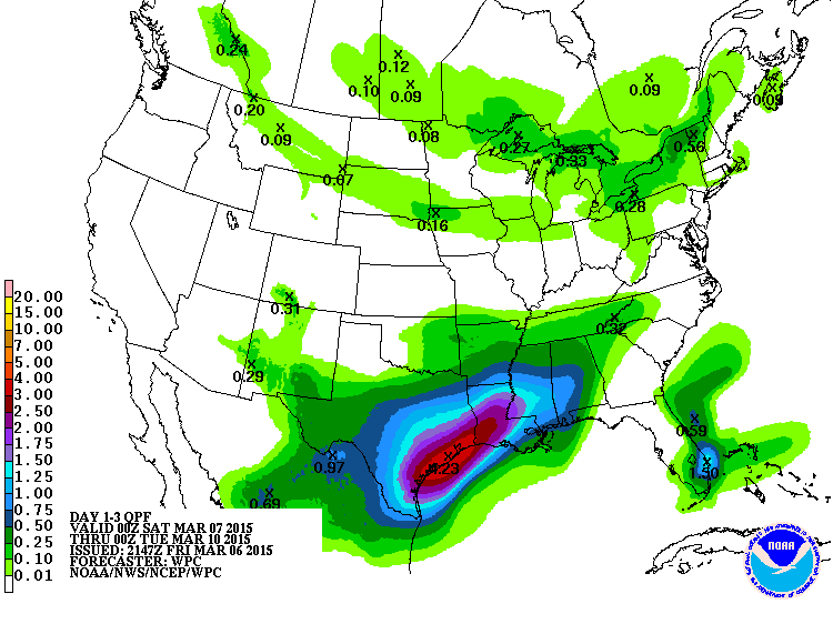
This storm system has the potential to bring widespread rain totals exceeding half an inch to Texas. Some locations will likely see over two inches of rain with local amounts up to four inches possible. With this event spread out over two days and the ground able to absorb plenty of water we shouldn’t have to deal with much in the way of flooding. As usual some of the typical urban trouble spots could see ponding. The Weather Prediction Center is forecasting the heaviest rains to fall across Southeast Texas with all folks south of the Texas Panhandle, South Plains, and Northwest Texas receiving at least some rain with this event.


0 Comments