
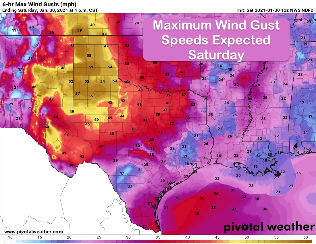
Good morning and happy weekend everyone! Skinny folks need to tie down today with very windy conditions expected across a large portion of the state as an upper level system and pacific cold front sweeps through this morning. High Wind Warnings are in place through 3pm this afternoon across portions of the Texas Panhandle, Guadalupe Mountains and Trans Pecos region. Elsewhere across the Panhandle, Permian Basin, Northwest Texas, northern Big Country and North Central Texas regions, Wind Advisories will remain in place until 6pm. We also have a small area across deep south Texas expecting gusty south winds today. There, we have a Wind Advisory in place until 3pm.
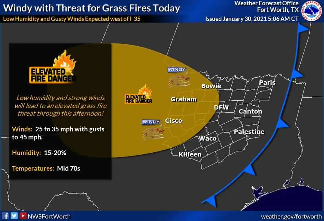
Peak winds are expected to be seen across the panhandle and western Texas through about noon today before slowly dying out through the afternoon hours. Further east, we’ll see winds begin to pick up after the pacific front passes as we get into the late morning hours. Periods of blowing dust in the panhandle region and an increased risk for grass fires will be the main hazards with the passage of this front. Rain out ahead of the front across northeast and far eastern Texas will continue for the next several hours before moving out of the area by this afternoon. Aside from a few claps of thunder, no severe weather is expected.
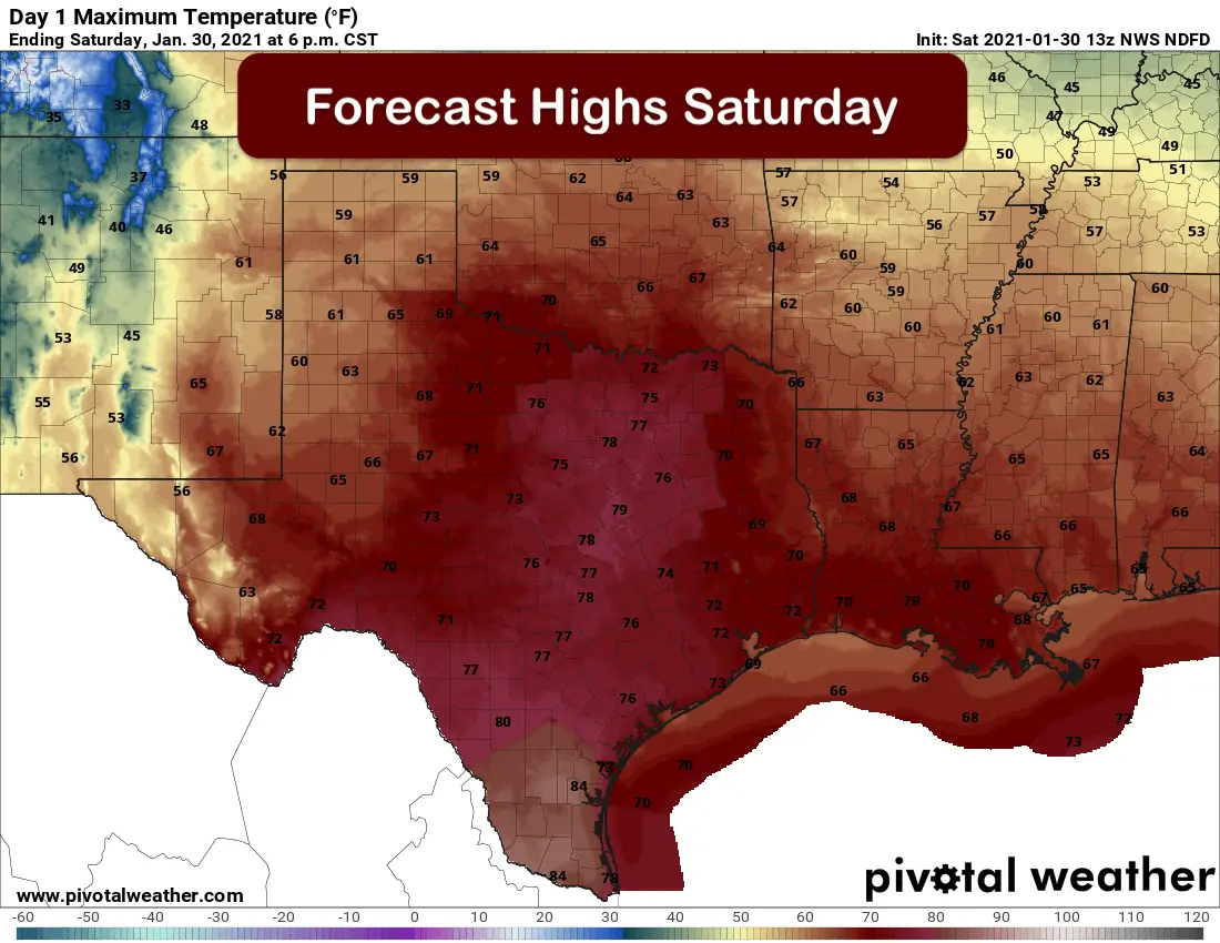
The passage of the Pacific cold front will not have an immediate effect on temperatures today. Highs today across north and central Texas will reach the low to mid 70s…well above normal for this time of the year. Deep South Texas will see highs creep into the low to mid 80s. The panhandle and parts of far western Texas will be cooler with highs only reaching the mid 50s to low 60s. Even with the warmer ambient weather this afternoon, the very gusty winds will not make it all that pleasant to be outdoors, so don’t get too excited and make plans for having a picnic or anything like that. Maybe flying a kite might be an option…but hold on tight! Once the front passes on by, we’ll see lows drop down into the 40s and 50s overnight. Reinforcing colder air will arrive from the northwest overnight leading to cooler daytime highs on Sunday across the northern half of the state. Coastal and deep South Texas will remain warm with highs in the 70s and low 80s. Winds will be calmer than Saturday, but still a bit breezy as northwest winds continue to filter in behind the front.


0 Comments