
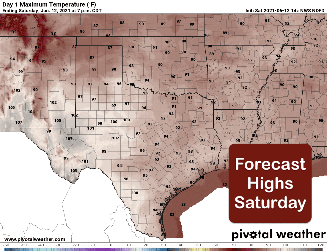
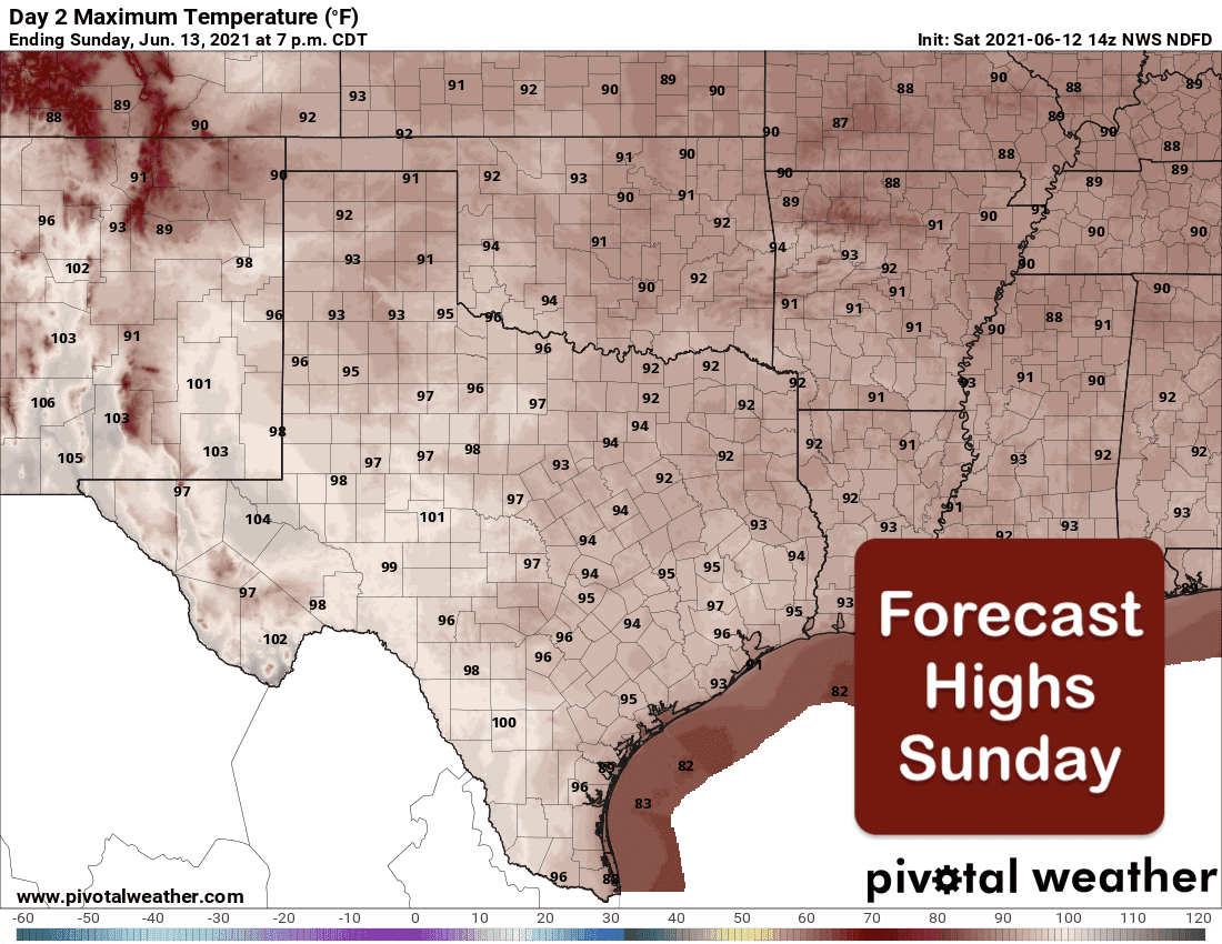
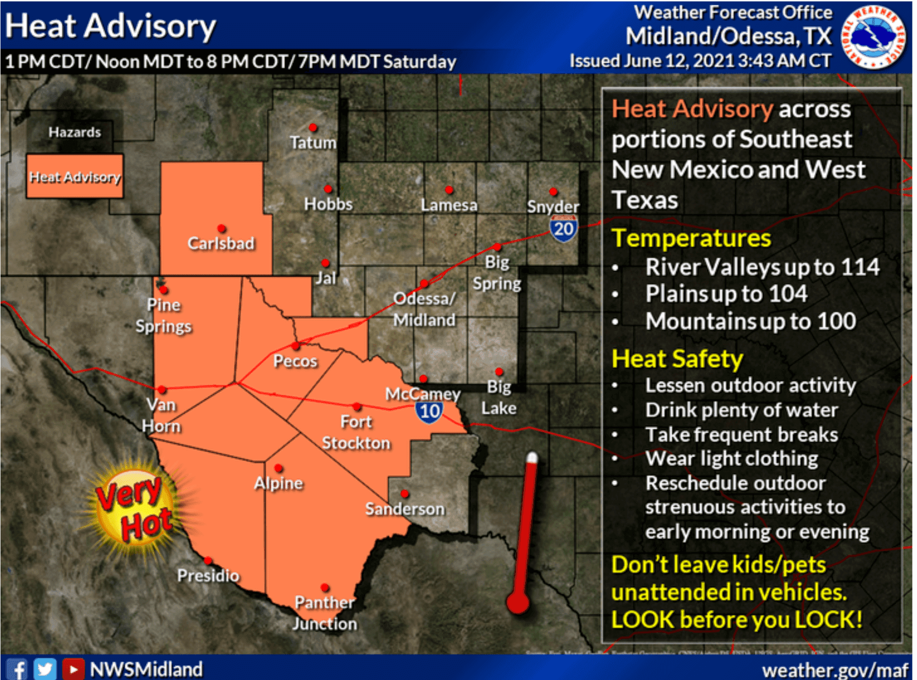
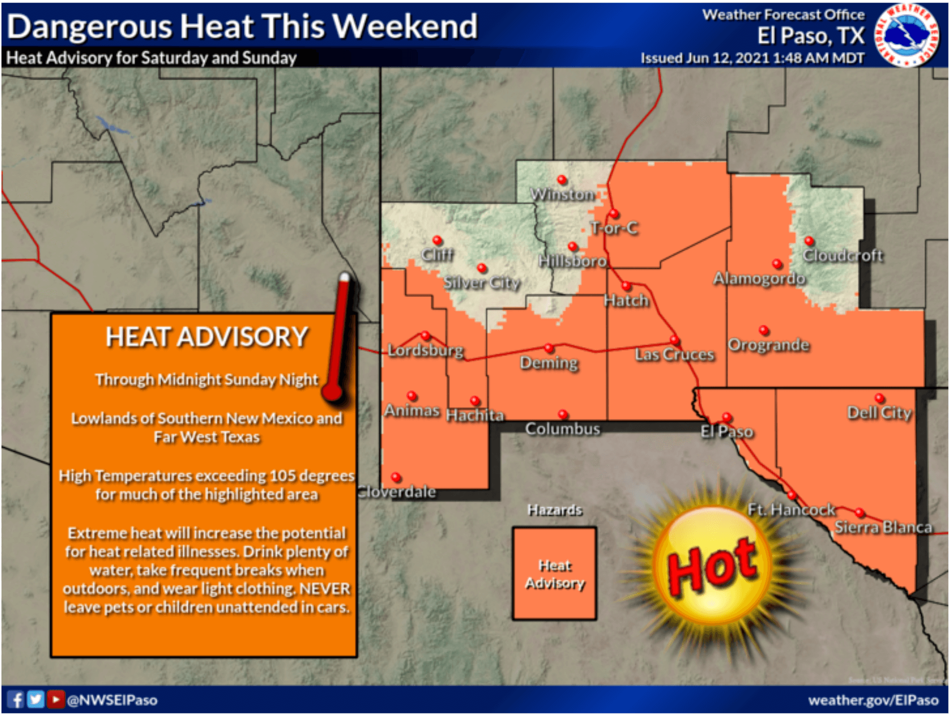
The overall theme this weekend will be the heat and humidity across the central and eastern portions of the state and the dangerous hot and dry conditions across the western half of the state. Summer had definitely taken hold rather quickly so our bodies have not had much of a chance to adjust, so do keep that in mind if you have outdoor activities planned this weekend. Across far West Texas, Heat Advisories will be in place for today and likely into tomorrow as well with forecast highs today ranging from 107 up to 114. Further east, temps are not expected to exceed the 100 degree mark, but an abundance of humidity will remain in place and lead to downright miserable conditions for being outside for any length of time. If you do have to be outside this weekend, remember to stay hydrated by drinking plenty of water, stay in the shade as much as possible, and avoid strenuous activity during peak daytime heating. Also be sure outdoor pets and livestock have access to plenty of water and shade.
Forecast Highs Today and Sunday
Western Texas – Heat Advisories
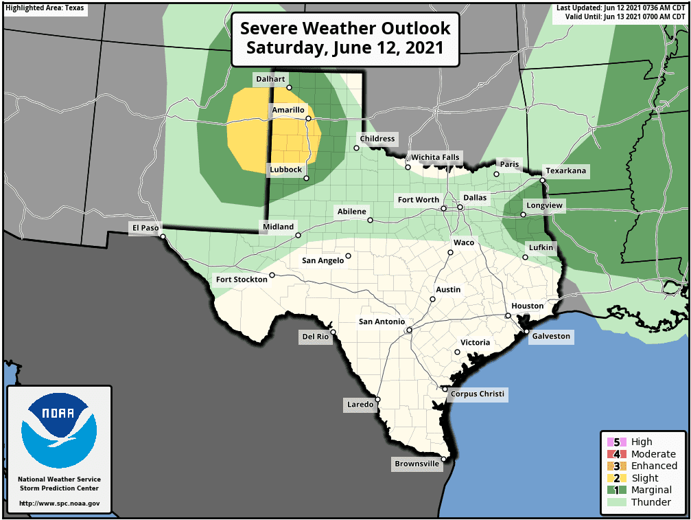
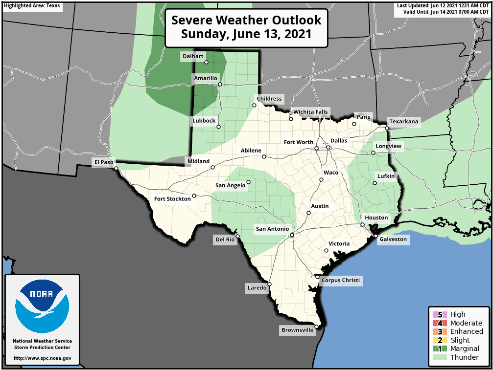
Aside from the dying storm complex that moved south out of Oklahoma overnight and impacted parts of north central and northeast Texas, the best chances for seeing any severe weather today will be across parts of eastern New Mexico into the western Texas Panhandle region where the Storm Prediction Center has outlined Marginal (Level 1) and Slight (Level 2) Risks for later this evening and into the early overnight hours. Across these regions, as storms develop across eastern New Mexico this evening, they are expected to congeal into a mesoscale convective system (aka “squall line” ) and drift into the western portions of the Texas Panhandle. With the squall line, large hail, damaging winds, isolated flash flooding and frequent cloud to ground lightning will be the primary threats. Sunday looks to be a repeat but with fewer storms and less of a risk of any severe weather. On both days, not everyone will experience storms, but for that do, enjoy the rain and brief relief from the heat that they bring. The upcoming work week looks mostly dry across a large portion of the state with chances for daily showers and pop up storms mainly in our coastal counties.
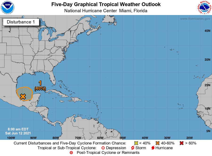
Now, for those curious about the potential for tropical mischief in the Gulf of Mexico, we are currently monitoring an area of disturbed weather over the Bay of Campeche. The current National Hurricane Center has a 40% chance of this developing into a Tropical Depression by the middle of next week. Current forecast long and mid-range forecast models are still all over the place with development of this system into anything that would impact the Texas Gulf Coast but we will continue to watch this development over the next several days and keep you up to date on the latest.


0 Comments