
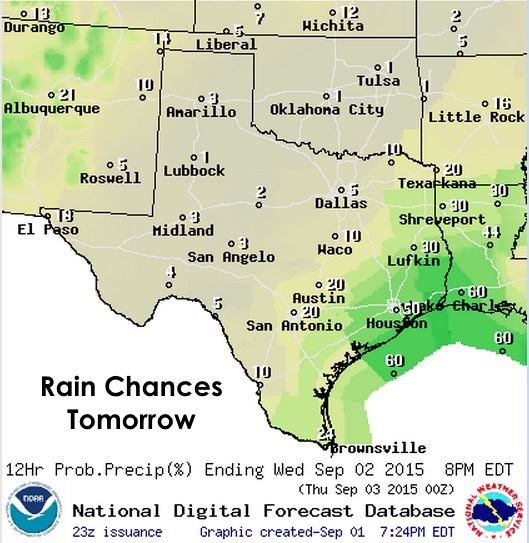
Another lull in shower and storm activity along the coast this evening, then chances for additional rain and storms returns by early tomorrow morning. A tiny upper level low continues to spin just off the coat near Matagorda bay, and will begin to slowly lift east/northeast through the day tomorrow taking some of the rain chances along with it. Between now and then, we expect conditions to remain relatively quiet through most of tonight with a re-emergence of storms again offshore and along the southeast Texas coast by tomorrow morning. Like yesterday, it will be difficult to pinpoint exactly where storms will impact the coast early tomorrow. This morning, we started off with a big blob of convection offshore between Corpus and Brownsville which eventually formed into a conga line of convection straight up into the Houston/Galveston area. Yes, those are fancy meteorological terms. Depending on how far east/northeast the tiny low shifts tonight…if it shifts at all…we could see convection develop a bit further up the coast to start with. Either way, it will likely mean a wet commute for some folks, so be sure to check radar before you head out in the morning. Heavy rainfall will also be likely once again with some folks picking up a quick 2 to 4 inches and some street flooding likely.

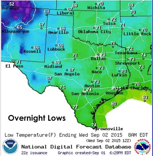
Temps…once again warm overnight for most and a few degrees above seasonal normals, and cooler out west where there’s less humidity (water vapor) in the atmosphere to prevent the release of longwave radiation away from the earth. Highs tomorrow, warm once again with highs in the 90s.

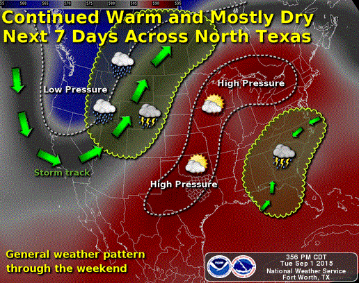
For the long haul….pretty much hot and rain-free across most of the state for the next 7 days. Rain chances will decrease along the coast, but won’t completely disappear. This will probably be good for those with outdoor plans this coming Labor Day weekend, but there’s plenty of us across the state that could sure use some rain. As of right now, it looks like mid-September is the earliest we’ll begin to see rain chances return to more areas of the state.


0 Comments