
Isolated showers will continue today in Central Texas as a weak upper level disturbance moves overhead. Unlike Friday’s system the moisture levels are much lower today. Only light rain totals are expected and coverage should remain much lower than yesterday. Our focus than shifts to the Sunday Night/Monday storm system when widespread rain/storms are expected along and east of Interstate 35. Precipitation will increase Sunday Night across North Texas, Northeast Texas, into the eastern Big Country, Central Texas, and East Texas. The increase in storms will be due to a cool front moving east/southeast. A line of storms will eventually form along the front and accompany it as it quickly races east/south on Monday. A few storms may be strong to severe, but like last week we may not see all the ingredients come together to support that threat. It’s something we’ll watch for and post updates as needed. Rain will end from west to east on Monday as the cool front races out of the state. Expect strong west/north winds behind the front. Temperatures won’t be too much cooler behind the front, but a more noticeable cool down will arrive on Tuesday and Wednesday.
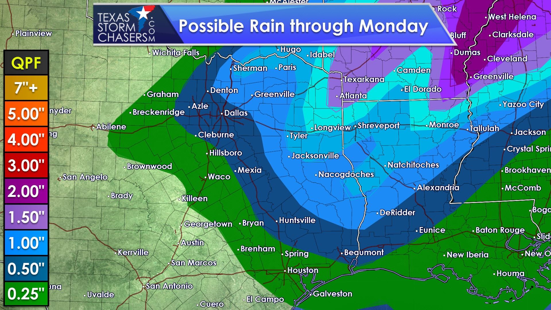
While actual rain amounts will vary locally it does look like most of Northeast Texas and East Texas will have the best rain totals with Monday’s system. A few folks may pick up an inch to inch and a half of rain. Totals will be lower with west/south extent. Localized, brief stream flooding will be possible. Widespread flooding is not anticipated at this time.
Temperatures will become slightly cooler by mid-week as cooler air filters in from the north. The coldest will be the Texas Panhandle where high temperatures will struggle to get into the 50s. A strong storm system will likely arrive late next week into the weekend with the potential for widespread, cold rain. At this time it does seem that parts of Texas could see their first winter weather of the season. It goes without saying any potential winter mischief wouldn’t be accurately forecastable until we got much closer in time.


0 Comments