
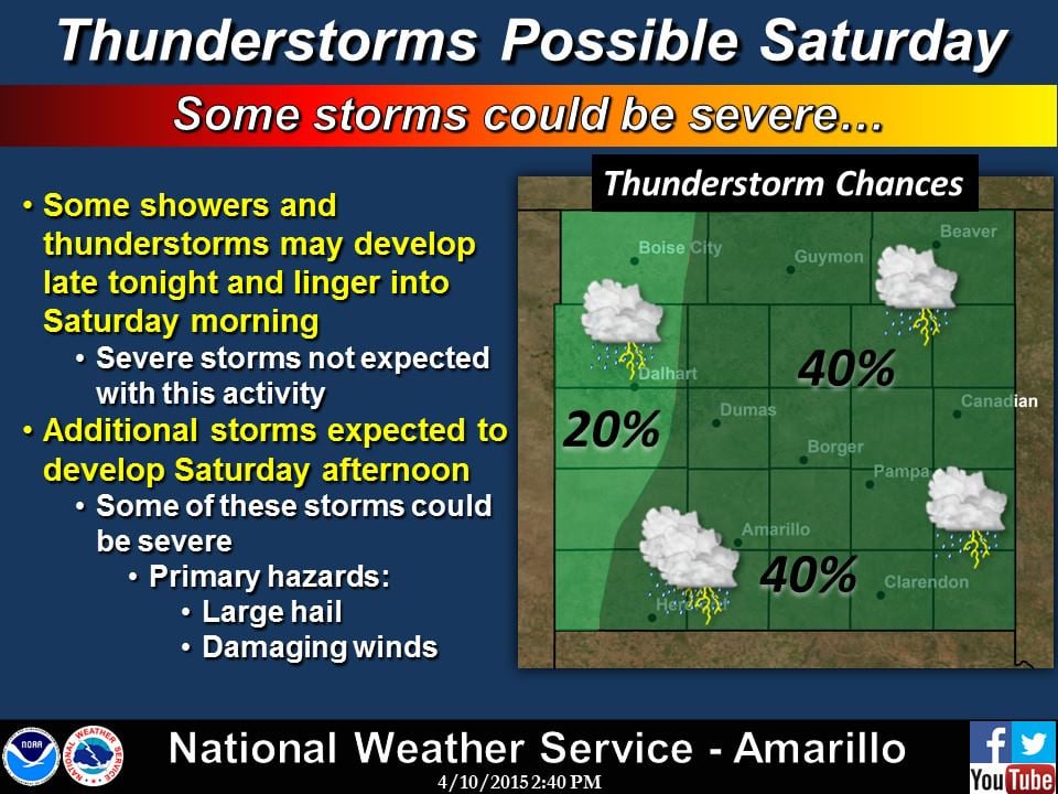
As a surface high across the eastern half of the state lifts northeast tomorrow, we’ll see winds begin to swing around from the south ushering in a rapid return of springtime moisture. In the upper levels, a disturbance will approach from the southwest bringing lift and widespread rain chances beginning early Saturday and lasting through the day. Highest rain chances will reside across the southern half of the state, with more scattered chances across parts of the panhandle, west central and northwest chances. The early day rain chances will be fairly benign, but as we get into the afternoon hours, breaks in the clouds across the panhandle and northwest Texas will create an environment supportive of strong to severe storms. The most likely place for this activity will be across the panhandle and up into western KS where the Storm Prediction Center has outlined a Marginal Risk area. Large hail and damaging winds will be the primary threats, but an isolated tornado cannot be ruled out. Those with outdoor activities planned in or near the Marginal Risk area will need to keep an eye on the weather tomorrow afternoon and plan to seek shelter should severe weather approach their location.

Elsewhere, mainly garden variety showers with a few strong storms, especially during peak daytime heating. Any breaks in the clouds across central or southern Texas will promote additional daytime heating and increase instability and the chance for seeing some stronger storms. Overall though, we should see only widely scattered storm activity. Here’s how the rain chances look beginning early tomorrow and through tomorrow afternoon.


Widespread cloud cover, especially across the central and north Texas will keep highs in check tomorrow. Definitely not too bad, temperature-wise. 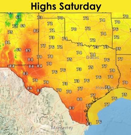
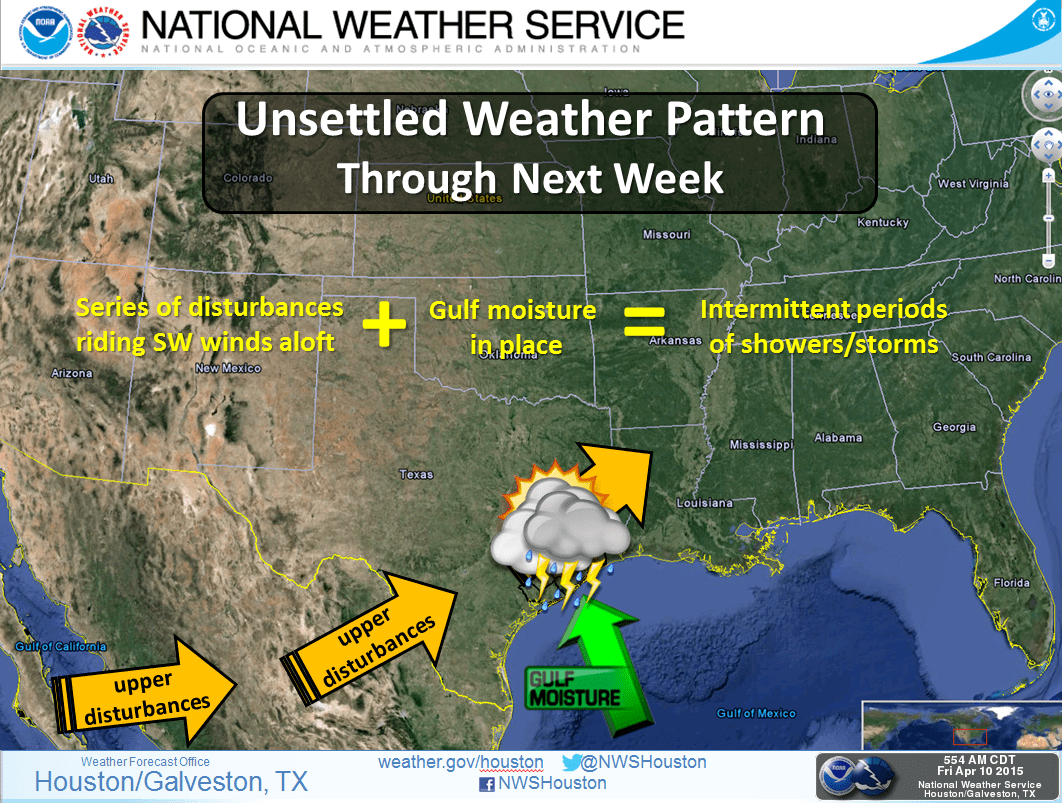
Throughout the weekend and into the first part of next week, it looks like we’ll stay in a rainy pattern, especially across the southern half of the state as several upper level disturbances arrive during the work week. By the end of next week, we could be looking at well over 3 inches of rain accumulation across parts of south central and southeast Texas. Spring showers!


0 Comments