
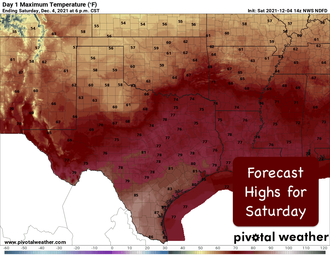
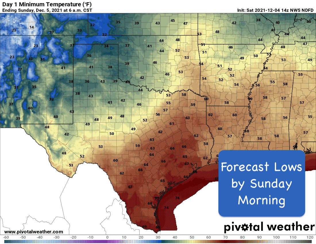
For a majority of the state today and even into Sunday, warm and pleasant conditions can be expected with daytime highs a good 5 to 15 degrees above average depending on where you’re at. A stationary front is draped across the western half of the state from the panhandle down into the south plains and up into parts of far western north Texas will keep temps across this region a bit cooler and closer to average today and tomorrow. Foggy conditions this morning across coastal, parts of east, northeast and north central Texas will continue to lift and burn off as the day progresses. Plenty of humidity will be present ahead of the stationary front with south/southwest winds across north central, northeast, central, south and southeast Texas continuing to pump in a good amount of gulf moisture. It’s a good bet we’ll see foggy conditions once again tomorrow morning for these same regions, so be extra cautious as you head out early tomorrow morning as well.
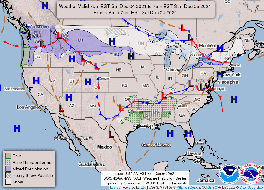
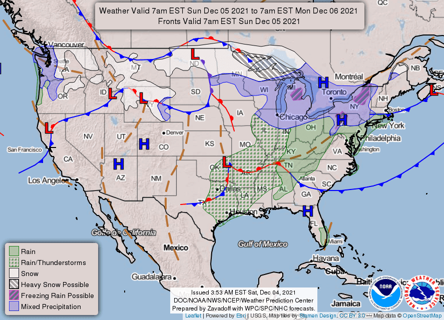
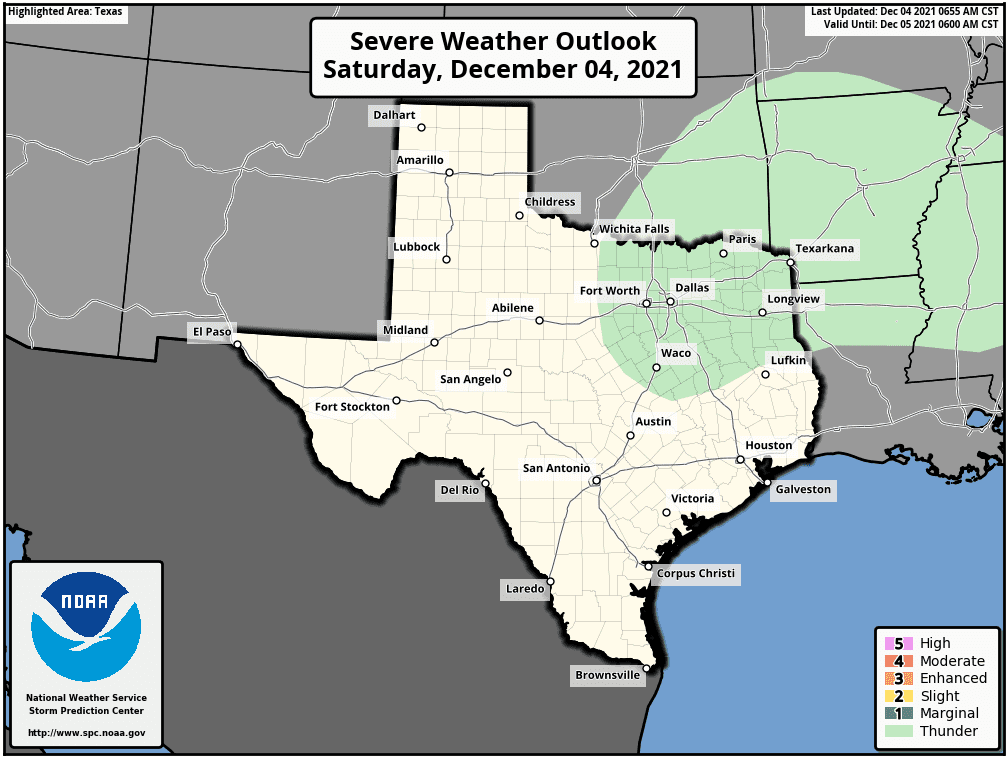
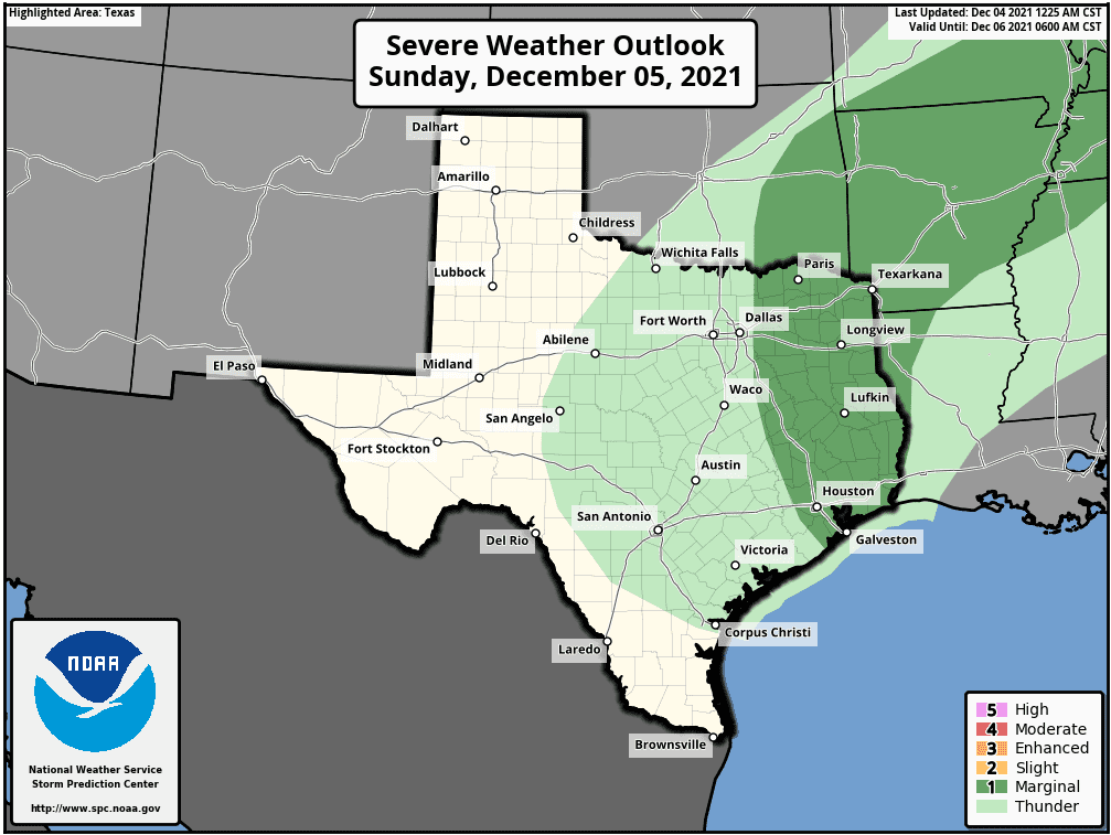
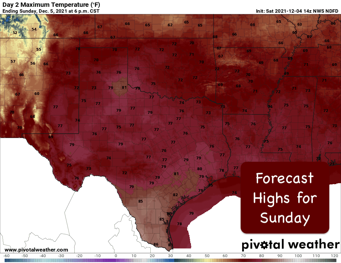
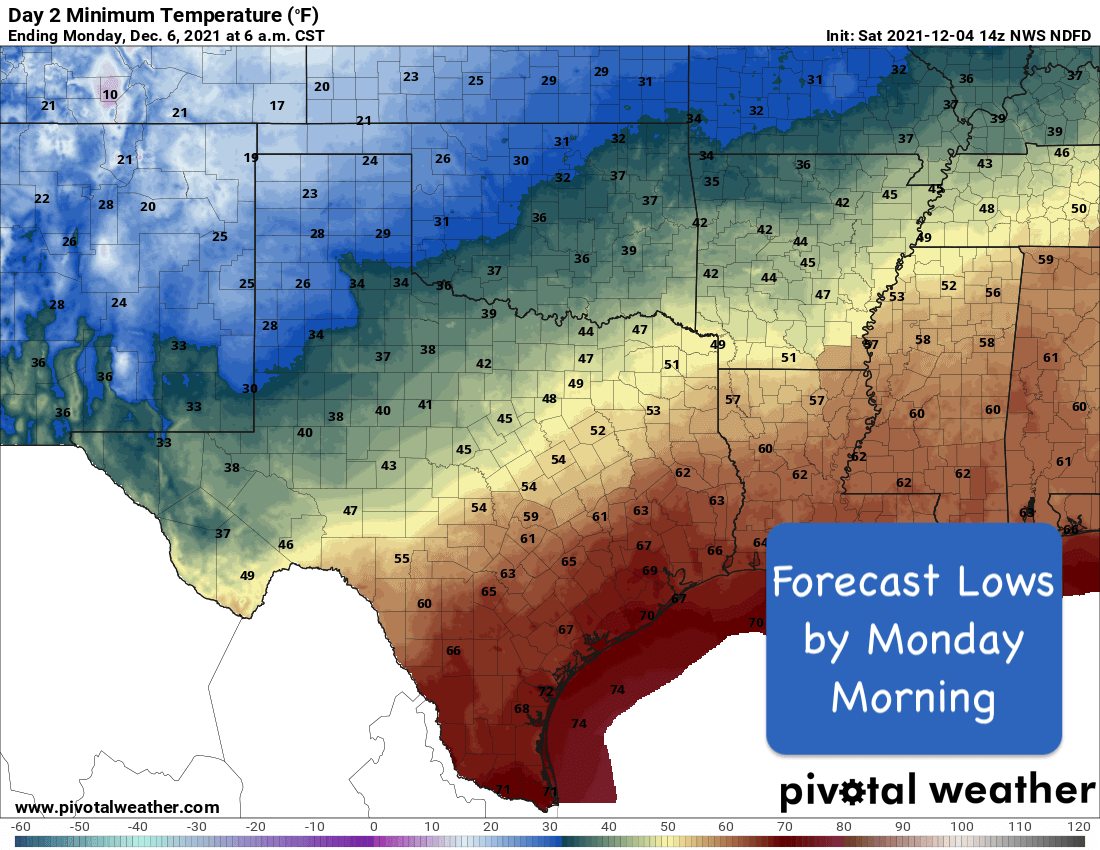
Rain chances today will be confined mainly to north central and northeast Texas. Even with that, the chances will be low and widely scattered at best with a few rumbles of thunder possible. Better chances for rain and stronger storms will arrive late tomorrow ahead of our next strong cold front which is currently forecast to move into the state Sunday night into early Monday morning. For Sunday, the Storm Prediction Center has outlined much of northeast, east and southeast Texas with a Marginal Risk (Level 1) of seeing strong to severe storm development. A few scattered strong to severe storms will be possible across these areas Sunday evening/night in advance of the front, but the best chances will occur along and ahead of the front in the form of a squall line as it moves through. Damaging winds and hail will be the main threats. There will be a small threat for an isolated tornado spin-up, but nothing to be overly concerned about at this time. Just have a way to receive weather notifications Sunday evening and Sunday night in case severe weather approaches your area. After the front moves through, much cooler and more seasonable December-like weather will kick off the work week ahead!
Severe Weather Outlook – Scattered rain showers for Saturday – Stronger Storms Possible Sunday Evening/Early Monday Morning
Weekend High/Low Temperature Outlook
2022 TSC Weather Calendar On Sale Now!!!


0 Comments