
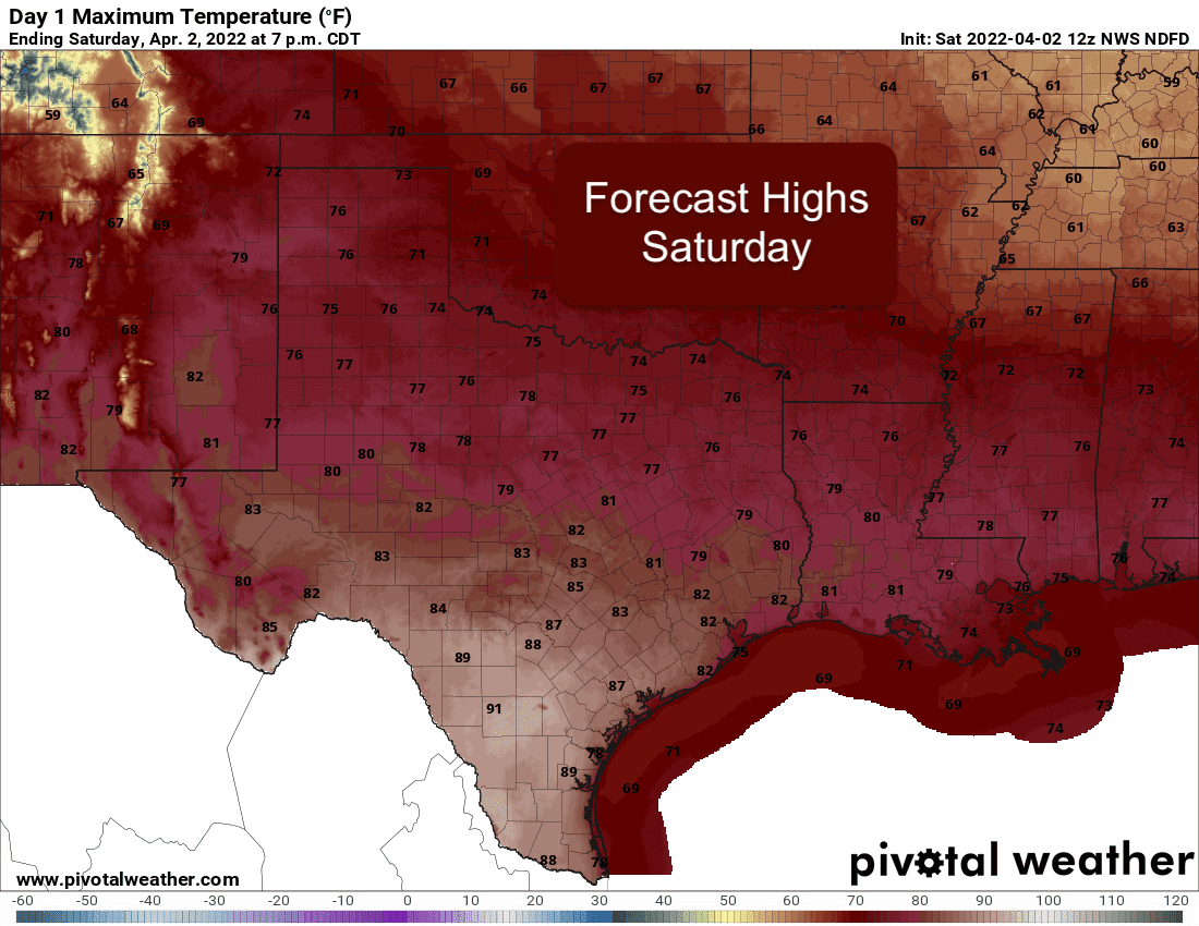
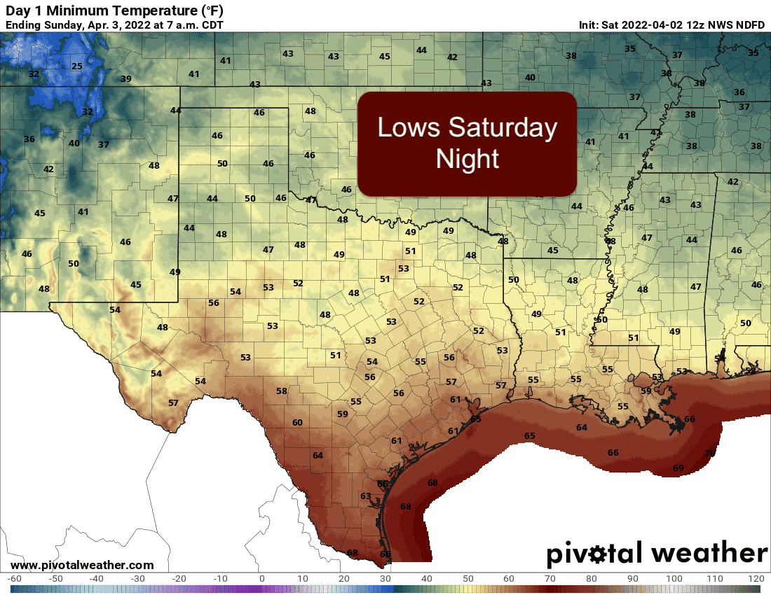
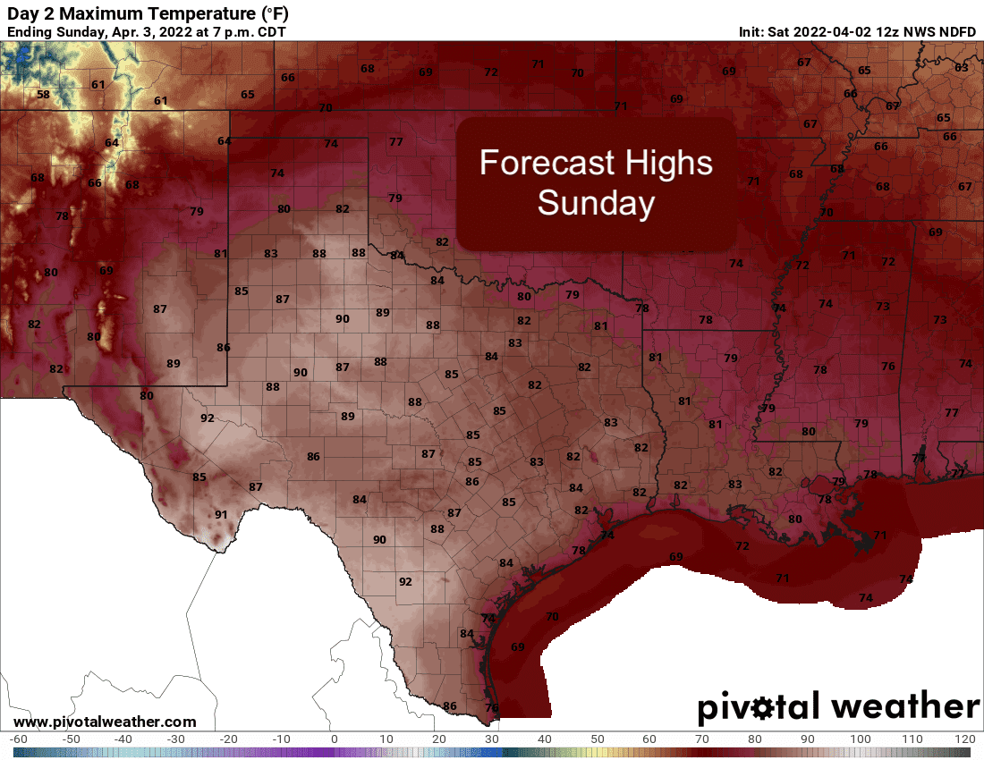
A weak upper level disturbance which brought rain and storms across northern Texas overnight has departed the state this morning leaving pleasant conditions in its wake. A weak cold front will continue to drift south, but it won’t make much of a dent in temperatures. Unfortunately this disturbance didn’t bring much rain, but we will have some additional chances across northern Texas by the start of the work week ahead. For Saturday, we’ll see pleasant conditions with daytime highs generally in the mid 70s across the northern half of the state with low to mid 80s across the southern half. We could even see a few locations down in the Valley and brush country of south Texas reach the low 90s today. No rain is expected and there will be plenty of sunshine for most everyone! For Sunday, basically a repeat of Saturday but with daytime highs climbing a few degrees with widespread highs in the 80s across the entire state. Again, isolated areas across south Texas could see temps in the low 90s by Sunday afternoon.
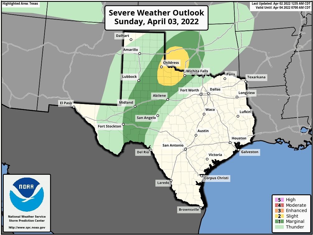
Our next chance for strong to severe storms will arrive Sunday afternoon mainly for parts of the northwest Texas, the eastern Texas panhandle region and into southwest Oklahoma. To address this threat for Sunday afternoon, the Storm Prediction Center has issued a Slight Risk (Level 2) for portions of northwest Texas up into southwestern Oklahoma. For Texas, this is a relatively small area stretching from about Childress down to Guthrie then over to Seymour then up to Wichita Falls. The main threats for Sunday afternoon and evening across the Sligh Risk and Marginal Risk areas will be isolated high-based strong to severe storms that could produce damaging wind gusts and large hail. The tornado threat for Sunday and Sunday evening is very low. At this point, it looks like a majority of this activity will be north of the Red River into southwestern and southern Oklahoma, but we are expecting at least a few storms to impact Texas residents in the risk regions on Sunday. Again, not a widespread event, but do pay attention for the development of storms in your immediate area Sunday afternoon.
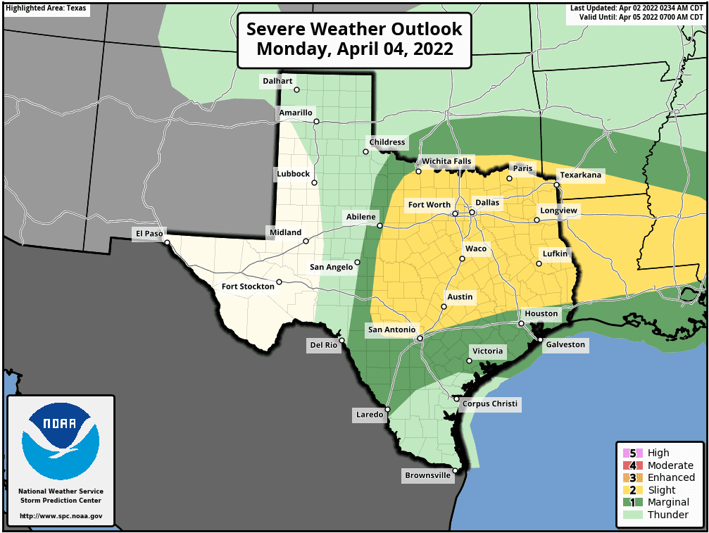
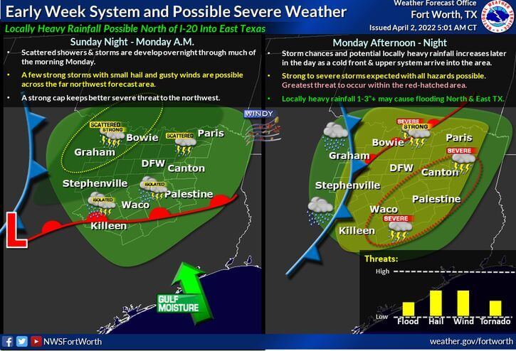
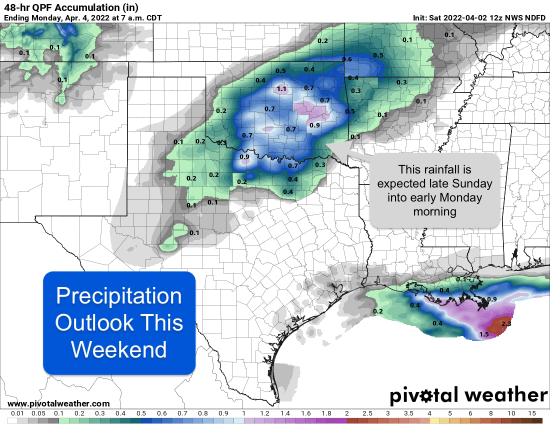
For Monday, there is still some uncertainty with regard to where storms will develop but the ingredients will be in place for at least some strong to severe storm development across parts of north and north central Texas down into central…and for eastern Texas as we get into the late evening and overnight hours. To address this risk, the Storm Prediction Center has placed a large portion of north, central and eastern Texas under a Slight Risk (Level 2) for Sunday afternoon, evening and overnight. As what happens on Sunday and early Monday is expected to have an impact on severe storm development on Monday, we do expect to see some changes to this risk area over the next 24 to 48 hours, so do not get too focused at this time on any particular risk area. For now, just be aware that strong to severe storms are currently in the forecast and stay tuned for updates as the forecast becomes more refined and nailed down.


0 Comments