
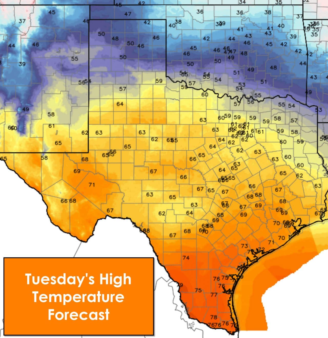
After a series of cooler days today will feature above-average temperatures for most of the state. High temperatures from Interstate 20 south will top out in the 60s today. San Antonio, Houston, south into the Coastal Plains into the Rio Grande Valley will top out in the 70s today. I wish I had time to make the drive down to Houston today – I’d do it just to enjoy the warmer weather! The Texas Panhandle will experience their high temperatures earlier in the day. A cold front will push in later this morning with temperatures dropping back into the 30s and 40s by the afternoon.
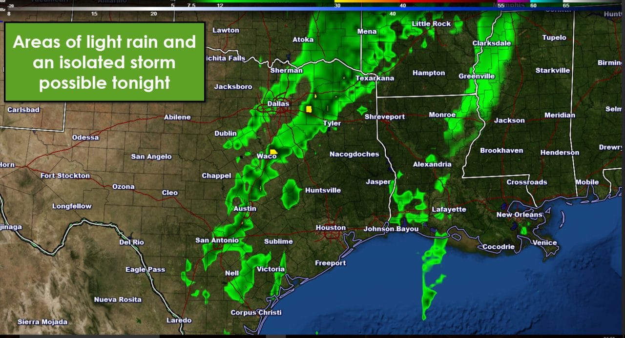
The cold front should be pushing into the D/FW Metroplex between 6:30 and 8:30 PM this evening. Moisture levels will be limited but the front should provide enough forcing for light showers tonight. At this point it looks like the showers will be limited to the leading edge of the cold front. An isolated thunderstorm is possible but severe weather is not a threat. Rain totals will be very light and likely only amount to a trace to a few hundredths of an inch. Low clouds and fog will be possible south of the front tonight as well. The front should be approaching Austin and Longview by 2 AM Wednesday. It’ll continue to progress south and southeast on Wednesday.
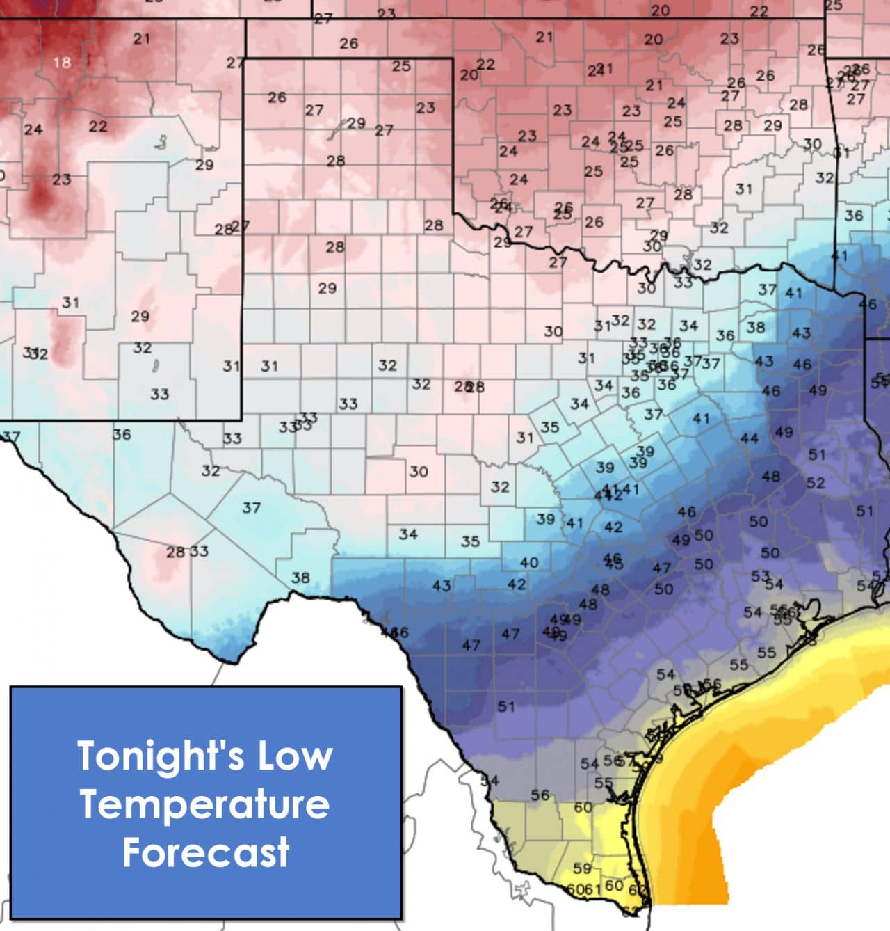
As the front pushes south temperatures behind it will fall off into the 30s and 40s. More temperate conditions will continue tonight ahead of the front with temperatures in the 50s. Low temperatures by sunrise Wednesday will be in the 20s across the Texas Panhandle, South Plains, Northwest Texas, and the Big Country. It won’t be much better with low 30s across the Permian Basin, West-Central Texas, Concho Valley, and western North Texas. Mid 30s to low 40s can be expected across Northeast Texas, North Texas, Central Texas, and Southwest Texas. It’ll be warmer across Southeast Texas, the Coastal Plains, into South Texas and the RGV.

The front will become stationary and start to mix out on Wednesday. Cold air advection will continue to impact the eastern Texas Panhandle, Northwest Texas, North Texas, and Northeast Texas. Temperatures in those regions will only top out in the 40s to low 50s. Southeast Texas, South-Central Texas, the Hill Country, into the Permian Basin will top out in the 60s to low 70s. South Texas and the Rio Grande Valley will come dangerously close to topping out at 80 degrees.
0 Comments