
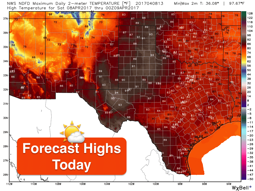
Upper level high pressure will begin moving east today as our next weather maker begins to approach from the west. This next upper level system will be slow moving and offer several opportunities throughout the week for rainfall across different regions. Conditions today and tomorrow across the state will remain dry and breezy with moisture increasing and temps rising back above normal once again. Parts of the panhandle and western Texas may see a few record highs broken today with highs reaching the low to mid-90s across the area.
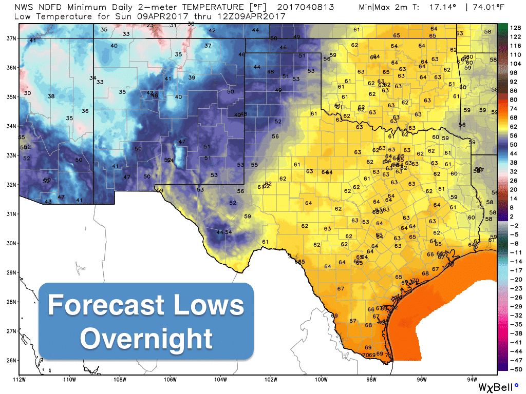
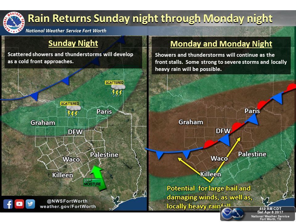
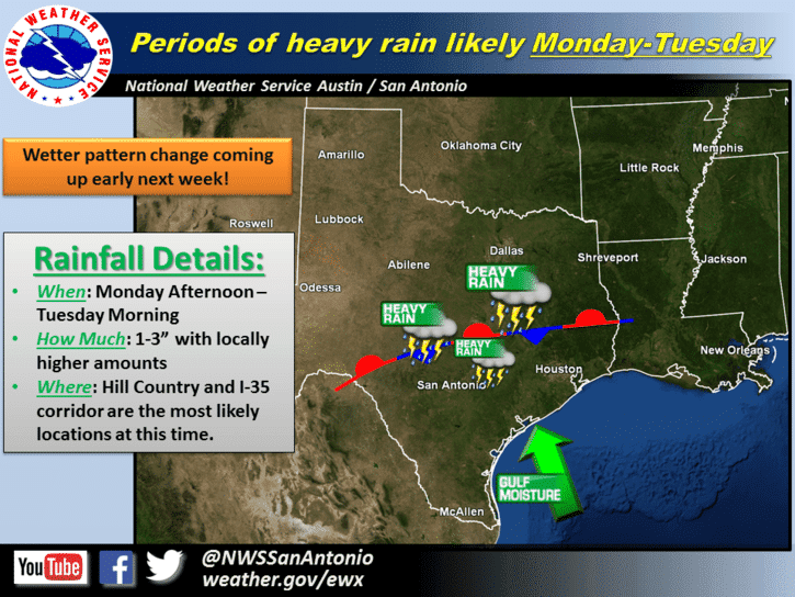
By Sunday afternoon, a cold front will be approaching from the north at the same time a the first in a couple of pieces of upper level energy will arrive. A dryline will set up across western north Texas Sunday afternoon and we could see a couple of storms fire up along the dryline out towards Wichita Falls Sunday by evening. The cold front will continue to push south Sunday night and is currently expected to stall somewhere around the I-20 corridor by Monday. This stalled front combined with additional lift from another piece of upper level energy will generate widespread rain chances on Monday through Tuesday across north and central Texas including the Hill Country and western Edwards Plateau region. The greatest weather concern for this week will be the heavy to very heavy rain chances Monday into Tuesday across the above-mentioned areas. Rainfall between 1 and 3 inches is likely with isolated totals exceeding 5 inches in a few places across central Texas mainly along and west of the I-35 corridor. In addition to heavy rainfall, some of the storms could become strong to severe with a hail and wind threat as well. At this time, the threat for any tornado development appears very low, so again, greatest threats Monday through Tuesday will be the heavy rain and flooding potential across central Texas.
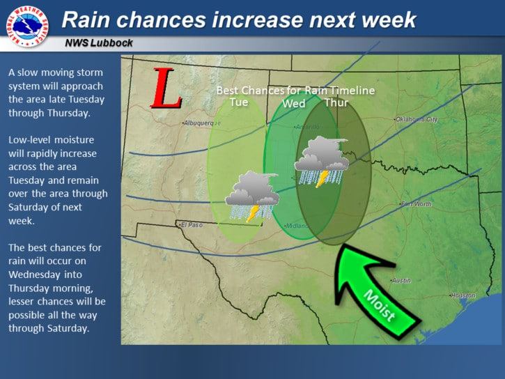
Once we get into Wednesday and Thursday the rain chances shift north a bit to encompass parts of the panhandle and northwest Texas. We’ll get into more detail on the mid-to late-week rain chances as we get closer…but overall, it looks like we’re going to remain on the wet side for most of the work week ahead.


0 Comments