
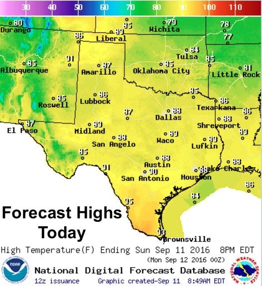
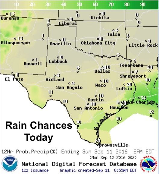
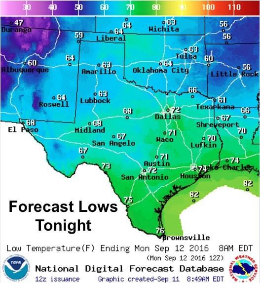
Crisp early fall air was abundant this morning across a majority of the state. With the exception of coastal and south Texas, temps this morning across the state were ranging between the low 50s to the low 60s. Very nice for sitting out on the patio with a cup of your favorite morning beverage! Mostly dry and warm conditions will prevail during the early part of this week with high pressure in place. However, we’ll see a couple of things happen this week which will bring rain chances back into the forecast beginning Tuesday and lasting through the remainder of the week. For today, highs will be pleasant and warm ranging from the upper 80s to low 90s across most of the state. Rain chances will also be pretty much next to nothing with just a few scattered showers possible across the coastal bend up into southeast Texas later this afternoon. Everywhere else, dry with lots of sunshine and lower humidity making for a great day to be outdoors! Lows overnight will be a few degrees warmer but still pleasant for most with low 60s to low 70s.
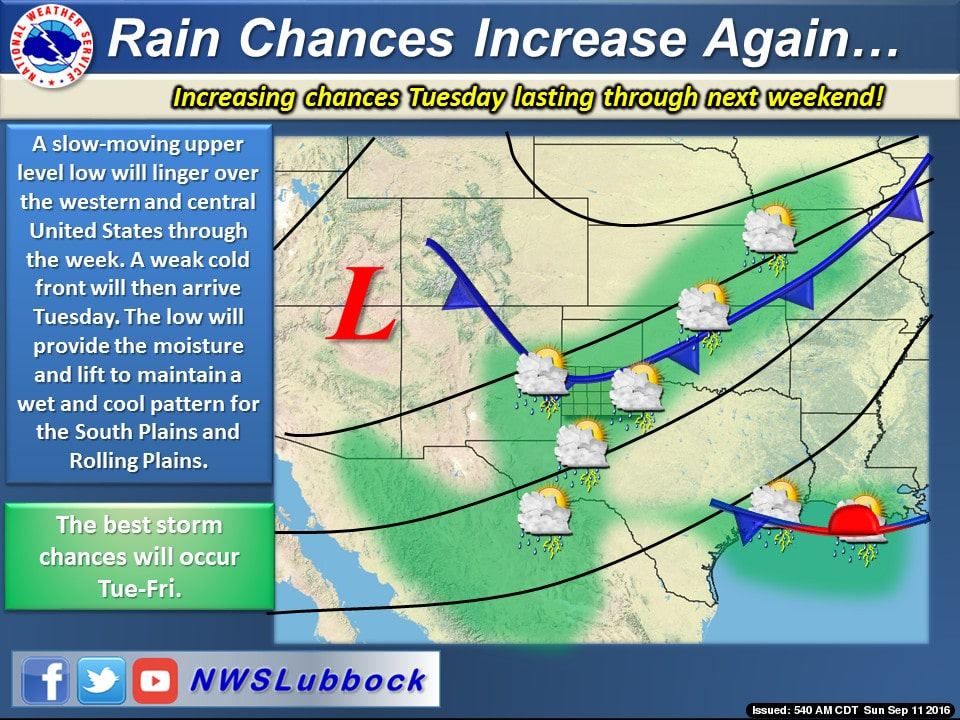
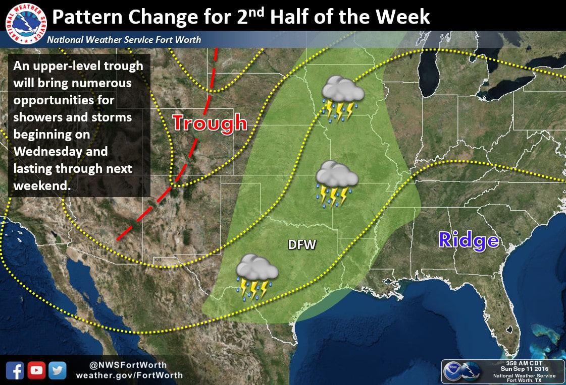
As we get closer to Tuesday, we’ll see a pattern shift with high pressure drifting eastward and a west coast trough of low pressure moving eastward and lingering over the desert southwest through the week. We will also see a weak cold front drop down into the panhandle and Oklahoma where it will stall out. This will set up rain chances for parts of west Texas and the Texas panhandle region beginning on Tuesday and lasting the remainder of the week. While this front will not quite make it into north Texas, it will develop showers and storms out ahead of it which will likely move south into northern Texas by Wednesday. The west coast trough will continue to expand ever so slowly eastward during the week, with little upper level disturbances riding along its eastern periphery, which will keep chances for rain and showers in the forecast through next weekend. Severe weather does not look too likely with this week’s setup, but we’ll continue to review the forecast each day and bring you the latest on anticipated storm coverage and rainfall amounts as the latest forecast data arrives. Not everyone will see rainfall at all times, but at any rate keep the umbrellas handy!


0 Comments