
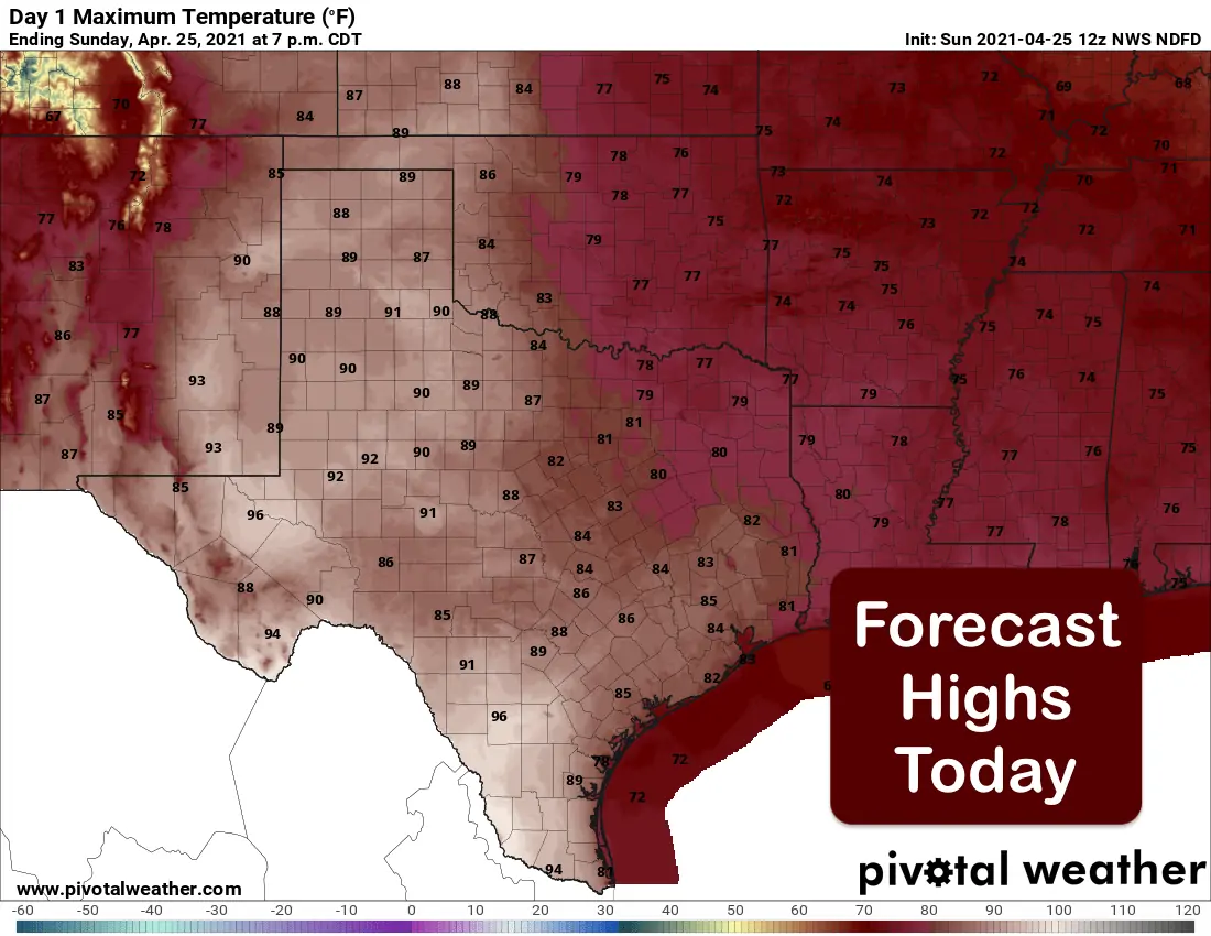
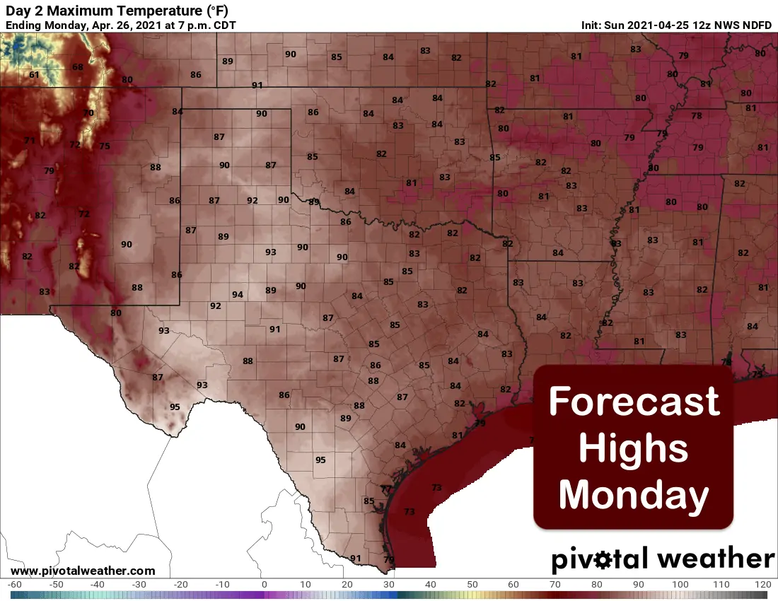
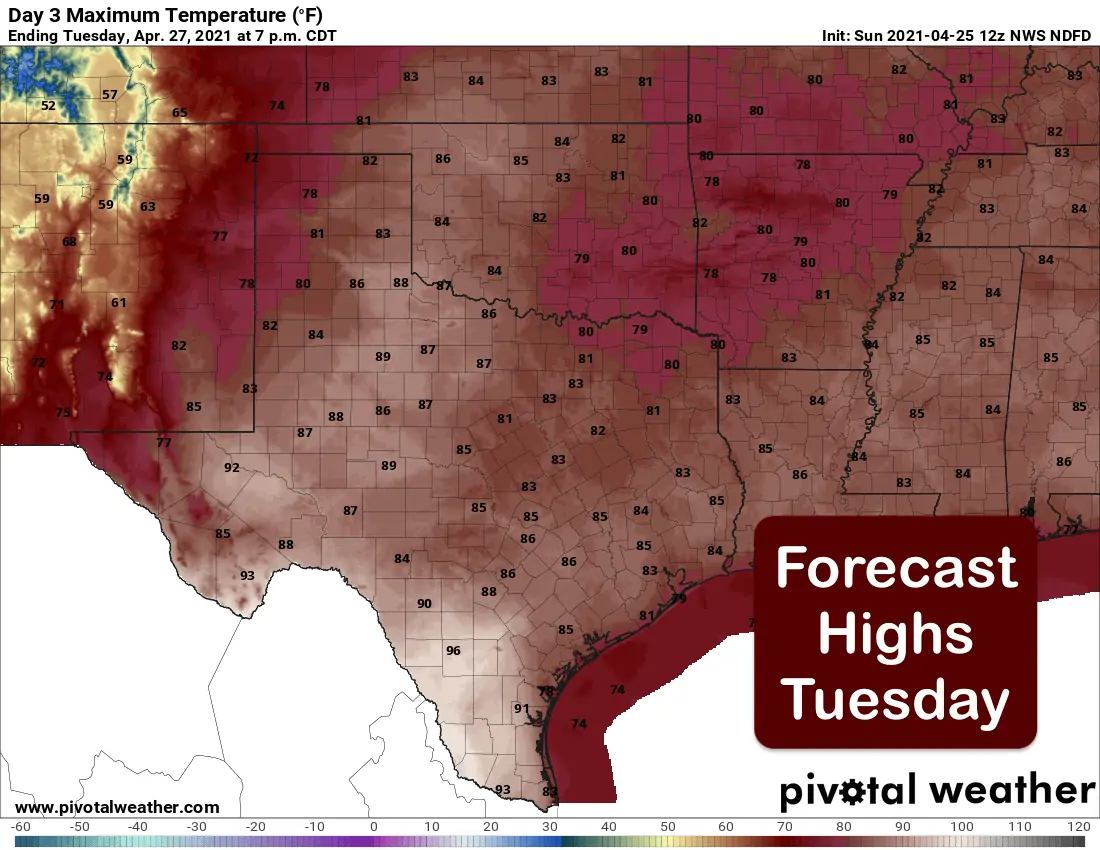
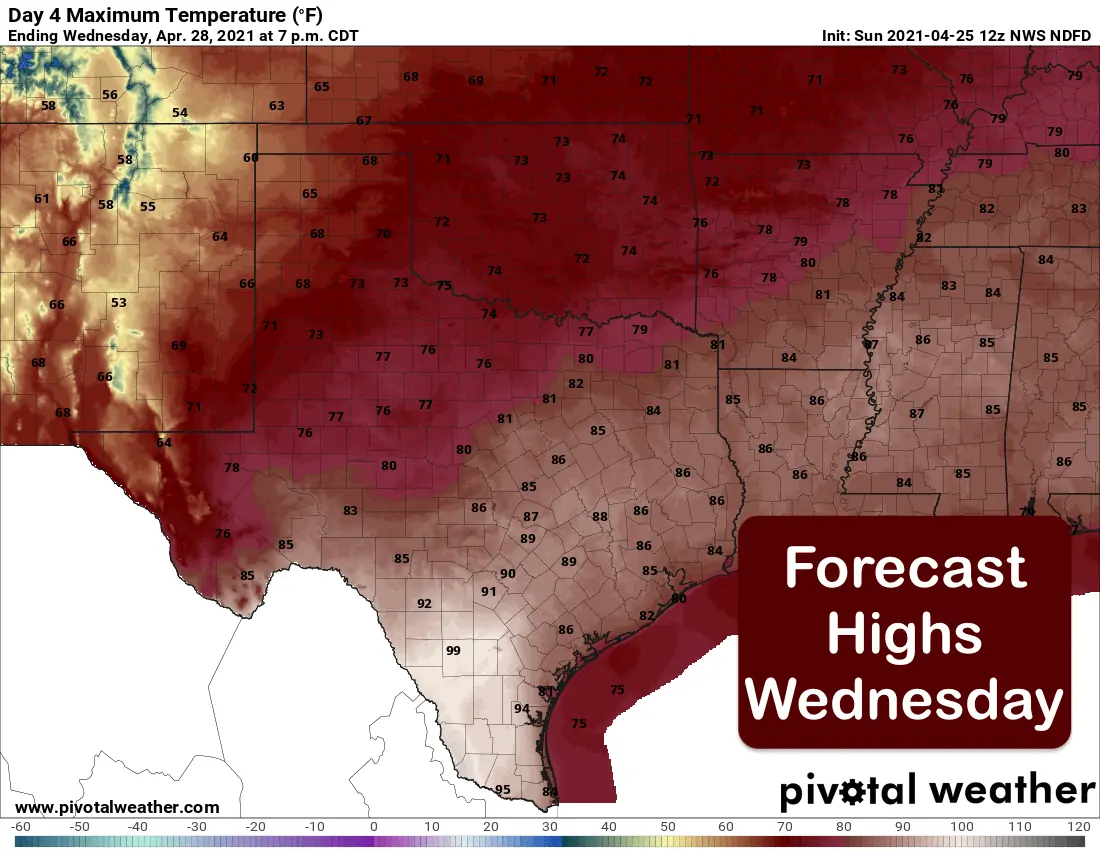
As typical in Texas, we go from cold to hot in the blink of an eye! Above normal afternoon highs and breezy conditions will prevail today through Tuesday until our next weather maker settles in. Our daily highs over the next several days will top out anywhere from 5 to 15 degrees above average…with the western half of the state experiencing the larger departures from normal temperatures due to the presence of drier less humid air. Those above average daily highs will come to an end by mid-week when our next upper level disturbance arrives bringing chances for rain and severe weather Tuesday afternoon, and multiple rounds of rain and the potential for flooding Wednesday through Thursday.
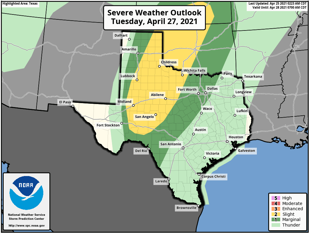
Keep in mind this is still several days out and there will be refinements to the forecast between now and then, the highest potential for severe weather will be across western north Texas down into the Big Country along a sharpening dryline Tuesday afternoon and evening. The Storm Prediction center has issued a Slight Risk (Level 2) for Severe weather across these regions for Tuesday afternoon into Tuesday evening. There are still questions about cap strength and if enough surface moisture will be in place…nevertheless, isolated to scattered supercell thunderstorms with the threat of hail (large to very large) and a few tornadoes will be possible. As we get closer to Tuesday afternoon, we expect to see a few refinements to this forecast for severe weather, so be sure to check back.
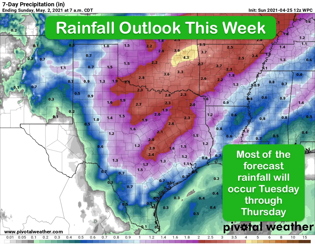
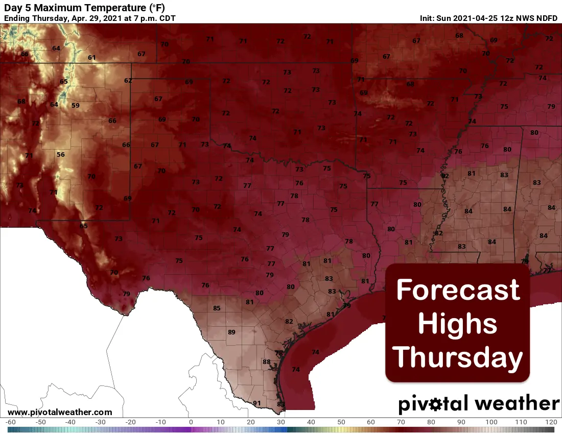
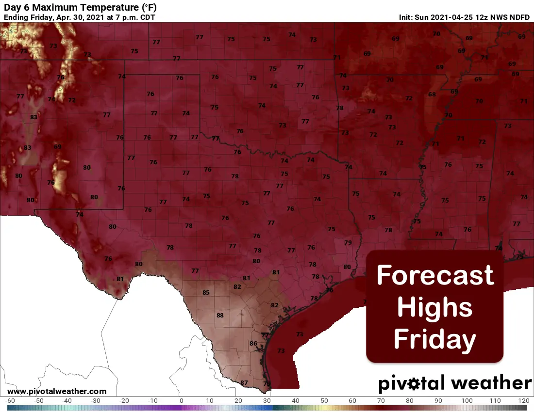
Outside of the severe weather chances Tuesday, widespread rain chances Wednesday into Thursday look likely as the approaching upper level low slows down and hangs out over the desert southwest for a few days. How long it hangs out is still in dispute as the forecast models diverge a bit after Tuesday. The current Rainfall Outlook is quite favorable for multiple inches of much needed precipitation both east and west of the I-35 corridor mid-week. We love these April showers! Should the upper level disturbance cut off and hang out longer, we could be looking at continued widespread rain chances through next weekend as well. We’ll just have to wait and see on that front. Speaking of fronts, a weak cold front will also arrive and begin to push through the state Tuesday night but will take its time making its way through the state. The results of this weak front and widespread cloud cover and rain chances can be seen in the temperature outlook graphics for our week ahead knocking us back down below average. Be sure to keep checking back with us this week for the latest on Tuesday’s severe weather chances and updates on rainfall for the rest of the week!


0 Comments