
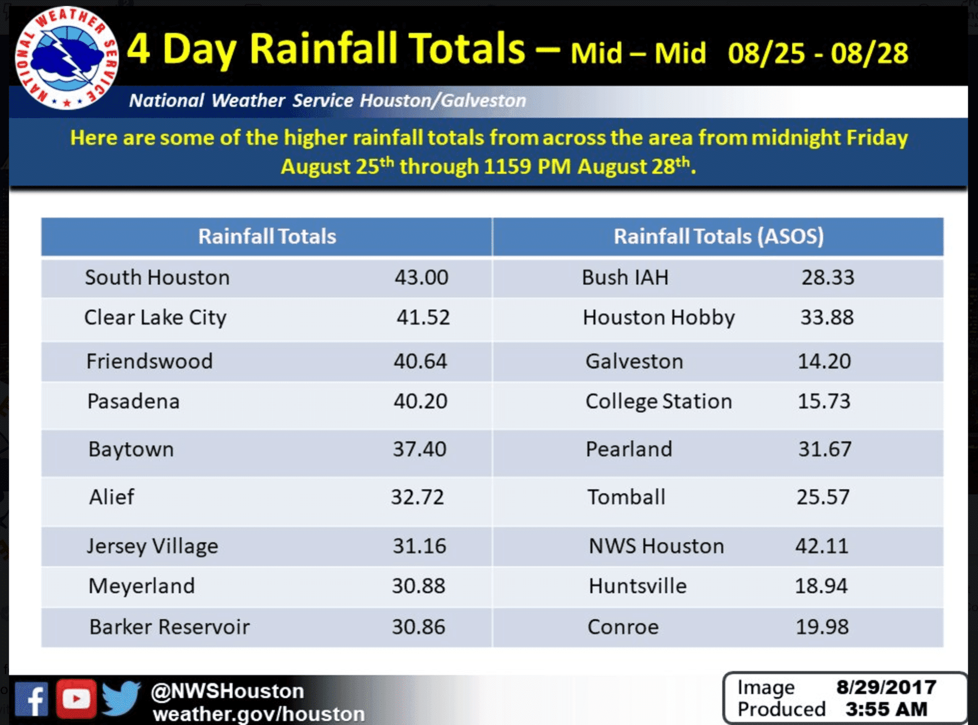
As of the 7am National Hurricane Center update, Harvey remains just off the coast of Galveston moving East/Northeast at 3mph with maximum sustained winds of 45mph. Further strengthening is not anticipated due to strong wind shear across the area. A second landfall is expected by Wednesday afternoon with the latest forecast track showing Harvey moving back onshore somewhere between Galveston and the coastal Louisiana border. Catastrophic and life threatening flooding continues to impact southeast Texas, but we will begin to see the light at the end of the tunnel as rainfall amounts slowly decrease today and tomorrow as Harvey begins to shift east. Forecast accumulations for today and tomorrow across southeast Texas will range from 2-4 inches in the Houston metro area and 7-8 more inches further south along the coast. Still not good, but better than what we’ve seen the past several days. It’s no doubt this will go down in the records as the largest weather-related economic disaster in US history with months and years of recovery ahead for residents in this area. To our knowledge, we’ve never had a tropical cyclone in the gulf make two landfalls within close proximity to each other, let alone hang around for days on end.
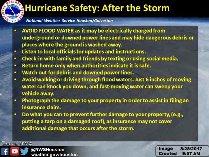
As we get further into the week and the rain begins to subside, please keep in mind these “After the Storm” safety tips before heading back in to survey your property damage. In addition to the tips below, please be aware of scammers who are out there ready and willing to take advantage of victims. Only donate to reputable charities and only deal with reputable, licensed and insured contractors.


0 Comments