
Heat has been the name of the game for most of Texas this week. Hot weather will continue to be the main story for most of Texas through the weekend. However, Mother Nature has a bit of a troll up her sleeve – and for that, we must ponder out into the Gulf of Mexico.
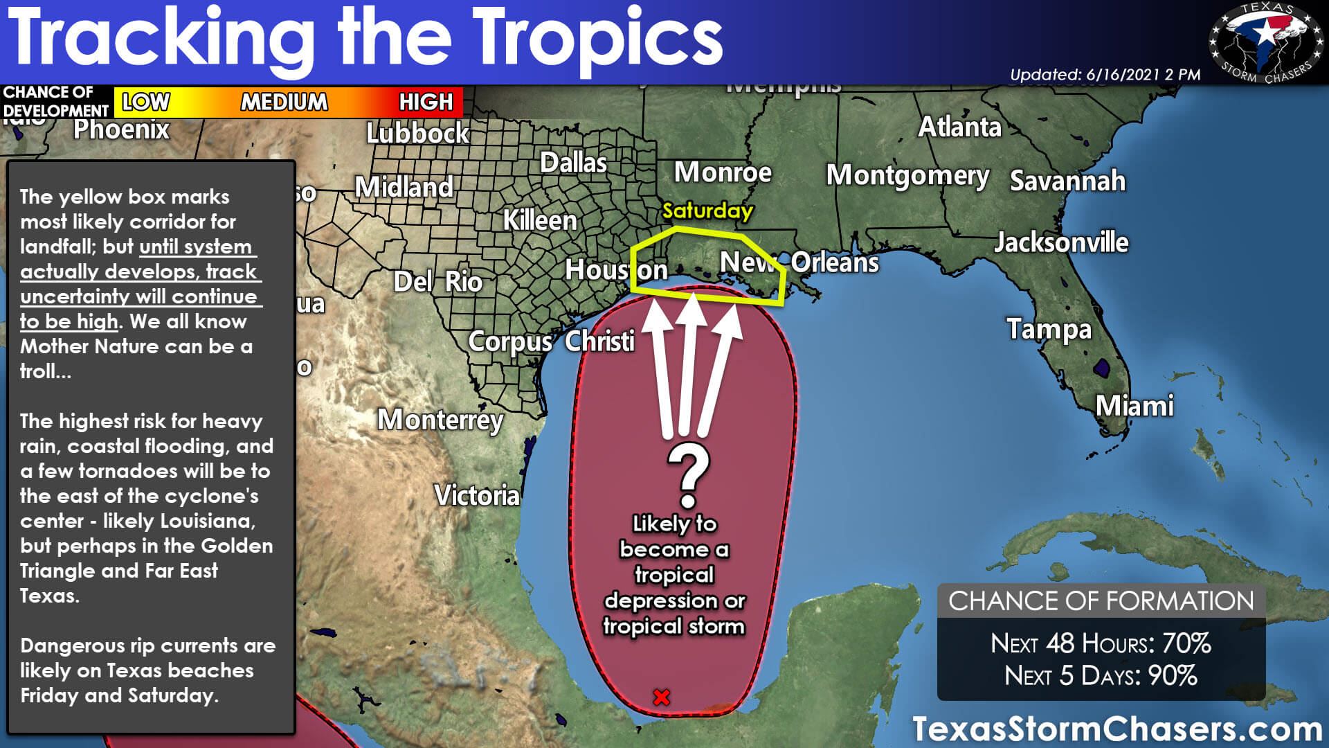
Invest 92L, an area of thunderstorms, is located in the southern Bay of Campeche. 92L will remain nearly stationary through tonight. On Thursday, Invest 92L should begin moving north into the Gulf of Mexico, where conditions become favorable for a tropical depression to form. There is a high chance of a tropical depression (and perhaps, a tropical storm) developing late Thursday or Friday as the system moves north.
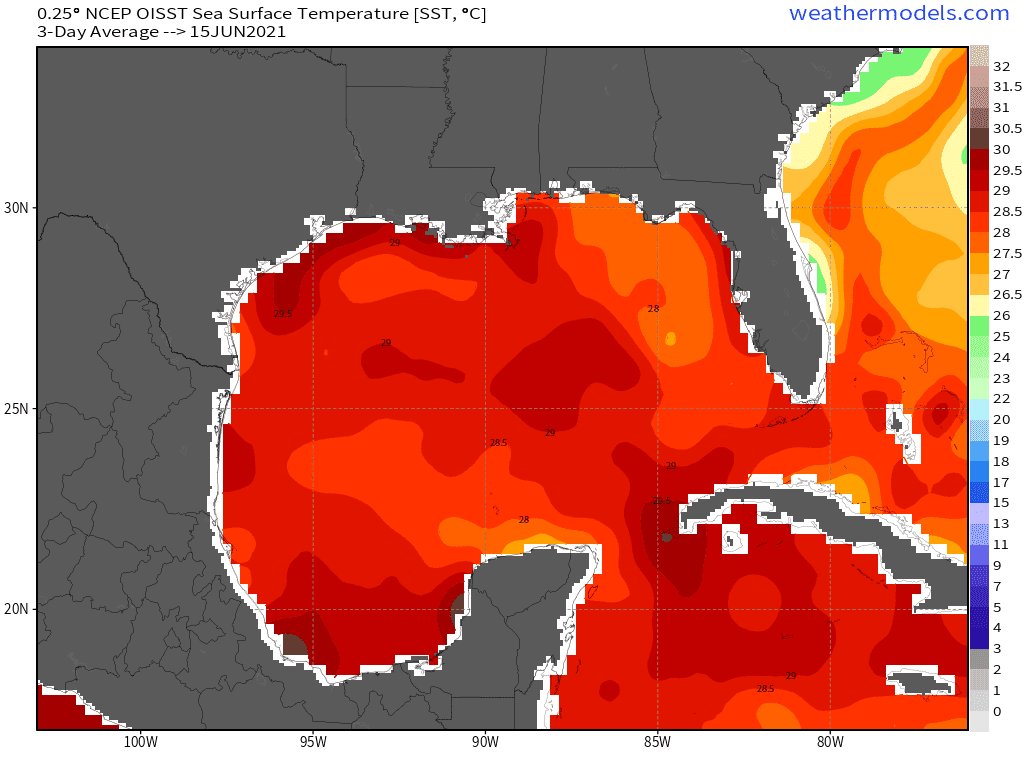
Sea surface temperatures across the western Gulf of Mexico are in the 28°-29°C (82°-85°F) range – which is plenty warm for tropical mischief. Those temperatures are actually a bit above the 30 year average for mid-June. Yet, we expect a slow strengthening trend on Friday and Friday Night as the system moves toward the northern Gulf Coast. There will be moderate upper-level wind shear, so that should help prevent rapid/explosive intensification into a hurricane. If tropical storm strength (39+ MPH sustained winds) is attained, the system will be named Claudette.
Early season tropical mischief typically results in rainmakers versus big-time wind/surge makers. Regardless of 92L’s eventual ‘name’, we expect it will hold to the early-season tendencies of being a rainmaker. Dangerous rip currents are likely along most Texas beaches on Friday and Saturday. The storm system should continue moving north across the western Gulf of Mexico on Friday.
By Saturday morning, perhaps a bit later, we should have landfall on the northern/northwestern Gulf Coast, depending on timing. Weaker tropical cyclones don’t typically have as tight of an inner core (in terms of an eyewall, damaging winds closer to the center, etc.) as hurricanes. However, the heaviest rains, some coastal flooding, and the risk for a few tornadoes will be highest to the east of the cyclone’s center. There may be much rain at all to the west of the storm’s center, so folks 30-50 miles west of the landfall location may only have some cloudiness.
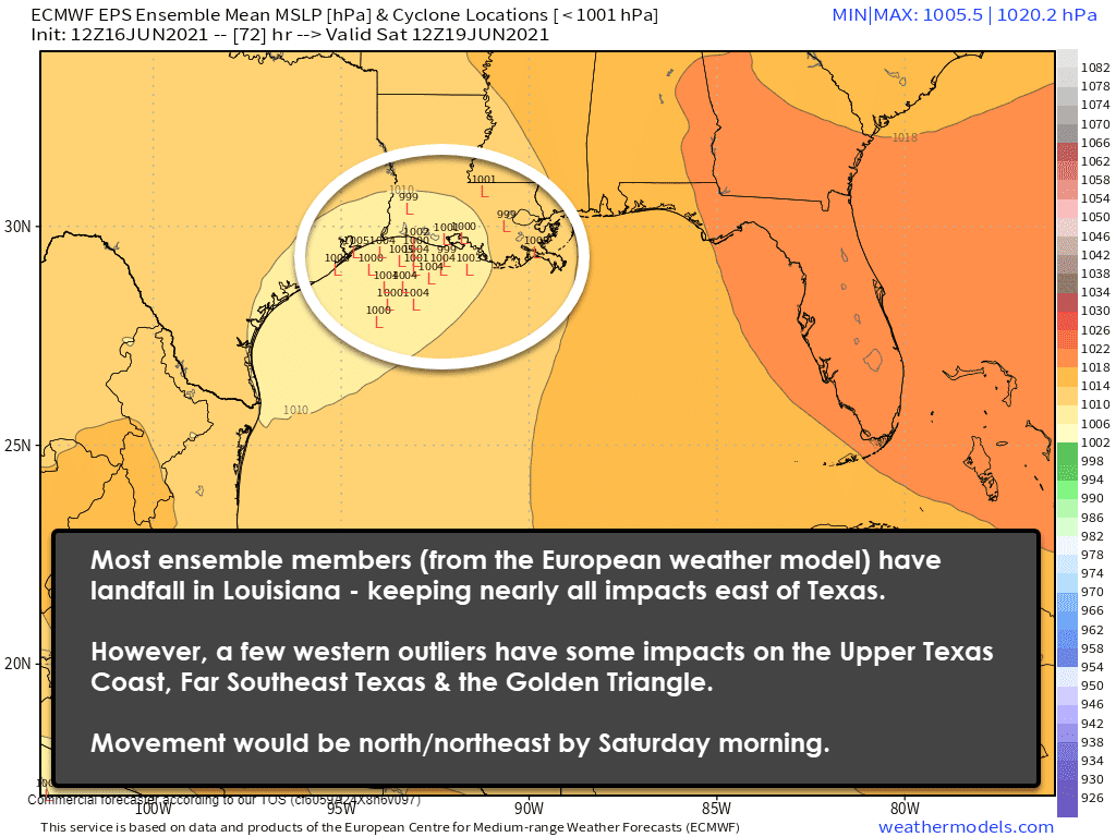
Most weather model guidance has 92L making landfall in Lousiana, between Sabine Pass/Port Arthur and Baton Rouge. Since this should be a weak tropical cyclone with most precipitation east of the center, the ‘Lousiana’ track would have minimal impacts on Texas. Perhaps some rain for the Golden Triangle (Far Southeast Texas) and Far East Texas – with flooding rains to our east. We’d have to contend with dangerous rip currents on Texas beaches and perhaps minor tidal flooding. That’s the ‘most likely’ solution at the moment.
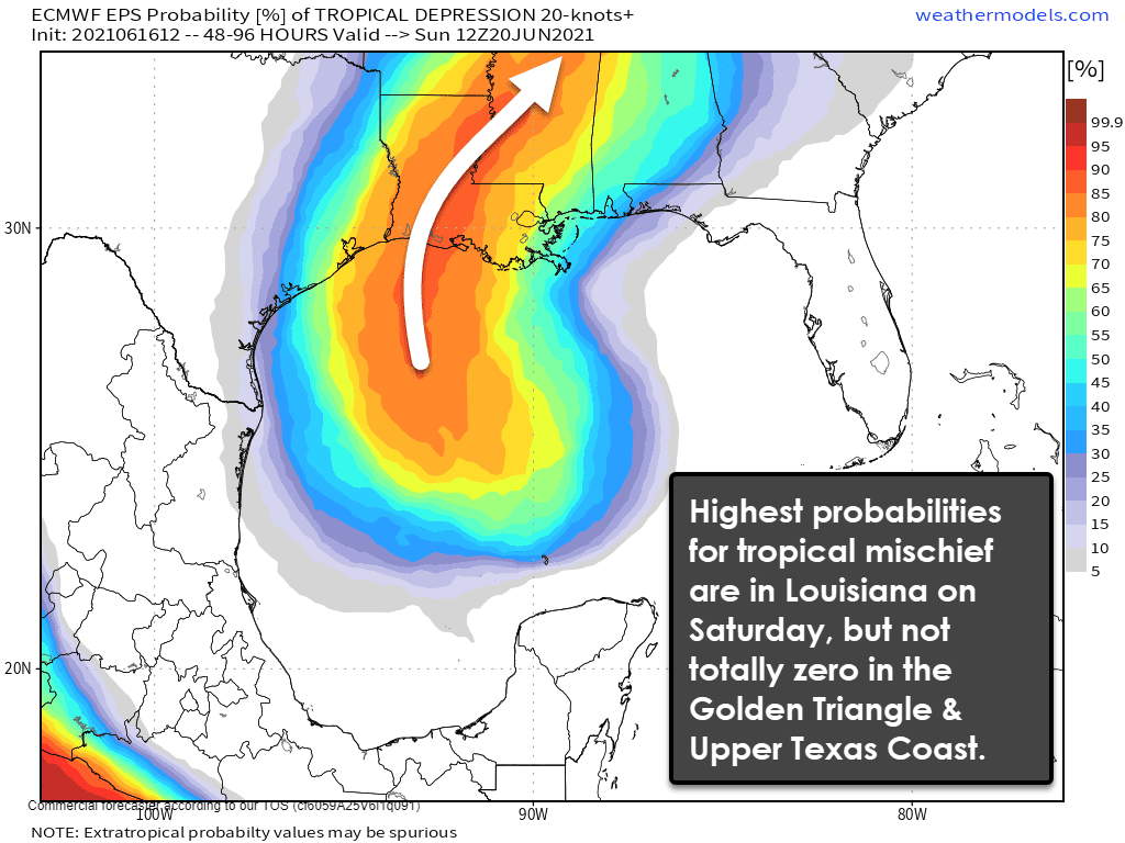
However, the system has not yet formed a well-defined center. We need to be cautious ‘pinning the tail on the donkey’ per-say until that organization occurs. If the storm ends up forming a bit farther west than models show, that would result in a westward shift in the downstream forecast. We’re not talking about hurricane-level impacts regardless. Still, if the system ended up moving farther west, we’d end up having much-increased rain chances (and rain totals) along with the risk of a few tornadoes in portions of the Upper Texas Coast, the Golden Triangle, and East Texas. A low-probability scenario for the moment, but one we’re not ready to completely rule out.
The 2021 Atlantic Hurricane Season is underway, and it looks to be another busy one. It only takes one ‘storm’ to make it a historic season for our little patch of the world. Take the time while the weather is quiet to review your hurricane safety plans and perform low/no-cost preparation. The National Weather Service in Houston has this quick guide to prepare for tropical mischief.


0 Comments