
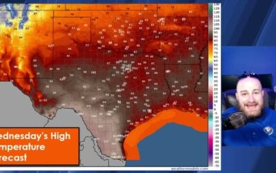
An aircraft from the Air Force Reserve Hurricane Hunters investigating a tropical low in the southwestern Gulf of Mexico this afternoon found a tropical depression had generated. Thus, we now have the twenty-second tropical depression of the 2020 Atlantic Hurricane Season. Modest intensification over the coming days will likely result in Tropical Storm Wilfred being born. Wilfred is the final name on the 2020 Atlantic Hurricane list. The only other time we ran out of names was back in 2005, although that was much later in the season.
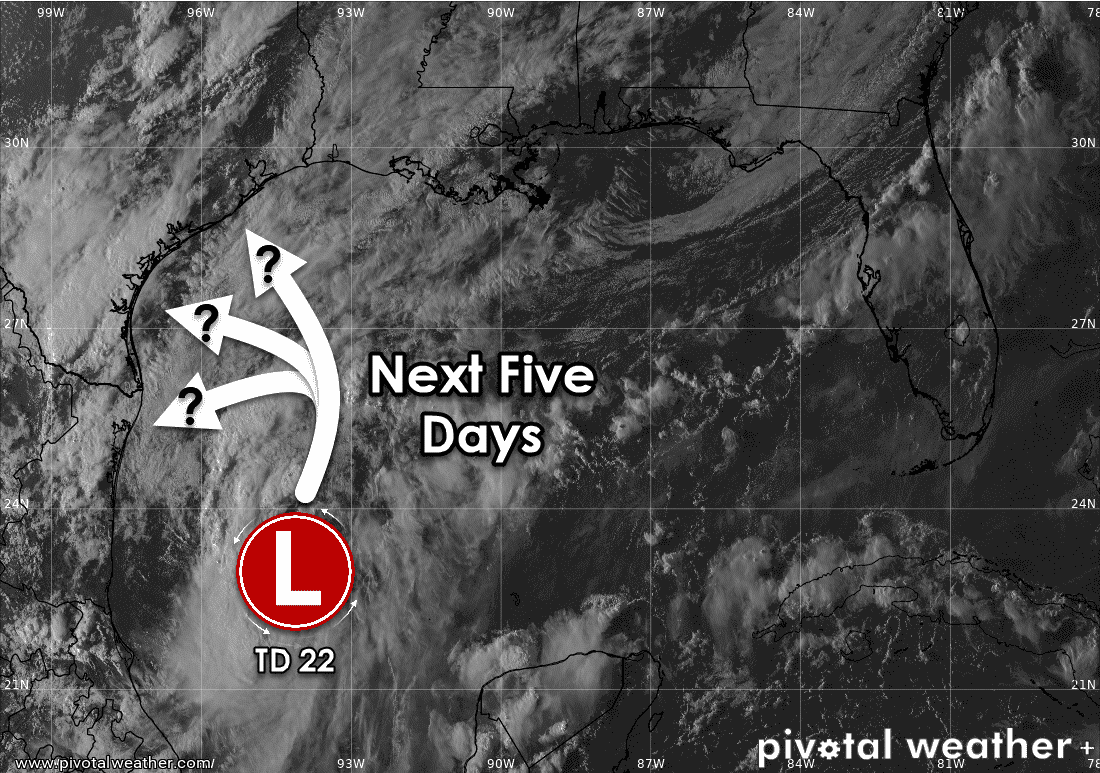
Since this system is in infancy, the ongoing movement today is a bit uncertain. Like storms earlier this season, the forecast will be a giant pain in the behind. There isn’t a big steering influence aloft that will pull TD22 in any particular direction. Meandering tropical systems are quite problematic since they’re even more difficult to create a forecast for. Let’s be honest, though – that’s just on par with what we’ve dealt with 2020. This system will likely be a hair-pulling one to forecast for over the coming week. Oh yes, it’ll probably still be creating headaches for us in a week – because without any big steering influences aloft – TD22/Wildfred will probably stay in our neck of the woods for a while.
Track and intensity forecast
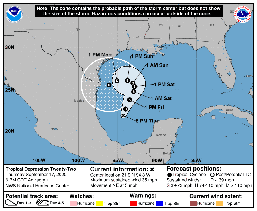
Tropical Depression Twenty-Two, likely to become Wilfred in the coming day, will not be moving anywhere in a hurry. The forecast from the National Hurricane Center has future Wilfred sitting east of Brownsville at 1 AM Tuesday. That being said, this is the first forecast on a newly-generated tropical cyclone. Weather models are all over the place, from showing a forecast as depicted above to a ridiculous solution that has the low transversing a majority of the Texas coastline from Brownsville north/northeastward to Galveston over the next week and a half.
If you wanted an easy forecast this system is not going to comply. Let me be clear – the forecast will change, and it will probably change many times. This will be more of a ‘nowcast’ situation versus a ‘trying to figure out where the darn thing will be in five days.’ Of course, we’ll try, but Mother Nature will make us look like fools more than once.
Wilfred is not forecast to become a hurricane at this time. However, I’m not ruling out Wilfred making a run at low-end hurricane status just because we’ve already had three other storms in the Gulf this year go from tropical storms to ‘angry I’m going to intensify right before landfall quickly.’ Right now, there is not much data supporting a rapid intensification solution, but we’re going to be watching that data closely.
Some wind and storm surge impacts could occur on the Texas coastline next week. The extent of those impacts and where exactly they occur are still way up in the air. We’re in the ‘keep an eye on forecasts’ phase versus the ‘hey, I’m gonna move momma inland and buy all the groceries’ phase.
Rain and Flooding Potential
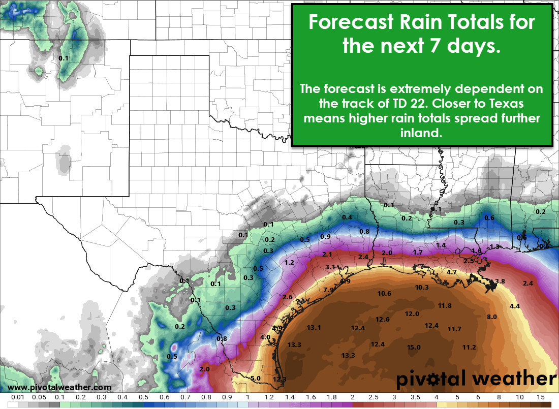
A slow-moving tropical system means big-time rain possibilities. The track of TD22/Wilfred will dictate how far inland flooding rains make it over the next five to eight days. The forecast shown here is a pretty good starting point but will be refined in future forecasts. Heavy rain and possible fresh-water flooding would certainly be possible in places like Brownsville, Corpus Christi, Port Lavaca, Angleton, and Galveston.
We note that rains will likely be measured by the foot in the Gulf of Mexico – but how far inland will those big-time rains make it into Texas? Again, that’s going to depend on the eventual track. If that track shifts farther west into the Rio Grande Valley, the higher rain totals will come farther in South Texas. The same goes for areas farther north. If the system rides up the coast – we’re going to have a lot of rain along our coast.
All I can do right now is encourage folks to check back for forecast updates and keep an eye on the Gulf. There are many great weather information sources out there, and I’d bet on most saying the same thing as I am tonight. We’re not calling for an Allison, Harvey, or Imelda situation right now. Those are historical extremes that frankly might be used as a comparison to other storms too often. Someone could get a lot of rain. Someone may get way too much rain, but all of that is still quite uncertain.
We’ll tell you what we know and explain some things we aren’t so sure of. Hopefully, I did a decent job of that this evening. I’ll have another blog post out early tomorrow afternoon and sooner if needed. Have a great rest of your night!
0 Comments