
It’s a special Sunday evening edition of the Texas Weather Roundup, with an active Monday expected across Texas.
Widespread wind gusts of 40 to 55 MPH are anticipated across Texas Monday through Tuesday morning. These stronger winds are due to an intensifying storm system and won’t be directly related to precipitation (snow, rain, storms).
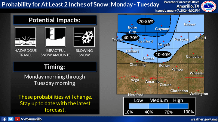
Accumulating snow, with blizzard conditions, are possible for much of Monday across the northern Texas Panhandle and the Oklahoma Panhandle.
Accumulating snow is expected across the northern Texas Panhandle Monday through Tuesday morning. Wind gusts of 60 to 70 MPH are possible with the snow. Blizzard conditions are likely, even if accumulations remain lighter (1 to 4 inches). Travel will become treacherous to impossible due to blowing snow.
Severe Storm Potential
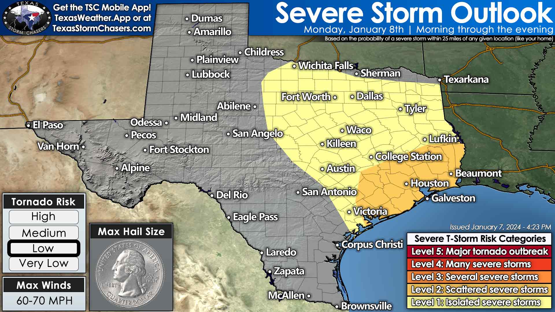
Severe thunderstorm outlook for Texas on Monday. The highest threat for severe storms, including a tornado risk, will be across Southeast Texas and the Golden Triangle.
Severe thunderstorms are possible Monday morning, depending on the atmosphere’s stabilization. If surface temperatures approach 70 degrees, the threat for all modes of severe weather (including tornadoes) will increase, especially along and south of Interstate 10 in southeast Texas. A conditional threat for a tornado will exist in East Texas, but if temperatures remain in the 50s to low 60s, that will limit the threat. We’ll more likely see a line of strong to severe storms move east on Monday into Monday evening across the eastern third of Texas. Damaging wind gusts are possible due to extremely strong winds a few thousand feet off the ground.
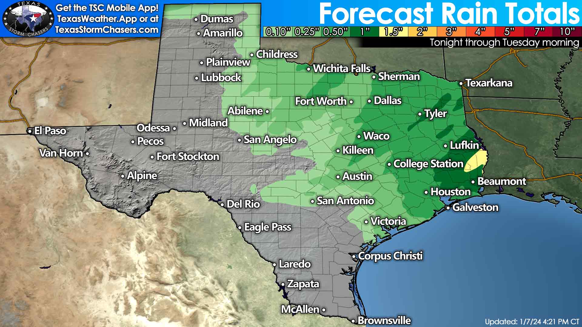
Forecast rain totals across Texas on Monday and Tuesday.
We’ll see precipitation exit Texas to the east on Tuesday morning. Gusty winds will stick around, though.
Get the FREE Texas Storm Chasers Mobile App for your local weather forecast, interactive weather radars, live Texas weather coverage, and more! Available in your device’s app store.
0 Comments