
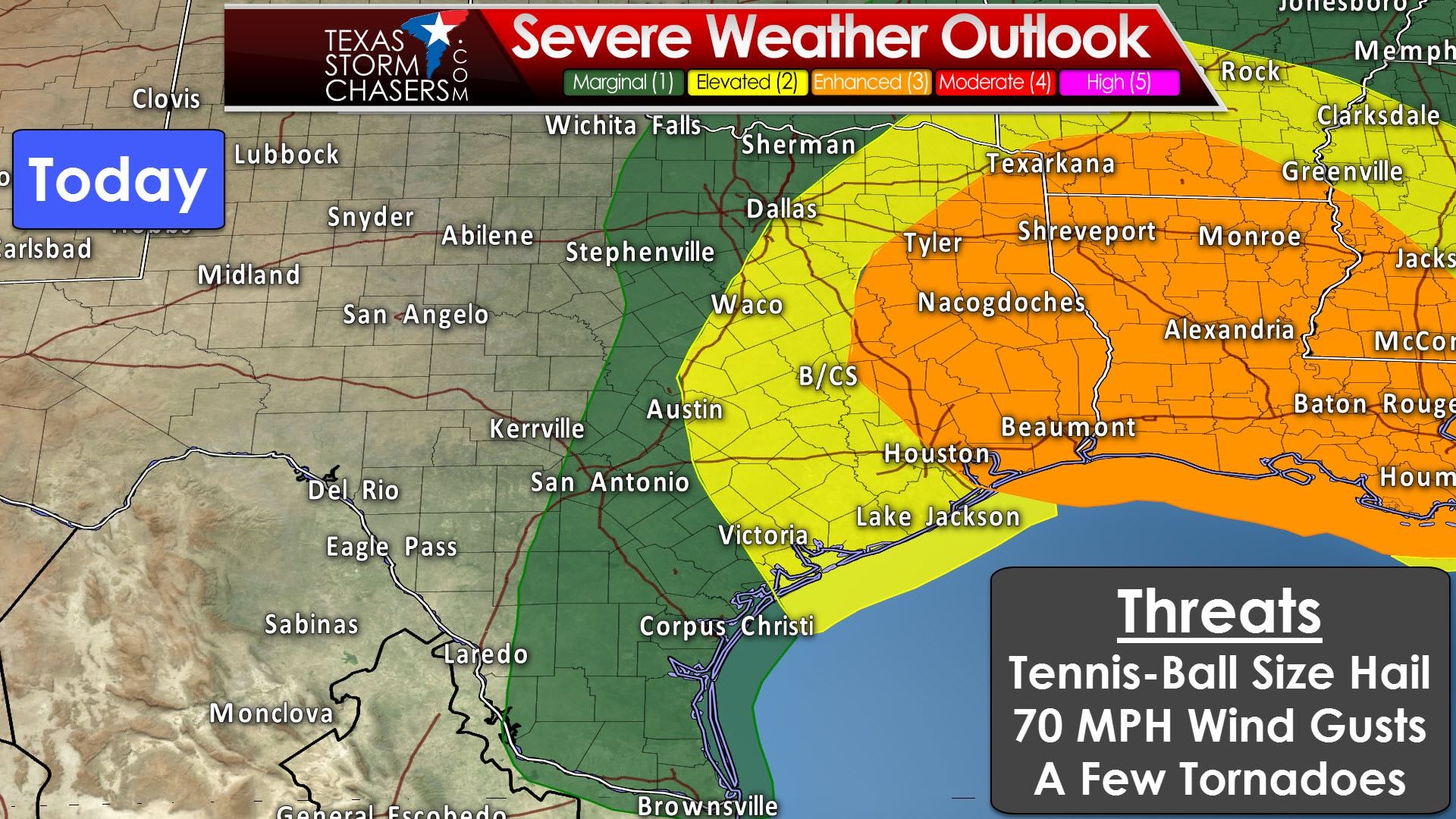
We already have a severe weather threat underway in Southeast Texas. For details of the tornado watch issued a bit earlier please see Jenny’s blog post. We do have a “enhanced” level 3 risk of severe weather across portions of East and Southeast Texas. This risk runs along and east of a line from New Boston to Athens to Buffalo to Madisonville to Houston east into Louisiana. A “slight/elevated” level 2 risk of severe weather includes eastern North Texas, Central Texas, the Brazos Valley, and the Coastal Plains. A “marginal” level 1 risk includes western North Texas, eastern portions of the Hill Country, South-Central Texas, South Texas, Deep South Texas, and the Rio Grande Valley. These risk zones are drawn based on the probability of experiencing severe weather. To learn more about these outlooks (including the probabilities) please see our dedicated severe weather outlook center.
Thunderstorms continue across Southeast Texas this morning. The strongest of these storms may produce large hail, damaging wind gusts, and a threat of a couple of tornadoes through the late morning hours. Eventually we’ll see these storms move east into Louisiana. These same locations will be impacted by a second round of storms this afternoon as a squall line moves south. The squall line may also contain severe storms with damaging wind gusts, large hail, and a threat for brief tornadoes. This projected line of storms will be caused by a southward moving cold front.

The cold front is currently located across Texoma. It will continue to move south this morning. By lunchtime this cold front should be moving into the D/FW Metroplex, from north to south. It is possible that the first storms will fire up on the cold front as it moves through D/FW. Once storms get going they could fire up in a hurry. Should these storms fire up in the D/FW Metroplex it is possible some folks could see large hail and localized damaging wind gusts. The good news is the squall line won’t stick around in one spot for long. It should be moving south at 25 to 35 MPH. Not all storms in the squall line will be severe. There remains uncertainty on how far west this squall line will fire up through the day. The simulated radar image from the HRRR (shown above) generally keeps the squall line east of Interstate 35. That may or may not be the case, so don’t be surprised if we end up seeing the storms fire up west to I-35 in Central and South Texas later today. By about 8-9PM the squall line should be moving off the Southeast Texas coast extending west through the Coastal Plains. The western sections of the squall line may be moving into South Texas, if we see development occur.
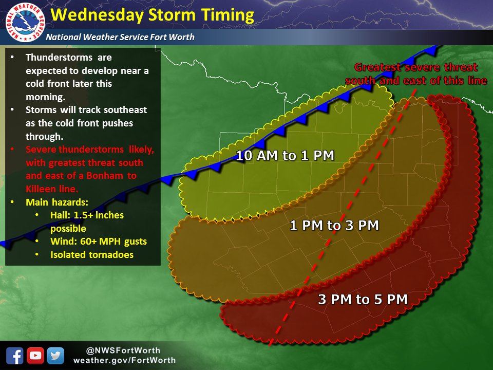
In summary: The strongest storms in the squall line later today may produce hail up to the size of golfballs and localized damaging wind gusts to 70 MPH. Brief tornadoes are possible with any intense wind damage swaths in the squall line. When storms first fire up early this afternoon on the cold front the first storms may produce very large hail before storms grow upscale into the squall line. Discrete storms this morning in Southeast Texas and any isolated storms ahead of the squall line will be watched for signs of low-level rotation and a possible tornado risk.


0 Comments