
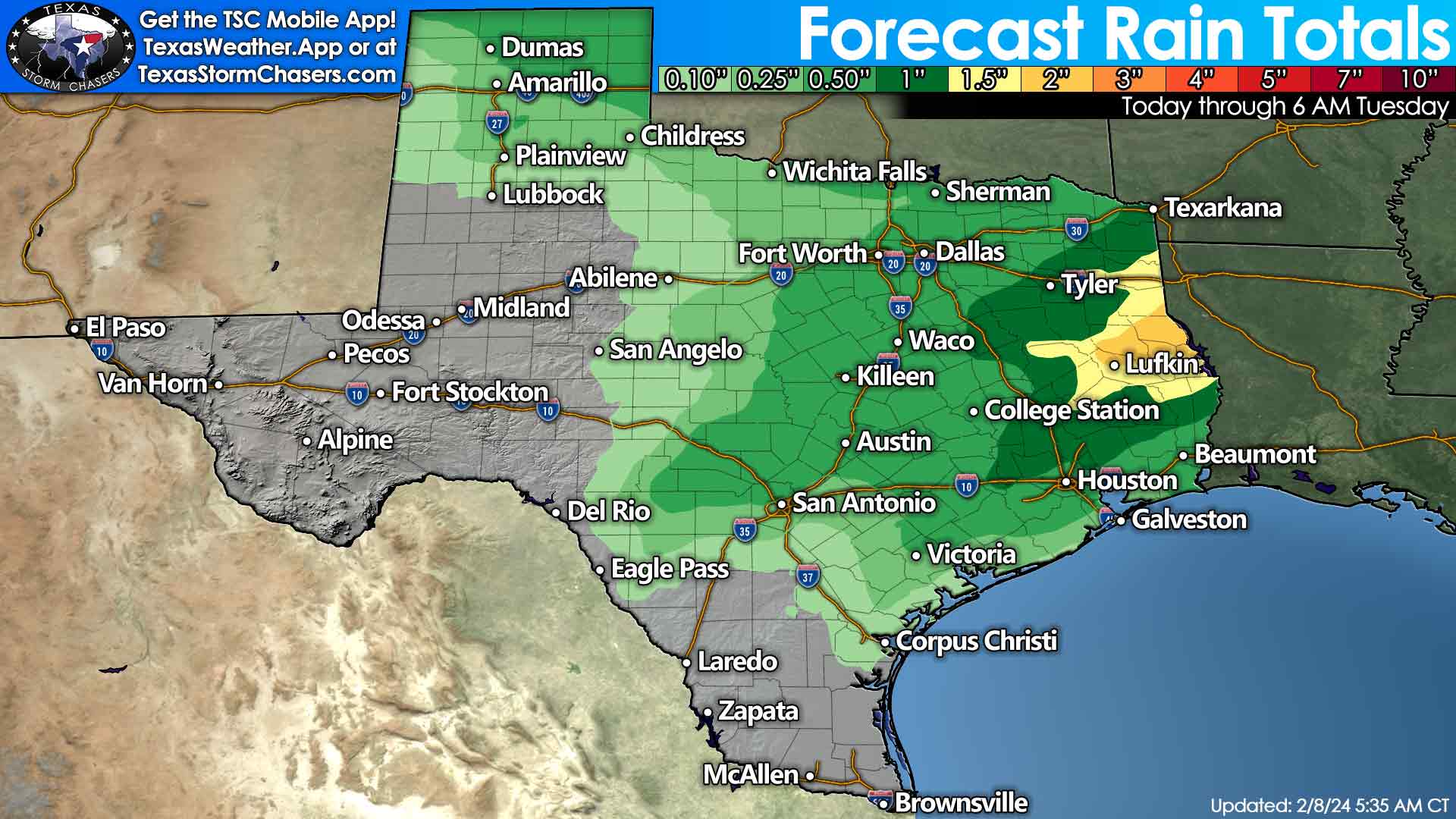
Warm weather will continue across most of Texas for the next few days, but changes are on the horizon with storms and snow. Friday night and Saturday will feature high rain chances across most of Texas. Best plan on indoor plans. Heavy rain will be possible at times across the eastern half of Texas on Saturday. Localized flooding may develop, but widespread flooding is not expected. One to three inches of rain will be possible on Friday through Sunday across the eastern third of Texas. Amounts will be lower to the west.
Strong or severe storms may develop on Sunday in Southeast Texas and the Upper Texas Gulf Coast. That possibility will be monitored as we get closer in time. Localized damaging winds and hail are the primary threats if we see stronger storms, with a tornado possible.
The track of an upper-level storm system this weekend will greatly dictate whether we deal with a snowstorm on Sunday. The chance for accumulating snow has increased across the Texas Panhandle, West Texas, and Northwest Texas. We won’t have a particularly cold airmass in place to support snow. However, the strong upper-level dynamics of the arriving system mean temperatures are likely to drop below/near freezing under its track.
That colder air, combined with enough moisture and lift, will likely support heavy, wet snow. A southern track would bring the highest snow chances to the abovementioned regions. A more northern track would keep snow chances along and north of Interstate 40. These systems are notorious for producing bands of heavy, wet snow that can pile up quickly – even with surface temperatures sitting a degree or two above freezing. The snow falls faster than it can melt. However, these system also have plenty of ‘fail modes’.
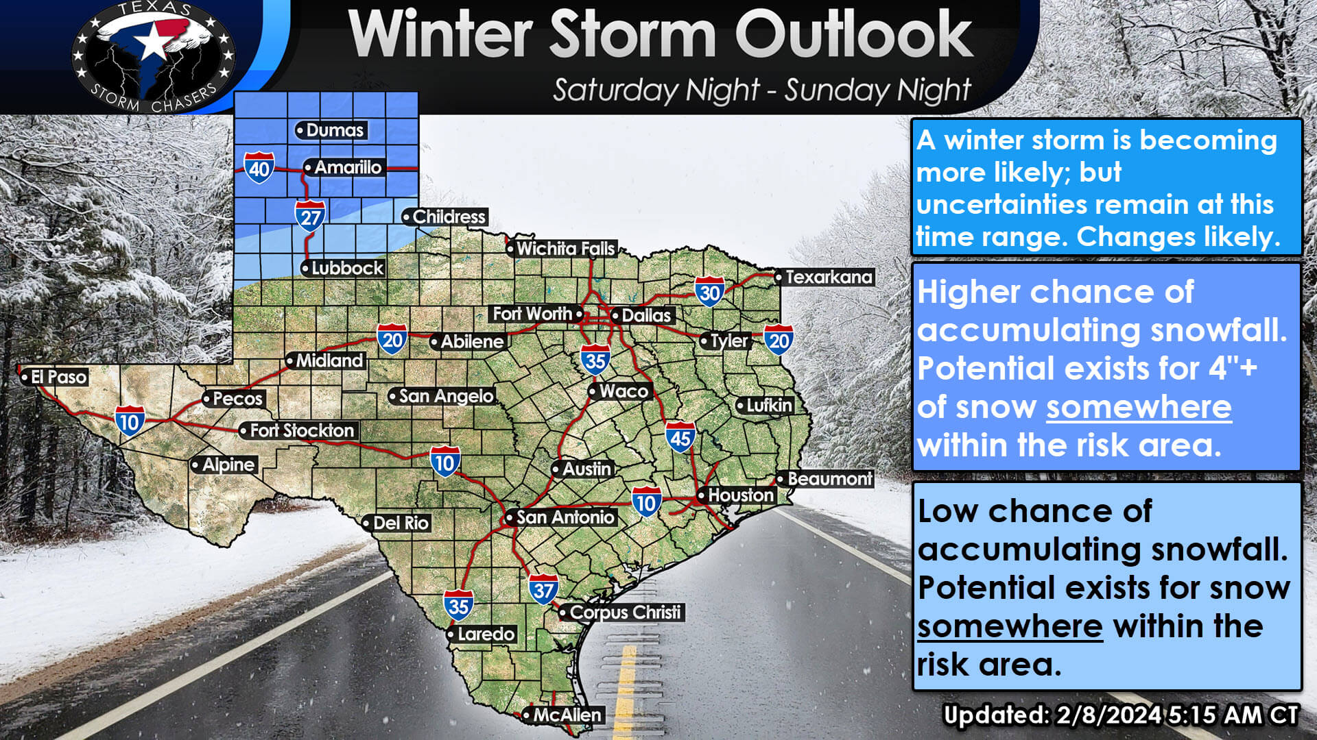
Our forecast follows consistency and highlights the most likely corridor for snow on Sunday – across the Texas Panhandle, with at least a low chance across West Texas and Northwest Texas. We’re too far out to get specific with snow numbers, and those will greatly depend on the track of the upper-level storm system. There is potential for an impactful, plowable winter storm with four or more inches of wet snow. We’ll become more specific and start throwing out accumulation maps once data becomes clearer, and it is responsible to do so. Any snow that does fall will likely mostly melt on Monday.
Precipitation chances end Sunday evening across Texas. A cool front will push south across Texas this weekend and on the backside of the departing upper-level storm system. Temperatures will be knocked down closer to February norms, but we’re not looking at a significant cold air intrusion. Temperatures will be above average, with afternoon highs in the 60s and 70s across Texas by Tuesday. Another period of dry weather is likely from Sunday night through mid-week.
You can watch the latest local forecast and more by downloading the free Texas Storm Chasers mobile app. You can also utilize our interactive weather radar without leaving our website. We’ll have our next video out by 7 AM Friday, with updates sooner if needed.
0 Comments