
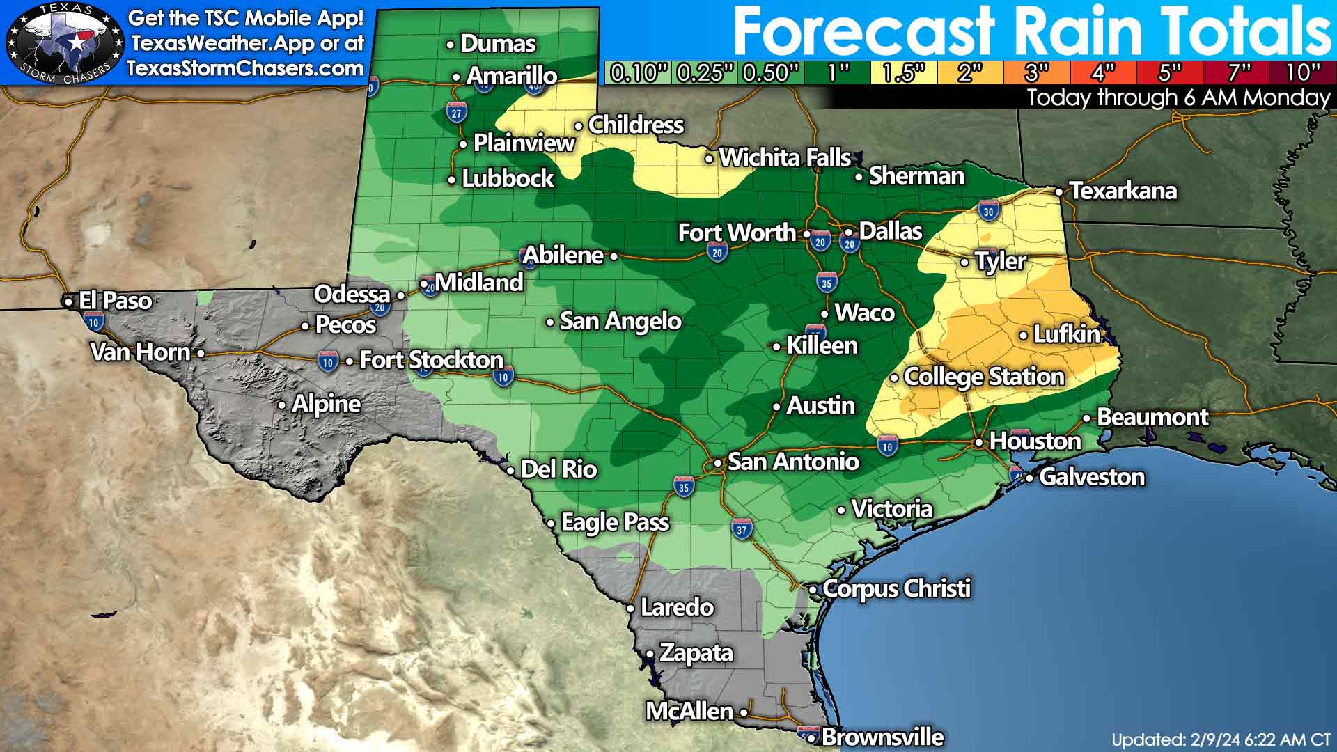
The weather across Texas will not be particularly pleasant for Super Bowl weekend. Rain is likely across the Edwards Plateau, Concho Valley, Big Country, North-Central Texas, into the Ark-La-Tex today and tonight. On Saturday, widespread showers and thunderstorms will make for a dreary day across the eastern two-thirds of the state.
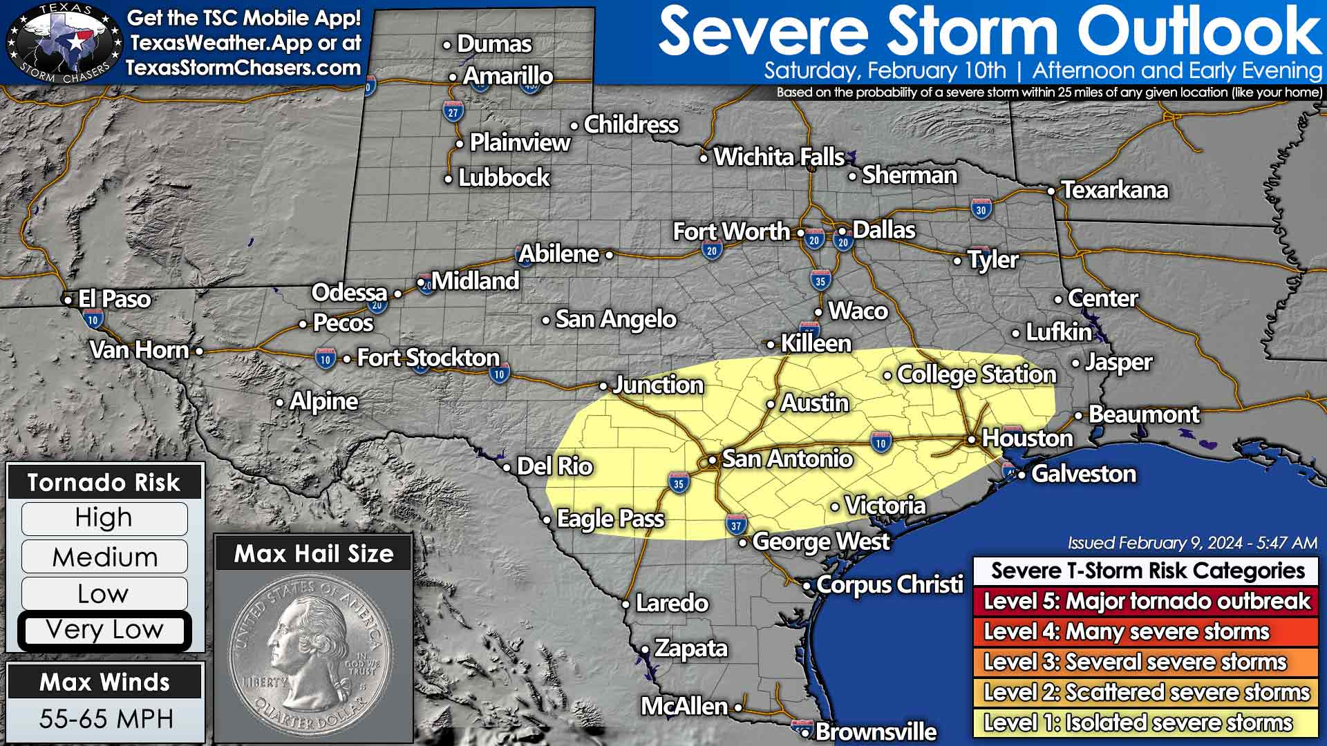
An isolated severe thunderstorm with hail and a brief tornado may occur in the afternoon from the Hill Country and South-Central Texas east through the Brazos Valley and Southeast Texas – including the Austin, San Antonio, and Houston metros.
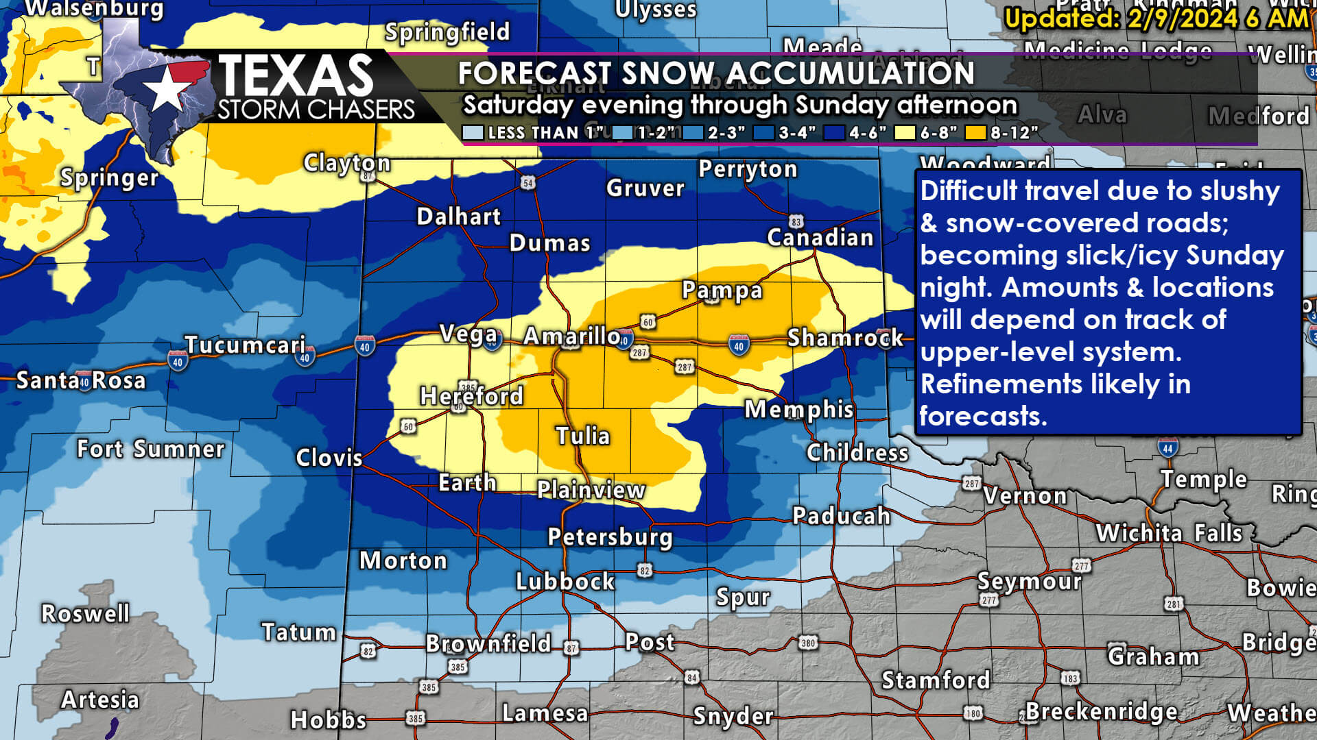
A winter storm will bring significant snow accumulations to the Texas Panhandle and West Texas tomorrow night through Sunday afternoon. Specific snow totals will depend on the track of an upper-level storm system and how much snow melts due to warm ground temperatures. Six to ten inches of wet snow may accumulate, with widespread three to seven inches a decent bet.
If temperatures trend any warmer, snow totals will decrease in subsequent forecasts. Likewise, some data is more extreme with snow totals. We’ll adjust the forecast as needed. Roads may initially remain just wet, but very heavy snow will eventually overcome the melting process – causing lots of slush and eventually some ice and snow-packed roads on Sunday through Monday morning. Snow will decrease in intensity Sunday afternoon, with perhaps a light rain/snow mix across Northwest Texas and Texoma.
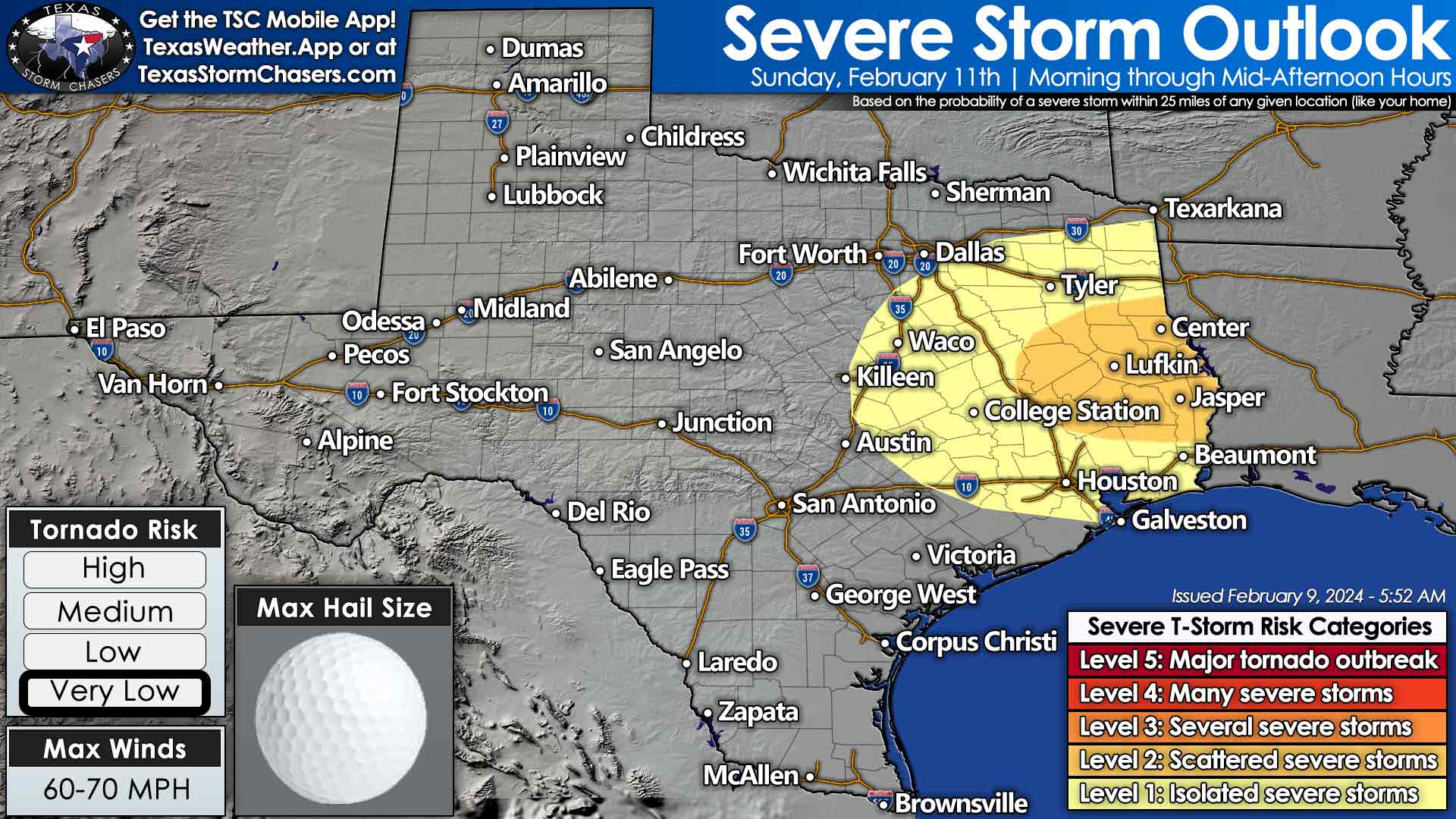
Saturday evening may bring a lull in precipitation to the eastern half of Texas. However, another round of scattered storms is expected to move east Saturday night into Sunday morning. Some storms may become severe in East Texas and Southeast Texas during the morning and early afternoon hours on Sunday. Large hail, localized damaging wind gusts, and a tornado are possible with the most intense storms. That activity will move east of Texas by late afternoon Sunday.
Temperatures will be knocked back down to February norms behind this weekend’s system across most of Texas. High temperatures on Sunday and Monday will be in the 40s and 50s across the northern two-thirds of Texas, with 60s across the southern third. Yup, it may be cooler – but it’s a far cry from any arctic outbreak mischief. The first half of the upcoming week looks dry.
Not in Dallas
Not in San Antonio
I don’t care about the Super Bowl but I’d love 💕 some rain.
Booo
Bring the snow lower to the DFW area! ❄️⛄🙏😁