
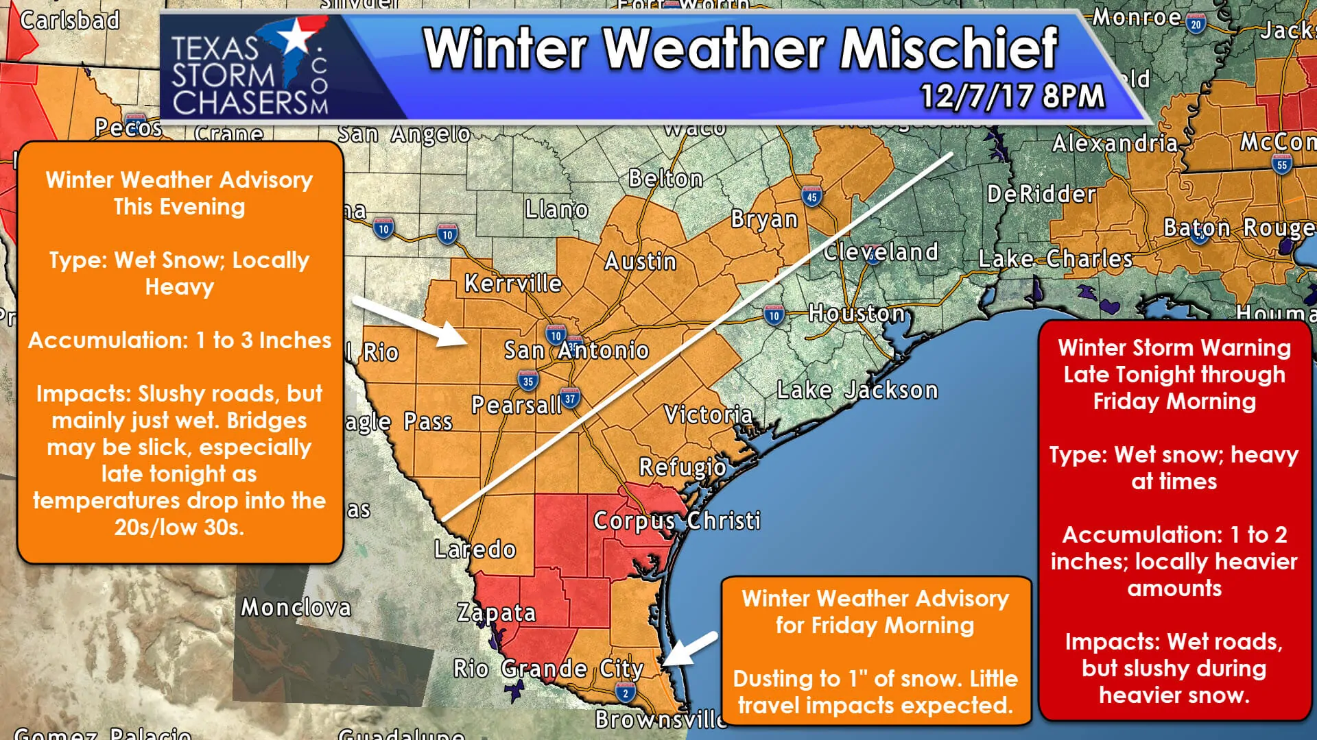
The big story and surprise this evening is the change-over to snow in Central Texas and the Brazos Valley. This changeover wasn’t expected, but obviously, temperatures in the low-levels of the atmosphere were able to cool more than anticipated. This surprise has resulted in one to two inches of snow accumulation in parts of Austin south to the north side of San Antonio east to Giddings and Bastrop. I wouldn’t be surprised to see a three-inch measurement at some point this evening. This locally heavy band of snow has moved east of Austin and now extends from the north side of San Antonio to near Seguin to Luling north to Bastrop and Giddings. We also have snow falling on College Station with 2″ measured on elevated objects. This heavier snow band should weaken by 10 PM but could bring additional accumulations to locations under it. This is the first round of precipitation, the second round expected later tonight in South Texas, the Rio Grande Valley, the Coastal Bend, into the Coastal Plains will not impact Central Texas.
At this time no forecast adjustments are needed for the second round of winter weather later tonight farther south. Please see my detailed blog post from 5 PM for the forecast on that event.

0 Comments