
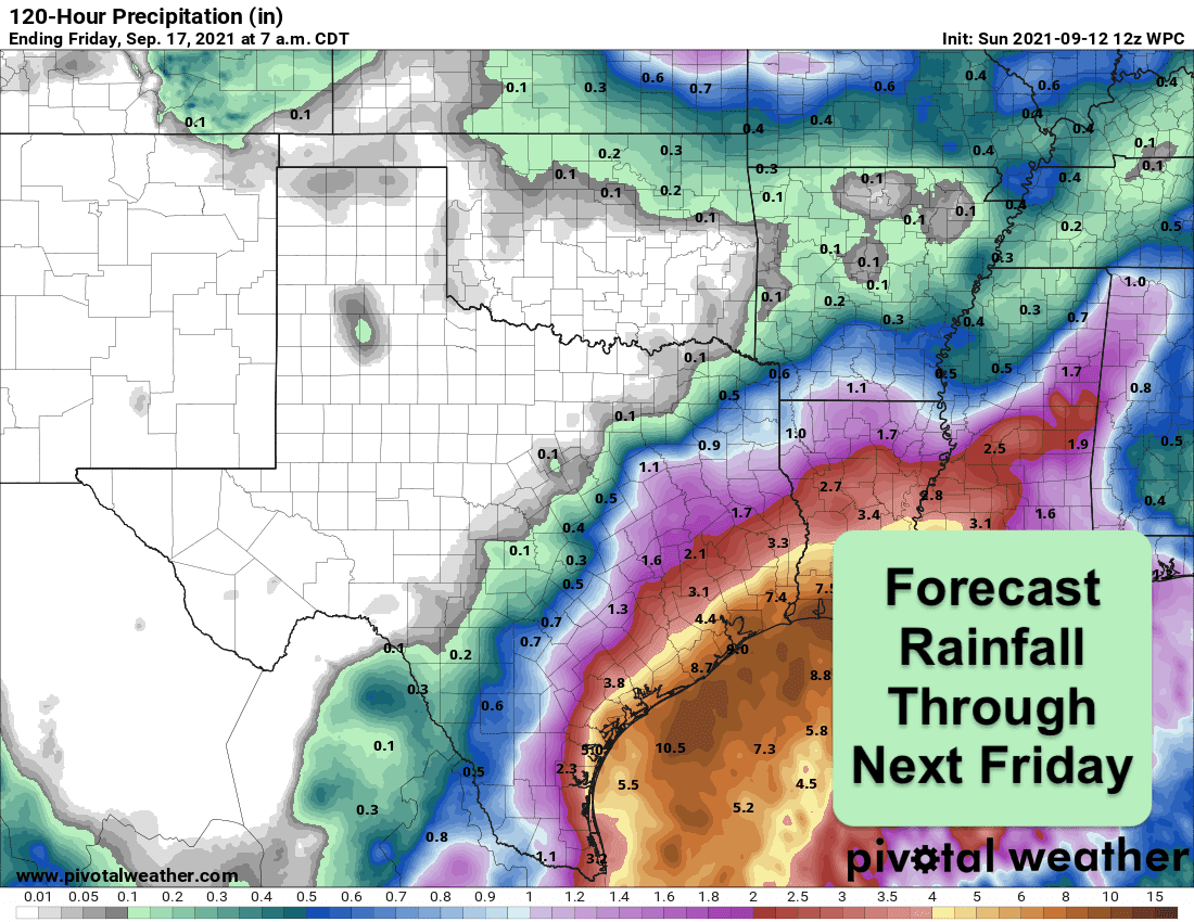
A large area of disorganized showers and thunderstorms which moved into the Bay of Campeche overnight is expected to become a tropical disturbance within the next 24 hours. Whether or not it becomes a named tropical storm is yet to be determined. Some of our forecast models from overnight are indicating this will develop into a tropical storm that will hug the coast eventually drifting onto land somewhere along the middle coast or southeast Texas coast. Hurricane Hunter aircraft are currently in route to investigate this disturbance and once data from their mission begins to filter into the forecast models, we’ll hopefully begin to have a clearer picture. If it does become a named tropical storm, it will be called Nicholas. Regardless of whether this disturbance becomes Nicholas or not, heavy rainfall all along our coast from Brownsville up to the Houston/Galveston and Beaumont areas will be the main threat. In fact, based on current radar at Brownsville and also Corpus Christi, rainfall along our south Texas and Coast Bend areas will begin sooner rather than later. Winds are not expected to be as much of a threat, but could reach tropical storm strength along the immediate coastline during this event with wind gusts of 40 to 50mph possible. This system is not expected to reach hurricane strength, but as we are in the peak of hurricane season, it can’t be completely ruled out, especially if it stays over the warm open waters of the Gulf of Mexico longer than currently anticipated. Folks who live along the coast need to be making preparations now for the possibility of heavy rainfall and flooding. We will continue to monitor this system for development and bring you updates later today and throughout the event.


0 Comments