
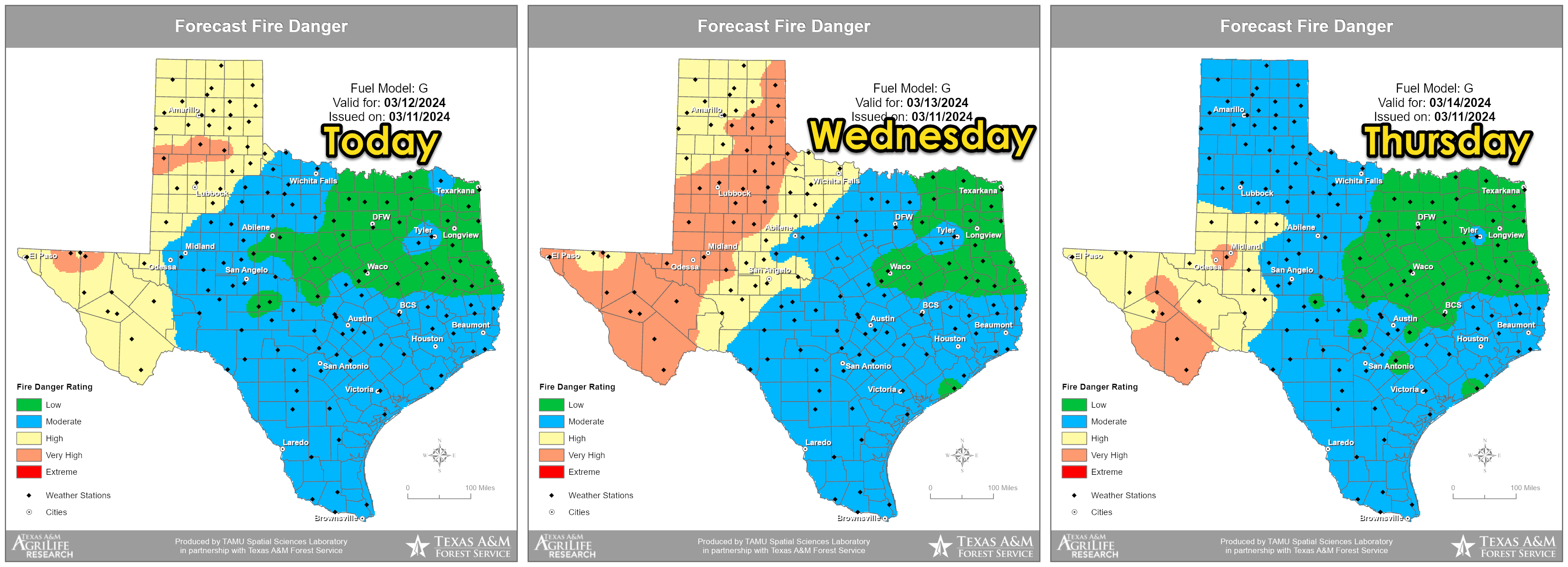
The weather across Texas is about to play switcheroo regarding precipitation chances. Today and Wednesday will feature windy conditions and very high wildfire danger across the western third of Texas. Oh, let us not forget about all of our allergies! Yeah, we are all going to stay miserable in that department.
An isolated thunderstorm cannot be ruled out Wednesday night in Northeast Texas. Comparatively higher thunderstorm chances will remain north of the Red River across eastern Oklahoma and Kansas. If we do have to deal with a thunderstorm, it could be capable of producing hail. Otherwise, we will have to wait until Thursday.
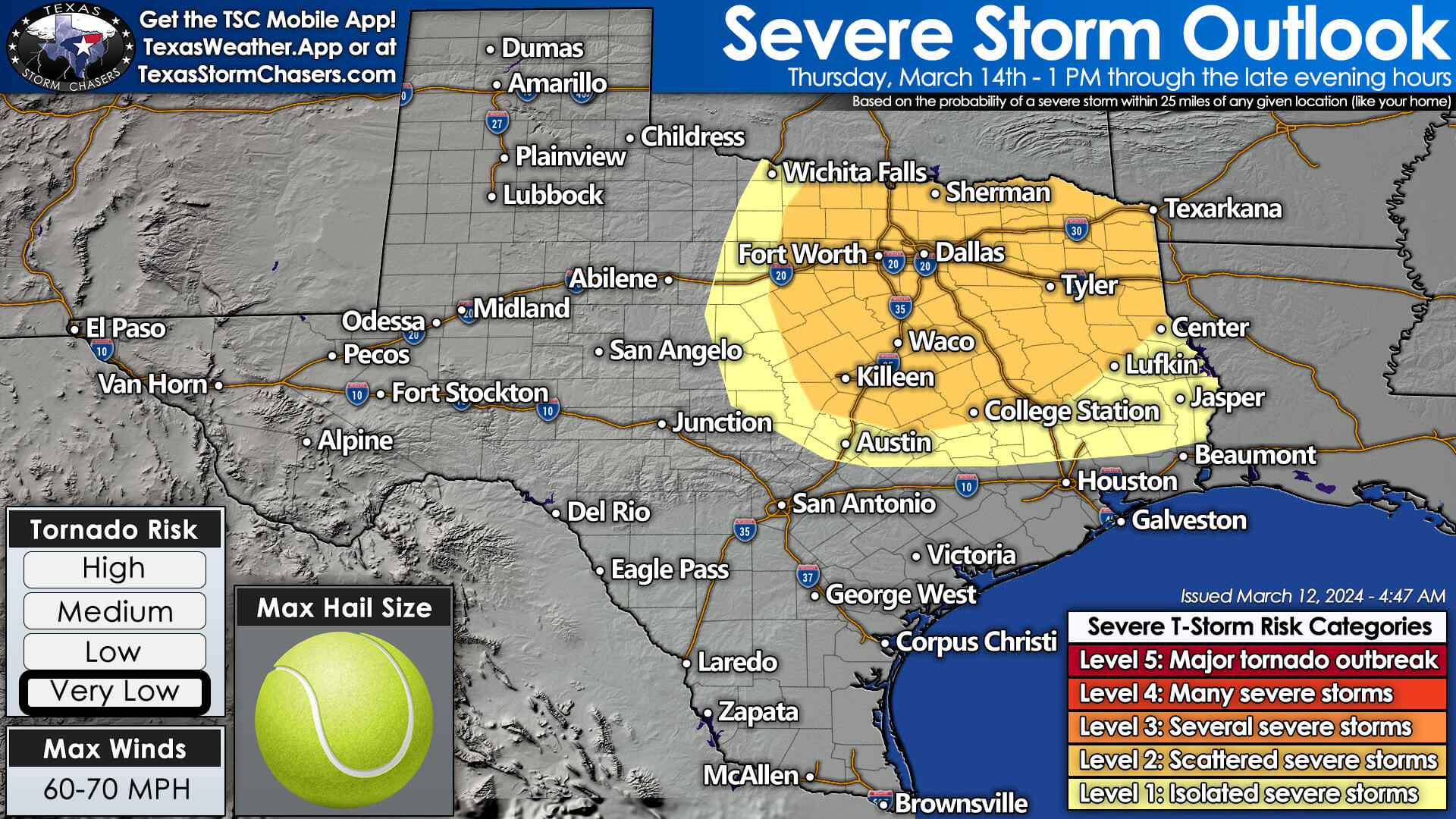
Scattered severe thunderstorms are possible Thursday afternoon through Thursday night across North Texas, Texoma, Northeast Texas, the Ark-La-Tex, and perhaps extending south into the Brazos Valley and East Texas by Friday morning. There remain appreciable differences in weather model data regarding the timing of thunderstorm development. Some data suggests that storms may develop around lunchtime. In contrast, others suggest we wait until late afternoon or even closer to dinnertime. Regardless, once thunderstorms get going, they will be in an environment supportive of large hail and localized damaging wind gusts. The tornado threat is uncertain due to the differences mentioned above in the data. However, at this juncture, the tornado threat looks like a secondary, low concern. A cool front will move south into Texas Thursday night into Friday. We are also dealing with substantial timing differences in data regarding the front’s southward progress and timing. That will be important for Friday because the highest number of thunderstorms will be near the front. We expect the highest storm chances across the Hill Country, Central Texas, East Texas, and Southeast Texas. However, that will be adjusted as we better understand Friday’s environmental conditions and where the front ends up.
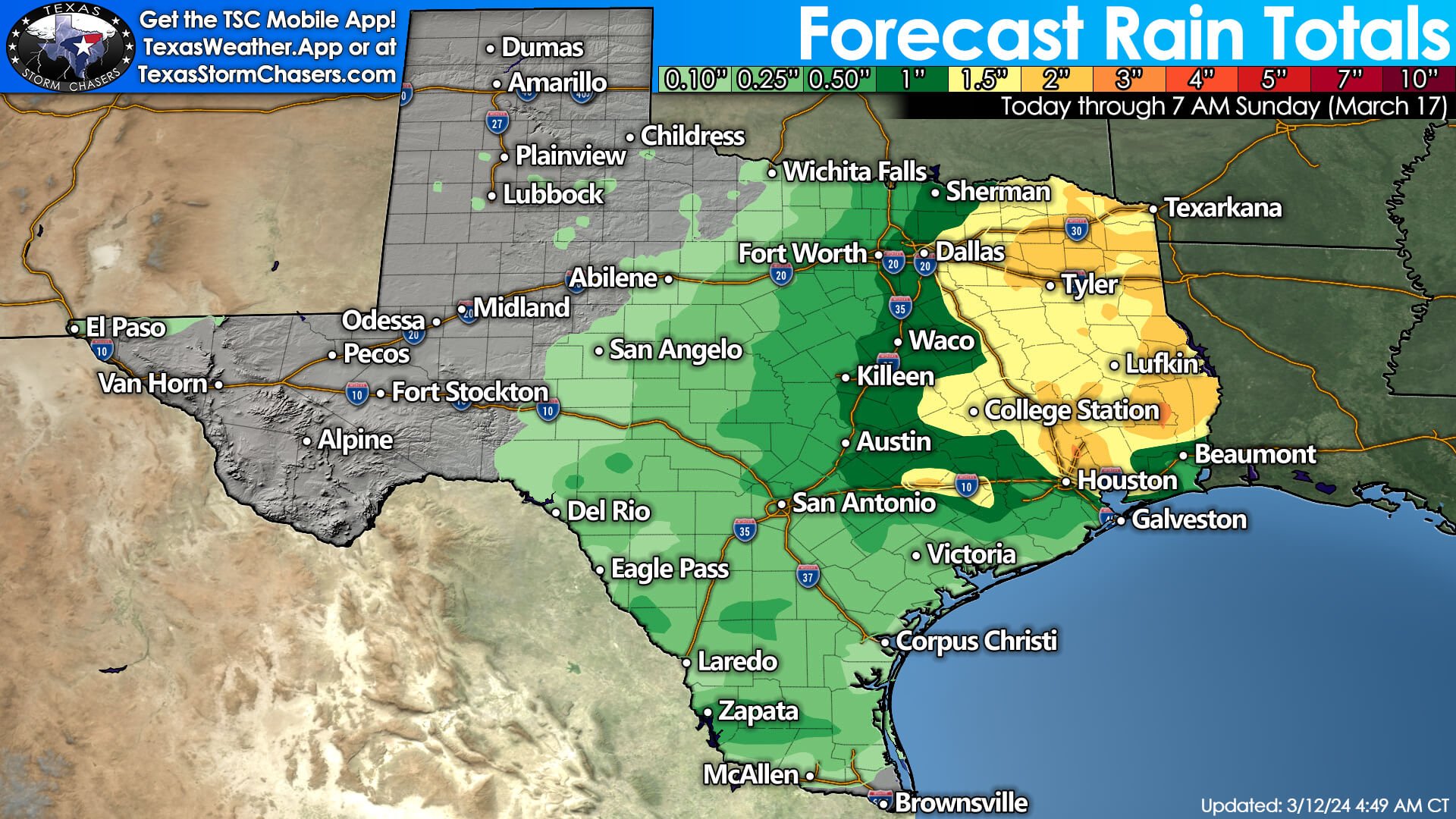
Some storms on Friday may also be rowdy with hail and strong winds. Over the weekend, scattered showers and thunderstorms will be possible nearly state-wide as multiple upper-level energy (lift) lobes move across the state. We will see some heavy rainfall across the eastern third of Texas. Light rain (and snow) may occur in the Texas Panhandle and West Texas, though precipitation totals will not be impressive. Welcome to the world of low-confidence forecasts! These are the days when we try to explain why the forecast is lower confidence and share a couple of plausible outcomes. We will try to narrow it down in the coming days!

0 Comments