
Some of us were able to enjoy a brief taste of fall after a cool front arrived yesterday and today. I know that the southern third of Texas wasn’t able to cash in before the front stalled out. They’ll be sharing their displeasure with us in the form of a rapid climb back up the temperature roller coaster today, tomorrow, and on Thursday. However, a true COLD front will be plunging south across the Plains and through all of Texas on Thursday and Friday. This next front will blow yesterday’s front out of the water.
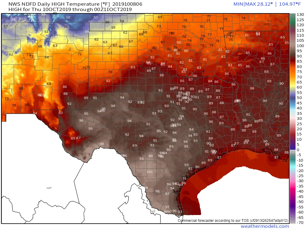
Thursday’s High-Temperature Forecast
Southerly flow will bring a rapid return of summer-like conditions to Texas over the next three days. Thursday is going to also feature compressional heating ahead of a strong cold front. Most folks are going to end up in the 80s, 90s, and even triple digits on Thursday. Some record high temperatures may be in jeopardy. However, the return of the record heat will be short-lived.
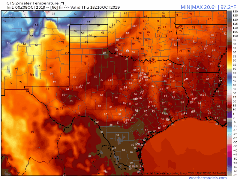
Global Forecast System (GFS) surface temperature output from Thursday afternoon through Friday afternoon.
I’m sharing the surface temperature output from the GFS from Thursday afternoon through Friday afternoon to demonstrate the cold front’s *potential* timing. These fronts have a tendency to come in faster than weather models depict, and this front is going to be a strong one. The timing of the front’s arrival at any given location may move up or get pushed back a few hours.
Strong northerly winds are expected behind the cold front. Temperatures immediately behind the front will drop twenty to thirty degrees. There will be wind chills with fairly cold wind chills expected across the northern third of Texas at various points (ranging from the single digits to the 30s). Given that most of us are acclimated to the summer heat this upcoming cold front will certainly bring about a sharp change.
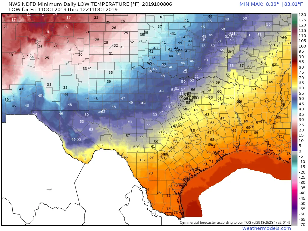
Friday Morning Low-Temperature Forecast
Temperatures by Friday morning are expected to be in the twenties across the Texas Panhandle. That means a hard freeze is expected for at least the northwestern half of the Panhandle. Temperatures may drop down into the teens from Texline to Dalhart. These may be a bit conservative and could be adjusted in the coming days.
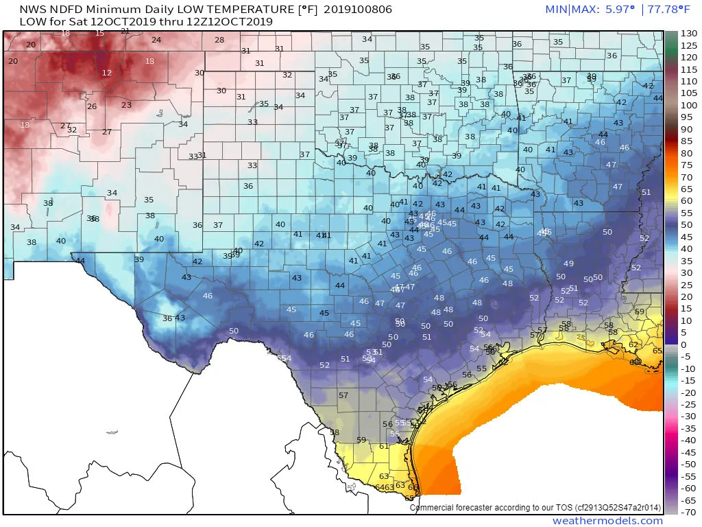
Saturday Morning’s Low-Temperature Forecast
As we move into Friday night into Saturday morning we anticipate temperatures falling into the 30s to around 40 degrees as far south as the northern Permian Basin, Big Country, and Texoma. Temperatures dropping into the 40s are expected south into the Hill Country, Central Texas, Brazos Valley, and East Texas.
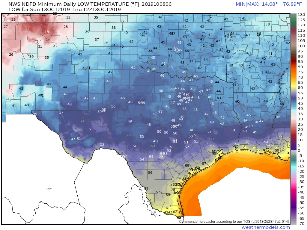
Sunday morning’s low-temperature forecast
It’ll be comparatively warmer farther south but still quite a departure from the summer months. Similar temperatures are expected for Sunday morning – perhaps a few degrees warmer compared to Saturday. We’ll start the climb back up the temperature roller-coaster with the start of the upcoming work week.
High temperatures behind the cold front on Friday and into the weekend will be far more comfortable than what we’re expecting over the next two days. Dewpoint temperatures (the primary way of measuring moisture) will be in the 30s-50s. Those dewpoint values have been in the 70s for much of the summer. It’ll feel much, much, much more comfortable out there. We’ll start the climb back up the temperature roller-coaster Sunday into Monday.
Thunderstorm Potential with the Front
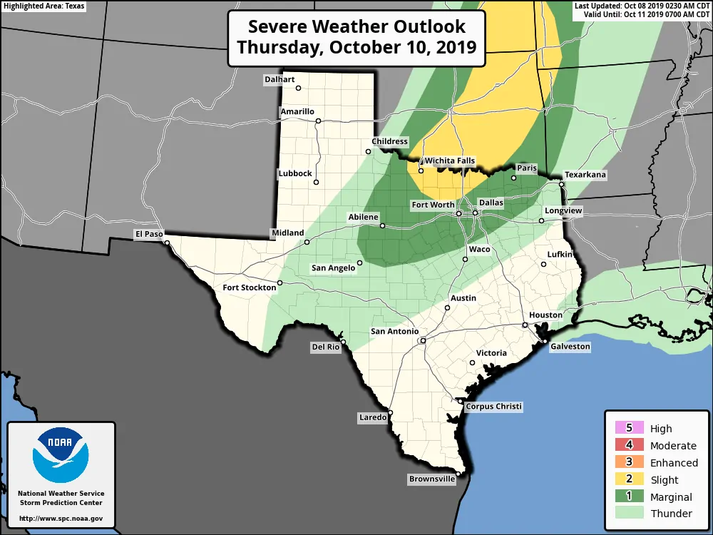
Scattered showers and thunderstorms are expected to occur with the cold front as it moves south on Thursday. There will be a risk of a few severe thunderstorms across the Big Country and North Texas.
At this time the overall scope of severe weather is expected to be limited due to the fast southward movement of the front. The primary threat with storms along the front itself would be gusty winds.
We may have thunderstorms occurring behind the front as well Thursday night into Friday. Those storms would primarily be capable of producing some hail in the ‘coin-size’ department (dime, nickel, a few quarters, etc). Keep an eye on the updated forecasts in the coming days.
Flash flooding is not expected to become a widespread threat. A few lucky folks may end up around one to one and a half inches of rain, but most amounts will be lower.


0 Comments