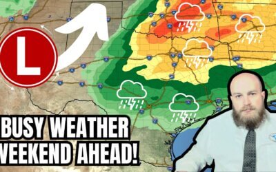
No sleep for the wary, and that certainly held true overnight in the Big Country. Multiple severe thunderstorms produced damaging straight-line winds, hail, and perhaps a tornado. We’ll get a brief break late this morning before we begin a more active afternoon and evening. Unlike yesterday, we’re expecting far more numerous thunderstorms today continuing into Thursday. Some storms will be severe this afternoon and tonight. Not all storms are going to be capable of producing severe weather, however. Let’s make that clear before we start getting emails saying, ‘YOU SAID I’D GET BASKETBALL SIZE HAIL AND MEGA TORNADOES.’ If a severe storm doesn’t hit a major city, some folks think severe storms don’t happen at all.
Severe Weather Outlook
Scattered severe thunderstorms are possible, if not likely, later today and tonight east of the dryline. The Edwards Plateau, Hill Country, Big Country, Northwest Texas, Texoma, North Texas, and Central Texas are in the threat zone. A level two out of five severe weather risk means a roughly one in five chance of severe storms in your area.
I would not be surprised if portions of the Edwards Plateau and Hill Country are upgraded to a level three risk later today. A level three risk would have a one in three chance of severe storms within your local area. Today’s most intense severe storms could produce hail up to the size of tennis balls and damaging straight-line winds up to 70 MPH.
Remember, risk zones convey the probability of severe storms in your area. Any risk zone means there’s the chance of a severe storm in your region. Learn more about the severe weather outlook risk scale here.
Tornado Potential
We’re keeping an eye on two regions for a few tornadoes this afternoon and this evening. Region one is across the Big Country, Northwest Texas, and western North Texas. Region two is in the Edwards Plateau and Hill Country, edging into the San Antonio metro. Both zones have a low chance for tornadoes, with very low risk in the remainder of today’s overall severe weather risk.
Timing and Threats
This morning’s thunderstorms complicate the forecast for later today. Boundaries produced from overnight storms will likely be initiation points by early afternoon in Northwest Texas south into the Big Country. Exactly where those boundaries end up is a wait-and-see issue. The dryline will also be a source of thunderstorm development by late afternoon in the eastern Texas Panhandle and West-Central Texas. Of course, perhaps we’ll continue to have rain/storms continue this morning and keep today’s severe weather setup messy.
I expect isolated to scattered storms will develop by mid-afternoon in the aforementioned regions. The strongest storms will likely produce large hail up to the size of golfballs and localized damaging wind gusts up to 70 MPH. A tornado or two will be possible, especially with any storms that interact with a boundary that can locally enhance low-level wind shear.
High-resolution weather models will not have a good handle on the ‘where/when’ of individual storms today, thanks to all the complex small-scale ingredients in play. Nevertheless, the overall timing may be decent. The common story will be increasing thunderstorm coverage by this evening from northern Mexico into southern Oklahoma. Most storms will move east/northeast, with some deviating east.
In addition to storms in northern portions of Texas, we’ll see increasing severe storms in northern Mexico and the Edwards Plateau by early evening. Those storms and other development in the Hill Country could impact some in the Hill Country, South-Central Texas, and in the Edwards Plateau this evening.
Strong instability combined with decent wind shear in all levels will promote a supercelluar storm mode. Very large hail up to the size of tennis balls, localized wind gusts up to 70 MPH, and a few tornadoes are all possible from the most intense storms.
The threat of severe storms could continue into the late evening hours. Some storms will continue producing gusty winds and hail after midnight in North Texas, Central Texas, and South-Central Texas.
Heavy Rain and Flooding
Tonight will feature numerous showers and thunderstorms from the Edwards Plateau north to the Red River. Overall rainfall amounts will average between one-half inch and three inches. Isolated amounts of four to six inches are possible where multiple heavy storms move over the same locations. Localized flooding of streams, creeks, rivers, and roads is possible tonight and Thursday morning.
Severe thunderstorms are less likely tomorrow, but it’ll still be a wet day with numerous showers and thunderstorms expected. Some storms may produce heavy rainfall, which could cause localized flooding. Rain chances will continue Thursday Night into Friday Morning as an upper-level low pressure slowly moves east.


0 Comments