
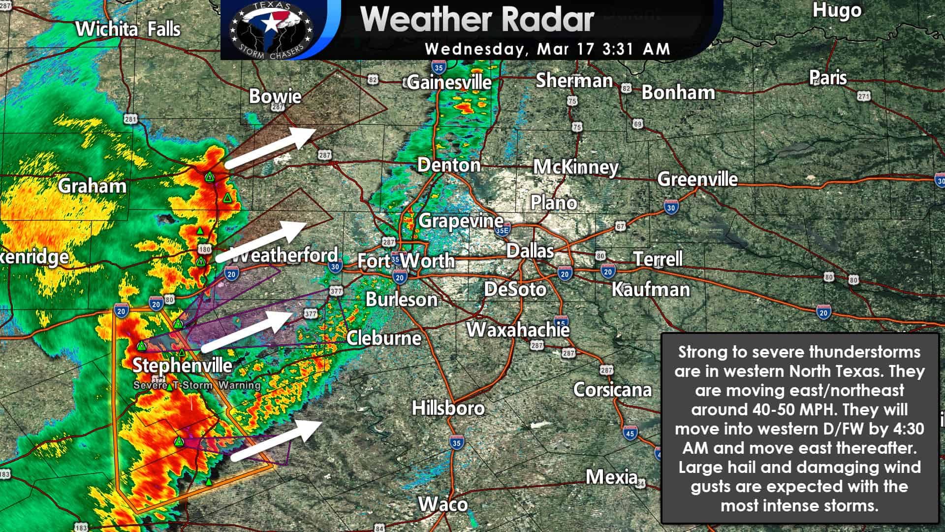
A line of strong to severe thunderstorms will continue racing northeastward across Northeast Texas this morning. With a forward movement around 50 MPH, we should be able to say goodbye to those storms by 10 AM. Additional storms may continue farther southwest along the cool front through the late morning/early afternoon hours. The strongest storms could produce wind gusts up to around 70 miles per hour and quarter size hail. Storms in East Texas late this morning and early this afternoon could produce localized damaging winds and some hail. You can track the storms with our interactive weather radar here. Those using our mobile app can click the ‘radar’ button on the bottom menu bar.
Major Tornado Outbreak just east of Texas today
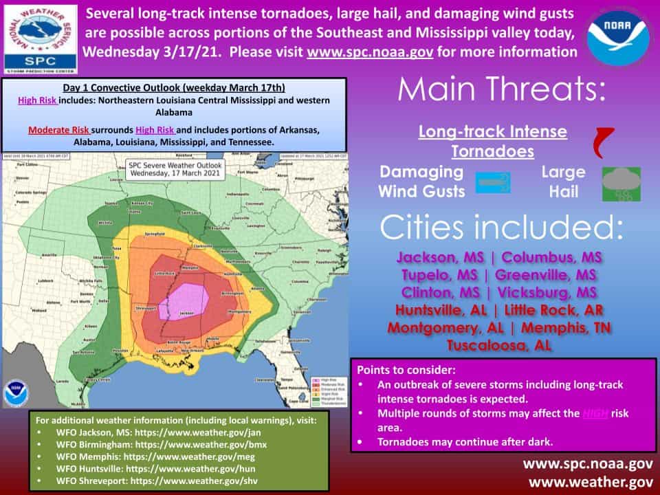
A major severe weather outbreak is expected just to our east today. A level five out of five has been issued for portions of Louisiana, Mississippi, and Alabama. Frankly, we don’t want folks to pay attention to the exact risk lines or colors. Those only represent the probability of a tornado/severe storm within 25 miles of any given location. The hazards across level 3, level 4, and level 5 (orange, red, and purple) remain the same. Long-track, significant tornadoes (EF2-EF5), destructive hurricane-force wind gusts, and baseball size hail (or larger) are expected in the most intense storms. Numerous tornadoes are forecast today, with a tornado outbreak probable in ‘Dixie Alley.’ Several members of our team are chasing in Mississippi/Alabama today. They’ll be streaming live to our YouTube channel – which we’ll also embed here on our website here.
Texas Panhandle Blizzard
Rain will change over to snow across most of the Texas Panhandle this morning. Accumulations are expected to range from one inch up to five inches. Strong winds up to 60 MPH will result in a blizzard with whiteout conditions. Travel will be very difficult to impossible with high winds, blowing snow, and very low visibility. Blizzard conditions will continue through the afternoon, even after the snow begins tapering off.
Strong Winds across Texas
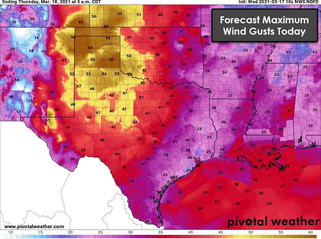
Very windy conditions are expected today across the western half of Texas. Now that the cool front has moved through, we’ll see winds become strong out of the west/northwest. Winds over 55 MPH are forecast in the Texas Panhandle and West Texas. Winds over 40 miles per hour are possible west of a Del Rio to Brownwood to Gainesville line. While winds will be slightly lower to the east, it’ll still be windy across Texas today. Blowing dust could become a problem by this afternoon – and we’ll have to see if we can get a dust storm generated across the western half of Texas.
High Wildfire Danger This Afternoon
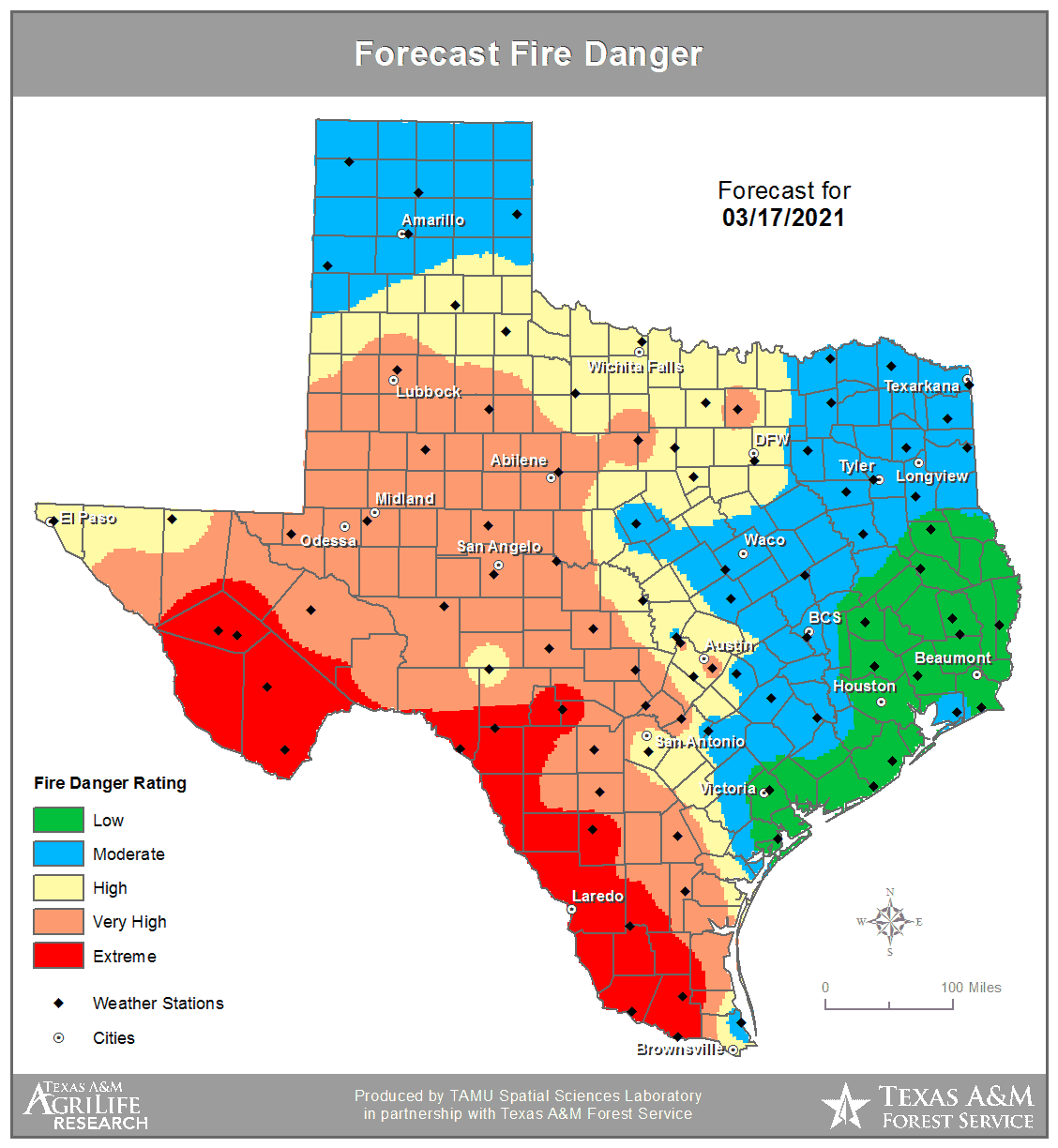
Strong winds and low relative humidity will result in high to extreme fire danger across Texas’s western two-thirds today. The Texas Panhandle, Northeast Texas, and Southeast Texas will remain on the ‘low’ side of fire danger. Those in the Big Country, Concho Valley, and North Texas who received rain will still have elevated wildfire danger this afternoon. Lowering humidity and strong winds will quickly dry out surface fuels by this afternoon. Any fires that get going in the ‘very high’ or ‘extreme’ zones could spread rapidly and require augmented resources to contain.


0 Comments