
The next three days will not feature chances for severe weather. National Weather Service crews from Fort Worth, Shreveport, and Houston have been out surveying damage from yesterday’s tornadoes. Thus far we are aware of at least three confirmed EF2+ tornadoes with two EF3s (the Roberston county/Franklin tornado and the second Alto tornado). We’ll share much more detailed information later this evening once those crews submit their full survey reports.
Our next upper-level storm system will arrive on Wednesday. A surface dryline is expected to set up shop around the Interstate 35 corridor from Oklahoma south toward San Antonio. Exactly where this dryline sets up will dictate the western delineation of a severe weather threat by Wednesday afternoon. Moisture values (dewpoints), projected wind shear profiles, and ample instability will support severe thunderstorms.
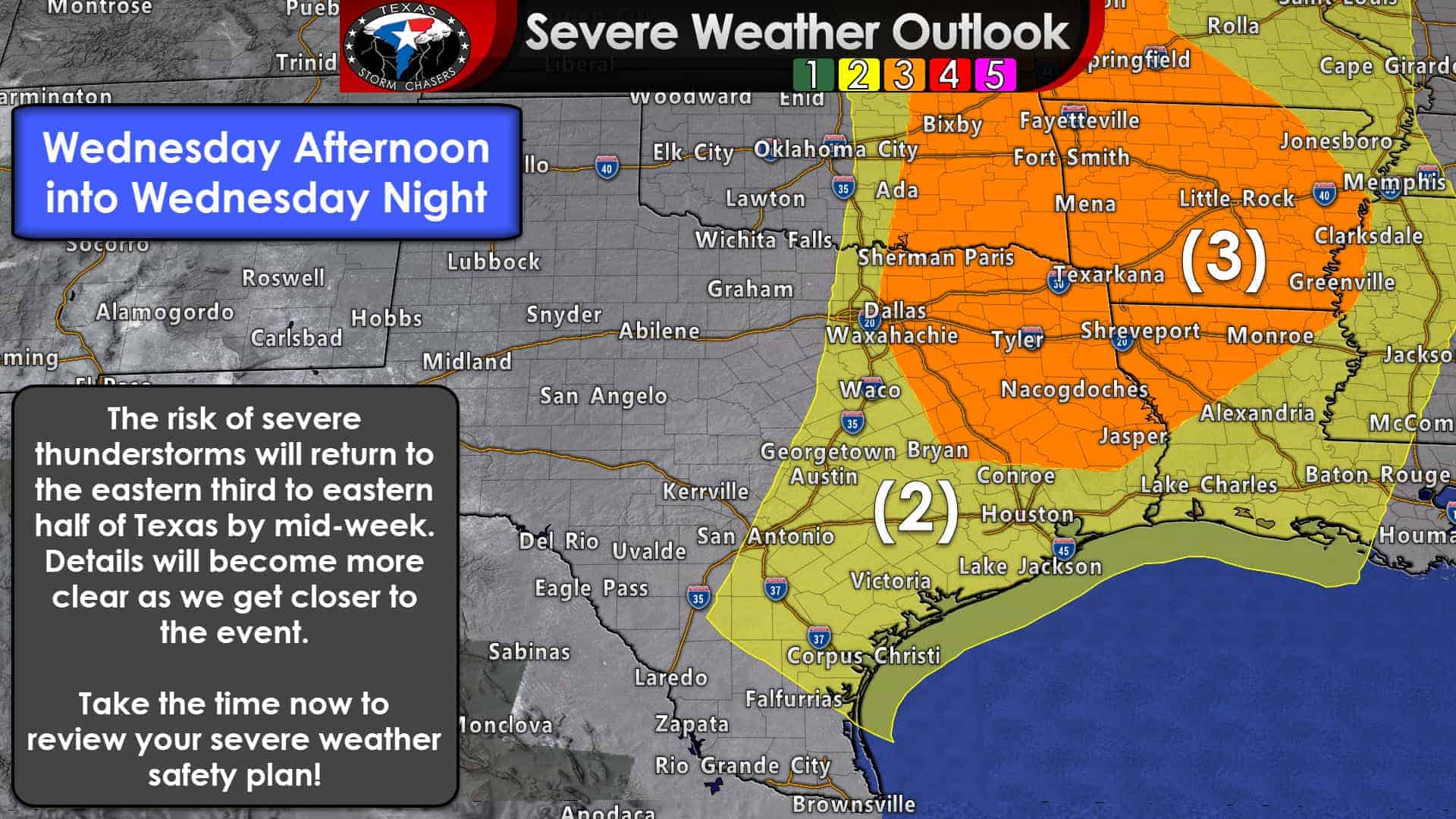
All modes of severe weather do appear possible at this time. That means large hail, damaging winds, and a tornado threat may exist. Once we get closer to Wednesday we’ll be able to start pinning down specific threat levels along with the highest threat zones. We already have an enhanced level 3 risk of severe weather in place for eastern North Texas, Northeast Texas, and East Texas. The standard level 2 risk runs from Oklahoma City to Montague to Gatesville to Lampasas to Boerne to Pearsall Kingsville – and points east. So essentially the eastern one-third to the eastern half of Texas is in play for a severe weather risk on Wednesday.
Timing should be from the mid-afternoon hours into Wednesday night as storms move east. We could deal with initial storms being discrete and supercelluar (with a big hail threat noted even at this range) with a squall line or cluster moving east Wednesday night. Consider this an early heads up that Wednesday could be busy in the severe weather department. It’s also a great time to make sure your safe place is ready to go. Don’t know what to do if severe weather approaches or just want to check up? Visit our tornado safety guide here.


0 Comments