
Today’s supercell which formed in the western panhandle near Dimmit turned out to be the overachieving storm of the day with multiple tornadoes reported in addition to instances of very large hail. Flooding also became an issue as the storm did not move very fast. While hail and damaging winds were in the local forecast, the probability of tornadoes was not high on the list; however, Mother Nature pulled a rabbit out of her hat today and surprised everyone. While the upper level forcing was weak, it appears there was just enough moisture pooled up and just enough wind shear near ground level to allow this storm to spin and develop into a monster tornado just to the west of Dimmit. Tomorrow’s conditions look similar to what we saw today…but just a bit further east. The dryline tomorrow is expected to shift east near the I-27 corridor or just along the edge of the caprock escarpment by early afternoon. Strong capping will be in place once again, just like today which will severely limit the number of storms that can form. However, with strong instability possible along the dryline, and juicy dewpoints in the mid 60s expected just east of the dryline, we have the potential to see a couple of supercells. Same as today, both local forecasters and the Storm Prediction Center are highlighting the risk of isolated supercells with very large hail (2 inches or more in diameter) and damaging winds up to 70mph. As additional data rolls in overnight, the forecast should become more clear by early tomorrow.
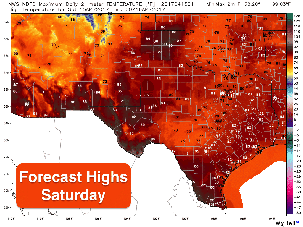
For the remainder of the state…rain free, warm and humid. Early morning fog is expected along the coast and inland which will dissipate after sunrise. Skies will be cloudy for areas east of the dryline but should begin to break up and scatter after lunchtime. Highs tomorrow will be pretty seasonal for most with the exception being parts of west Texas and the panhandle, behind the dryline, where temps will soar into the upper 80s and low 90s. More widespread rain chances return on Sunday, but right now not enough to ruin plans for Easter Sunday morning.


0 Comments