
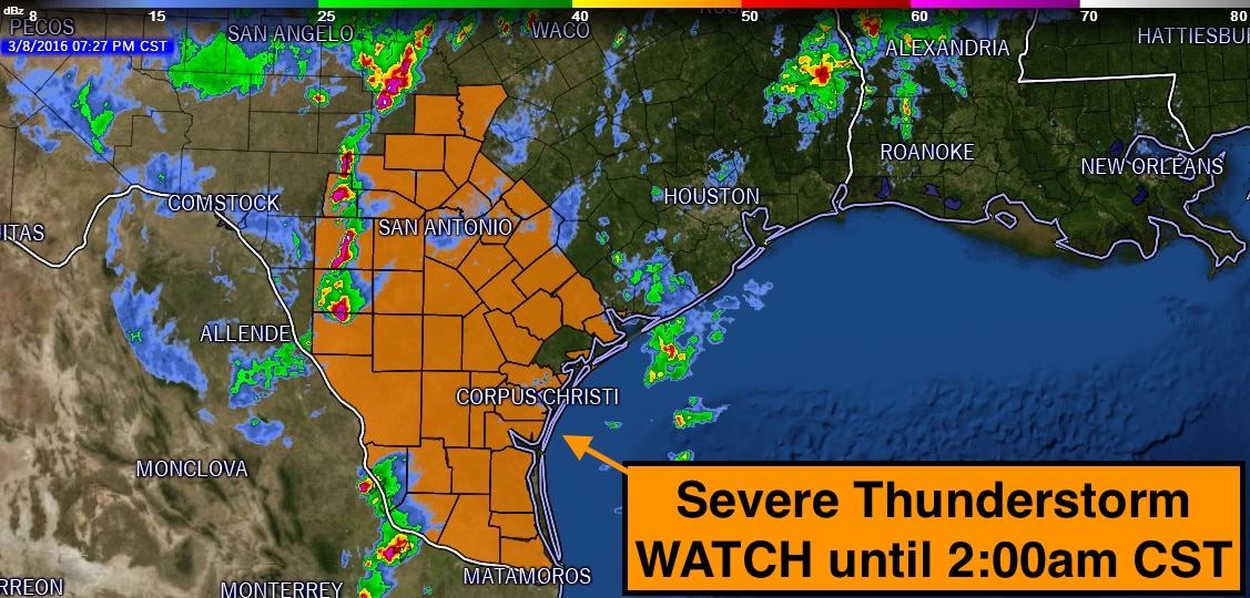
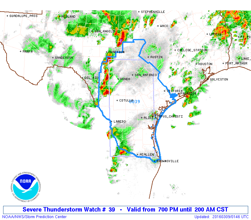
A Severe Thunderstorm WATCH has been posted for South Central and deep South Texas until 2:00am CST. We have two batches of storms that we’re monitoring at this time. One across South Central Texas east of Del Rio, and another batch developing along the international border in deep south Texas all moving to the northeast. Both areas are expecting to see an increase in storm coverage over the next several hours as forcing from the approaching upper level low increases. Initially, storms will be isolated and supercellular in nature with the threat of very large hail, damaging winds. As we get into the early morning hours, the storms are expected to merge into clusters with the tornado threat increasing as the storms move into more favorable environment closer to the coastline. Remember, a WATCH means that conditions are favorable for the development of severe thunderstorms, and residents in the watch area need to monitor the weather overnight and have a way to receive weather warnings should any be issued for your location.


0 Comments