
A relatively narrow, but long severe thunderstorm watch has been issued. This watch goes until 5 AM. It runs from Alpin and Fort Stockton northeast through San Angelo (Concho Valley) into southwestern North Texas, to the D/FW Metroplex, to Sulphur Springs, Emory, and Canton. It’s a weird looking watch so you’ll just have to look at the graphic to see where it includes. Alpine, Fort Stockton, San Angelo, Stephenville, Fort Worth, Dallas, McKinney, Greenville, Emory, Terrell, and Canton are a few towns included.
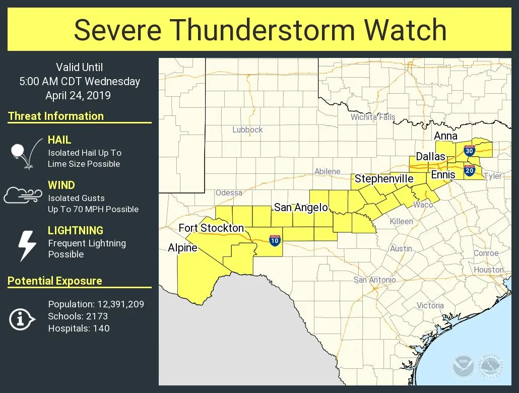
Scattered thunderstorms are expected to continue most of the night in the vicinity of a stalled cool front. This new watch essentially highlights where the front is located. The strongest storms overnight may produce large hail in the Concho Valley into southwestern North Texas. Damaging straight-line winds are also possible with the strongest storms across the watch zone. Hail seems a bit less likely farther northeast toward the D/FW Metroplex based off lower instability values. All storms will be capable of producing very heavy rainfall and isolated flash flooding tonight. Storms that move over the same areas (train) could result in 2-3 inches of rain in one hour in some spots. Several roadways in the D/FW Metroplex are currently flooded, and I expect we’ll see more of that occur across the Concho Valley into North Texas overnight.
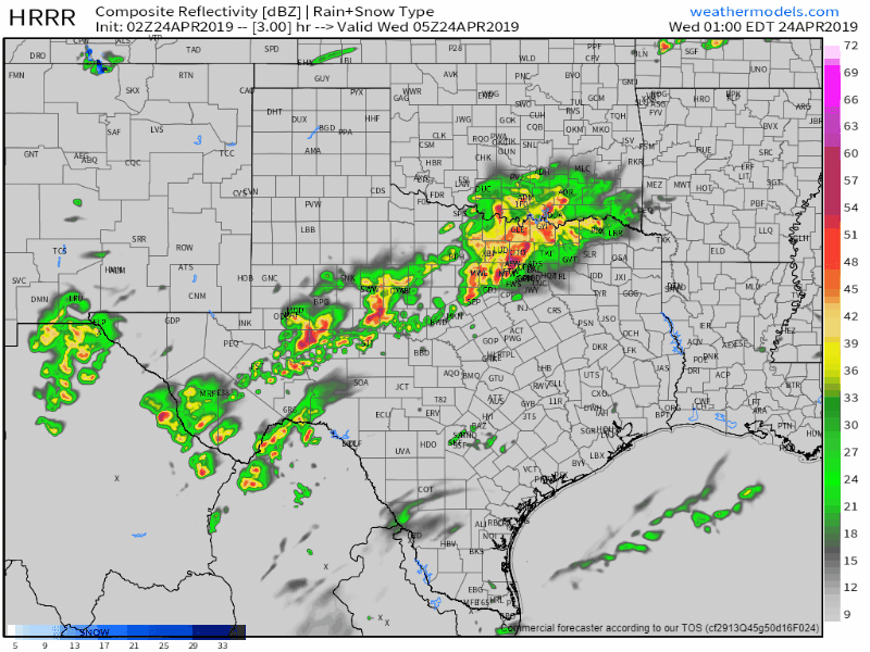
02Z HRRR: Simulated weather radar from midnight until 3 PM Wednesday. This model won’t get it exactly right, but it does a decent job. We note that it has new severe storms organizing in the Hill Country and Central Texas by early afternoon Wednesday. Those would be moving east. Click image for full-screen version.


0 Comments