
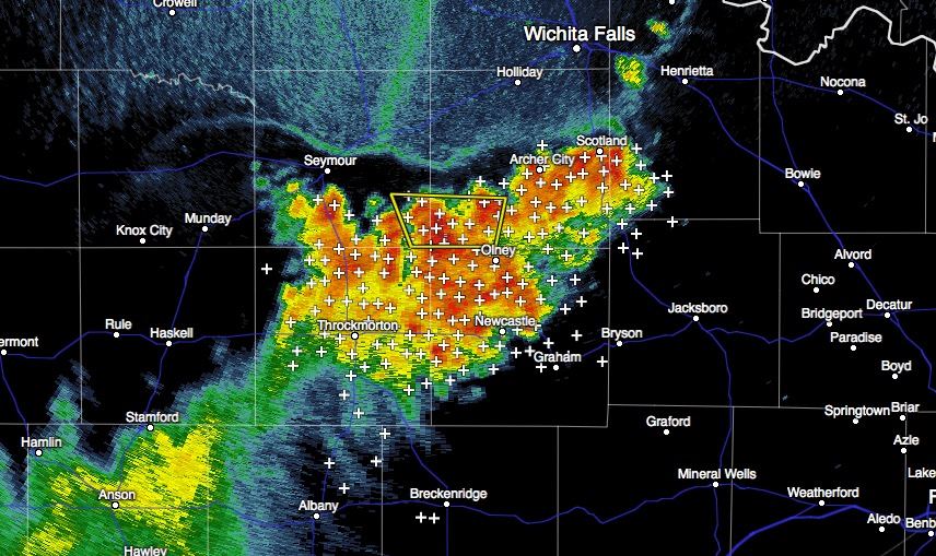
A batch of strong to severe storms has developed across parts of western north Texas this afternoon. The Severe Thunderstorm Warning for Archer and Baylor counties will remain in effect until 6:15pm. Frequent cloud to ground lightning at a rate of 40 to 50 strikes per minute have been measured across Archer, Baylor, Clay, Throckmorton and Young counties in the last half hour or so. This batch of storms is not moving much in any direction, and will produce heavy rainfall and localized flooding until they begin to dissipate.
Advertisements
HE NATIONAL WEATHER SERVICE IN NORMAN HAS ISSUED A

* SEVERE THUNDERSTORM WARNING FOR...
  SOUTHEASTERN BAYLOR COUNTY IN NORTHERN TEXAS...
  SOUTHWESTERN ARCHER COUNTY IN NORTHERN TEXAS...

* UNTIL 615 PM CDT

* AT 527 PM CDT...A SEVERE THUNDERSTORM WAS LOCATED 4 MILES SOUTH OF
  MEGARGEL...MOVING NORTHWEST AT 10 MPH.

  HAZARD...60 MPH WIND GUSTS AND QUARTER SIZE HAIL.

  SOURCE...RADAR INDICATED.

  IMPACT...HAIL DAMAGE TO VEHICLES IS EXPECTED. EXPECT WIND DAMAGE
           TO ROOFS...SIDING AND TREES.

* LOCATIONS IMPACTED INCLUDE...
  MEGARGEL AND WESTOVER.


0 Comments