
The threat of severe thunderstorms returns for our third Monday in a row. Tomorrow’s severe weather threat does not seem to be a ‘tornado outbreak’ situation, but it does have the potential to be more active than last Monday’s severe weather. We’re in April, and the spring severe weather season across Texas is well underway.
Severe weather outlooks issued by the Storm Prediction Center utilize a five-level risk scale. Each risk level is based on the probability of severe storms within twenty-five miles of any given point, such as your location. A level one risk is the lowest and means isolated/short-lived severe storms are possible. A level five risk is the highest, is quite rare, and indicates a significant tornado outbreak or derecho is likely.
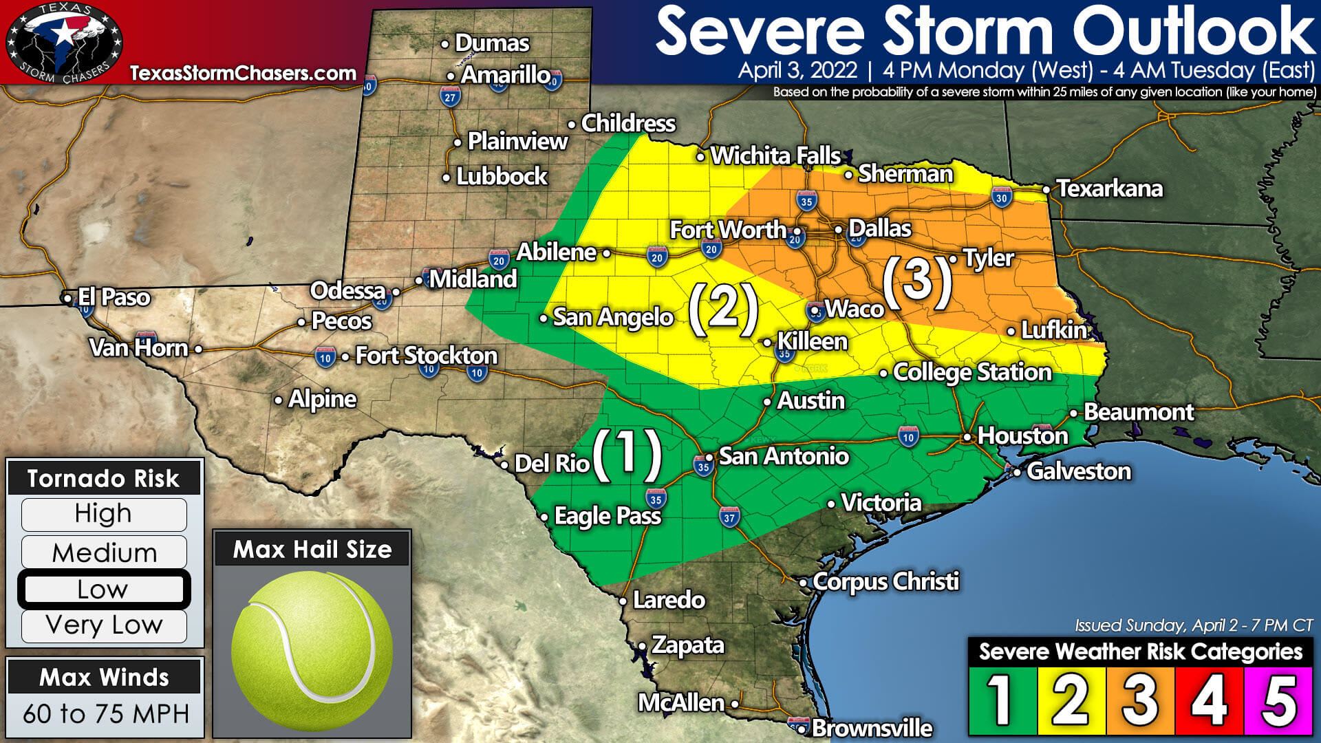
We have a level 3 out of 5 risk of severe storms Monday evening and Monday night across North Texas and East Texas. Mineral Wells, D/FW, Corsicana, Tyler, Mount Pleasant, Lufkin, and Marshall are a few cities included. The standard level 2 out of 5 risk of severe storms includes Northwest Texas, the Big Country, the eastern Concho Valley, Central Texas, the northern Brazos Valley, and Northeast Texas. Finally, a level one out of five risk of severe storms includes the Hill Country, Edwards Plateau, Coastal Plains, Southeast Texas, and the Golden Triangle.
Initial thunderstorm development tomorrow afternoon, or any discrete storms tomorrow night, could be supercelluar. Very large hail up to the size of tennis balls, localized damaging wind gusts over 60 miles per hour, and a low tornado risk may occur with the strongest discrete storms. The strongest thunderstorms within a squall line, or complex of thunderstorms, may produce destructive straight-line winds over 70 miles per hour, wind-driven golfball size hail, and embedded brief tornadoes. The level 3 risk of severe storms tomorrow evening is for the threat of more widespread damaging straight-line winds.
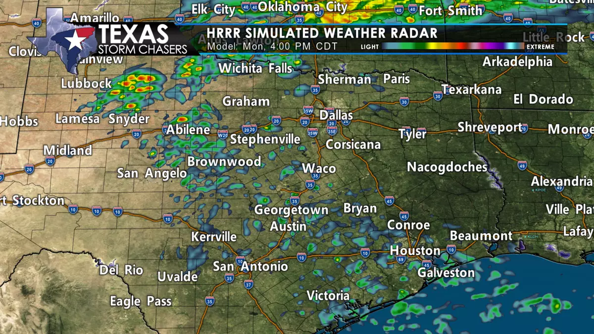
The threat of severe thunderstorms will increase after 4 PM Monday across Northwest Texas and the Big Country. Thunderstorms will tend to move northeast initially. A gradual uptick in intensity is expected through 6 PM – with some storms evolving into supercells. Large to very large hail and localized damaging wind gusts will be possible. A tornado can’t be ruled out in Northwest Texas and western North Texas. Between 6 PM and 8 PM, we anticipate thunderstorms to grow upscale into a complex.
As evolution into a thunderstorm complex occurs, we’ll see that complex turn east and eventually east/southeast toward North Texas. Damaging straight-line winds will become an increasing threat, along with large hail and perhaps a tornado. The thunderstorm complex will begin accelerating east/southeastward into the D/FW Metroplex through the mid-evening hours, with a substantial risk of damaging straight-line winds up to 75 miles per hour, wind-driven hail, and the threat of brief embedded tornadoes. We may also see more isolated thunderstorms with very large hail further southeast into the eastern Concho Valley and Central Texas.
I’d say between 9 PM and 11 PM for D/FW as it stands now. The complex of thunderstorms will continue accelerating east/southeast late tomorrow evening as it moves into Northeast and East Texas. Widespread damaging straight-line winds of 50 to 75 miles per hour are likely, along with wind-driven hail and the threat of brief tornadoes. I mention the widespread damaging wind risk as we could see many trees knocked down on buildings and roads. Those with tall trees near their homes in East Texas should be mindful of the impactful damaging wind event tomorrow night.
Thunderstorms will start moving east of Texas into Louisiana around 2-4 AM Tuesday. We’ll see more spotty storms continue into the early morning hours across Southeast Texas. Still, the threat of severe weather will be comparatively lower. We’ll see the threat of severe storms quickly diminish behind the thunderstorm complex tomorrow night.


0 Comments