
A benign and fairly typical summer evening is underway across Texas. The fairly widespread rain that fell across the Texas Panhandle and surrounding regions this morning is long gone. Any afternoon ‘popcorn’ storms have also mostly dissipated. A few thunderstorms may roll south into the Texas Panhandle during the pre-dawn hours Friday, but severe weather is unlikely. We don’t expect as high of thunderstorm coverage compared to this morning’s episode.
Low thunderstorms chances are in place for Friday across the Texas Panhandle, but a repeat of this morning’s widespread rain is not expected. A couple afternoon popup storms are possible across the Rio Grande Valley and in Northeast Texas. Any diurnal activity will dissipate not long after sunset.
We will have to watch for another complex of thunderstorms Friday Night into Saturday Morning. This complex of storms will develop in eastern Wyoming and western Nebraska. As the storms grow upscale tomorrow evening they’ll move south/southeast into western Kansas and eventually into Oklahoma. We’ll have to watch for the western part of that thunderstorm complex in case it makes it into the eastern Texas Panhandle. Whatever is left of the thunderstorm complex may approach the Red River during the morning hours Saturday.
Outside of thunderstorm chances, it’ll be your typical Texas summer in the temperature department. High temperatures tomorrow and on Saturday will range from the lower 90s up toward about 103 degrees. Saturday will be a degree or two warmer than Friday. If the complex of storms is able to make it into Texas on Saturday that may result in a downward revision of forecast temperatures in Texoma.
The ‘heat dome of doom’ responsible for our record heat during the last ten days has shifted back into the southwestern United States. The position of that upper-level high pressure puts us in a ‘northwest’ flow aloft – meaning whatever storms form in the High Plains will move southeast. That pattern can result in night-time thunderstorm chances in parts of Texas.
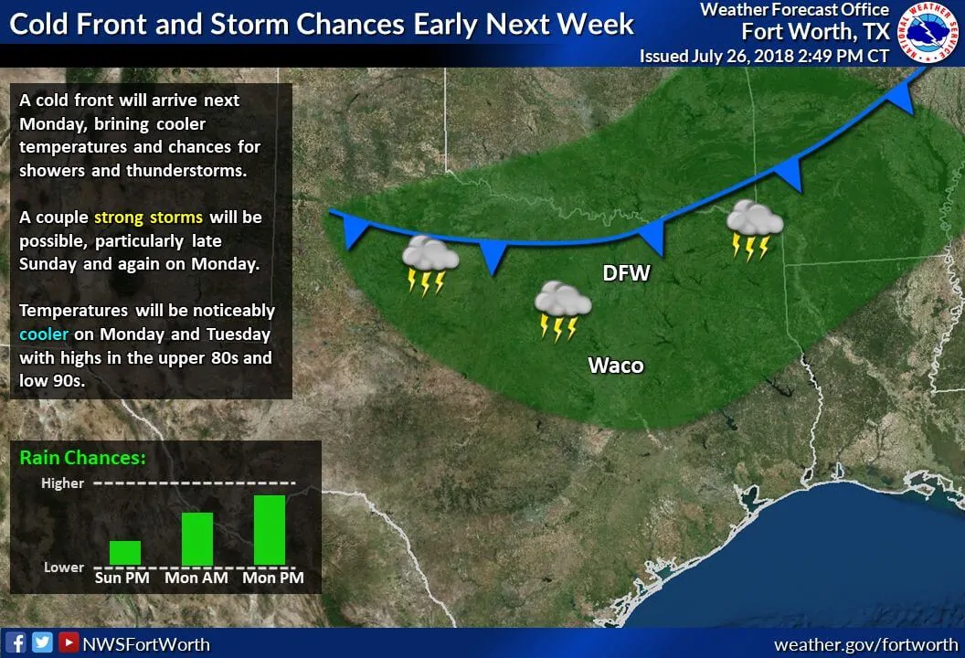
A weak cool front will also be able to push south into Texas on Monday and Tuesday. The front will probably stall out before reaching Interstate 10, but it will help knock temperatures back down into the 80s and 90s across the northern half of Texas early next week. Thunderstorm chances will increase in the proximity of the front, so we’ll get to talk about rain chances. Let’s get into the weekend and then we can get specific on who might see some rain.
Have a great night and a great Friday!


0 Comments